File:Confini del Molise.png
Jump to navigation
Jump to search
No higher resolution available.
Confini_del_Molise.png (658 × 586 pixels, file size: 811 KB, MIME type: image/png)
Captions
Captions
Add a one-line explanation of what this file represents
Sggbnrreiveobyggnliusna fppazvbntraddignnlla
Summary[edit]
| Description |
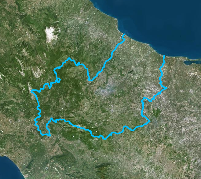
Italiano: Confine della regione Molise - Mappa di Institut géographique national |
| Date | |
| Source | https://www.geoportail.gouv.fr/donnees/photographies-aeriennes |
| Author | Institut National de l'information geographique et forestiere |
Licensing[edit]
| This file is licensed under the Licence Ouverte 1.0 (License text, English license text).
|
File history
Click on a date/time to view the file as it appeared at that time.
| Date/Time | Thumbnail | Dimensions | User | Comment | |
|---|---|---|---|---|---|
| current | 09:59, 13 July 2020 | | 658 × 586 (811 KB) | Sayatek (talk | contribs) | Uploaded a work by Institut National de l'information geographique et forestiere from https://www.geoportail.gouv.fr/donnees/photographies-aeriennes with UploadWizard |
You cannot overwrite this file.
File usage on Commons
The following page uses this file:
File usage on other wikis
The following other wikis use this file:
- Usage on it.wikipedia.org