File:Confederation Bridge -b.jpg
Jump to navigation
Jump to search

Size of this preview: 800 × 502 pixels. Other resolutions: 320 × 201 pixels | 640 × 402 pixels | 1,024 × 643 pixels | 1,280 × 804 pixels | 2,560 × 1,608 pixels | 3,537 × 2,221 pixels.
Original file (3,537 × 2,221 pixels, file size: 2.26 MB, MIME type: image/jpeg)
Captions
Captions
Add a one-line explanation of what this file represents
Summary[edit]
| Description |
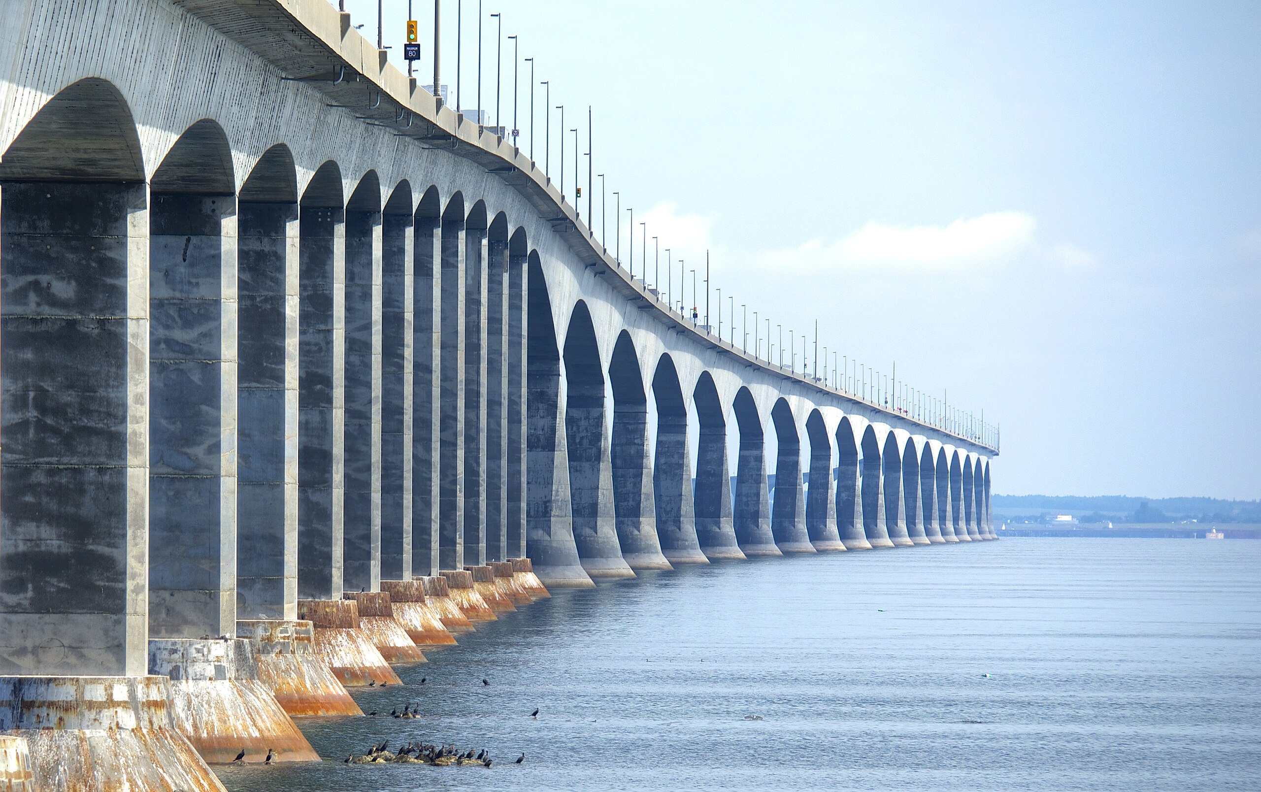
Bridging the gap between New Brunswick and Prince Edward Island, the bridge is the longest in the world over ice covered waters. The hoof shapes at the base of the pylons are especially designed to break sheets of ice, when tides and currents shove them into the bridge. The pylons are not in a straight line. Designers thought the bridge was sufficiently long that it was necessary to have a slight waviness in the route -- to keep drivers alert. Walls of the bridge were designed to be too tall to prevent sightseeing, to keep drivers from becoming distracted. |
| Date | |
| Source | Confederation Bridge |
| Author | Jamie in Bytown from Ottawa, Canada |
| Camera location | | View this and other nearby images on: OpenStreetMap |
|---|
Licensing[edit]
This file is licensed under the Creative Commons Attribution 2.0 Generic license.
- You are free:
- to share – to copy, distribute and transmit the work
- to remix – to adapt the work
- Under the following conditions:
- attribution – You must give appropriate credit, provide a link to the license, and indicate if changes were made. You may do so in any reasonable manner, but not in any way that suggests the licensor endorses you or your use.
| This image was originally posted to Flickr by Jamie in Bytown at https://www.flickr.com/photos/15609463@N03/7841164544. It was reviewed on 10 December 2012 by FlickreviewR and was confirmed to be licensed under the terms of the cc-by-2.0. |
File history
Click on a date/time to view the file as it appeared at that time.
| Date/Time | Thumbnail | Dimensions | User | Comment | |
|---|---|---|---|---|---|
| current | 05:04, 10 December 2012 | | 3,537 × 2,221 (2.26 MB) | Geo Swan (talk | contribs) | {{Information |Description=Bridging the gap between New Brunswick and Prince Edward Island, the bridge is the longest in the world over ice covered waters. |Source=[http://www.flickr.com/photos/15609463@N03/7841164544/ Confederation Bridge] |Date=2012-... |
You cannot overwrite this file.
File usage on Commons
The following page uses this file:
File usage on other wikis
The following other wikis use this file:
- Usage on de.wikipedia.org