File:Conemaugh River east of PA217.jpg
Jump to navigation
Jump to search

Size of this preview: 800 × 532 pixels. Other resolutions: 320 × 213 pixels | 640 × 426 pixels | 1,024 × 681 pixels | 1,280 × 851 pixels | 2,560 × 1,702 pixels | 6,016 × 4,000 pixels.
Original file (6,016 × 4,000 pixels, file size: 7.1 MB, MIME type: image/jpeg)
Captions
Captions
Add a one-line explanation of what this file represents
|
This is an image of a place or building that is listed on the National Register of Historic Places in the United States of America. Its reference number is 74001817. |
| Camera location | | View this and other nearby images on: OpenStreetMap |
|---|
| Description |
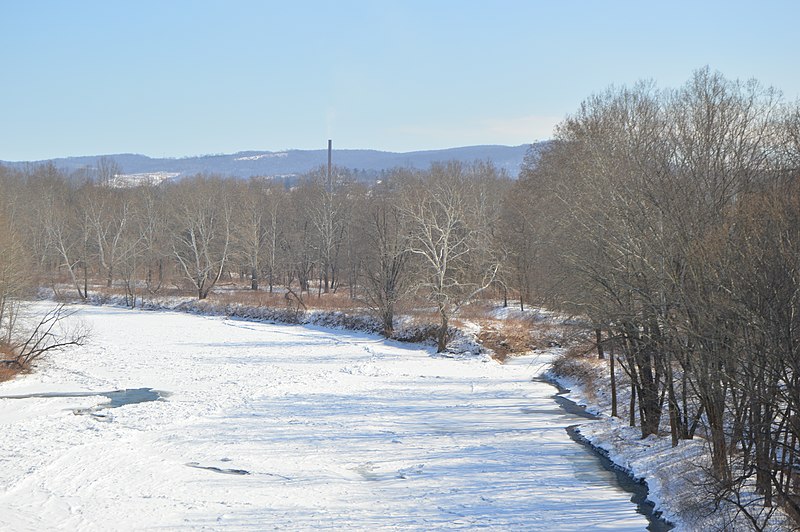
English: Looking east from the Pennsylvania Route 217 bridge over the Conemaugh River immediately south of Blairsville, Pennsylvania, United States. In the distance and to the right, one can dimly see the remains of the Western Division Canal, which is listed on the National Register of Historic Places. |
||
| Date | Taken on 28 February 2015 | ||
| Source | Own work | ||
| Author | Nyttend | ||
| Permission (Reusing this file) |
|
File history
Click on a date/time to view the file as it appeared at that time.
| Date/Time | Thumbnail | Dimensions | User | Comment | |
|---|---|---|---|---|---|
| current | 03:10, 7 March 2015 | | 6,016 × 4,000 (7.1 MB) | Nyttend (talk | contribs) | {{NRHP|74001817}} {{Location|41|7|6|N|81|29|36|W}} {{Information |Description={{en|Looking east from the {{w|Pennsylvania Route 217}} bridge over the {{w|Conemaugh River}} immediately south of {{w|Blairsville, Pennsylvania|Blairsville}}, {{w|Pennsylvan... |
You cannot overwrite this file.
File usage on Commons
There are no pages that use this file.
File usage on other wikis
The following other wikis use this file:
- Usage on en.wikipedia.org