File:Conakry us map 1981.jpg
Jump to navigation
Jump to search

Size of this preview: 539 × 599 pixels. Other resolutions: 216 × 240 pixels | 432 × 480 pixels | 691 × 768 pixels | 921 × 1,024 pixels | 1,465 × 1,629 pixels.
Original file (1,465 × 1,629 pixels, file size: 181 KB, MIME type: image/jpeg)
Captions
Captions
Add a one-line explanation of what this file represents
Summary
[edit]
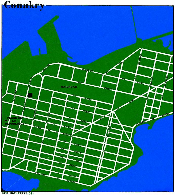
| Description | CIA World factbook map of Conakry (new town only, colored by uploader) |
| Date | |
| Source |
http://www.lib.utexas.edu/maps/world_cities.html Perry-Castañeda Library Map Collection |
| Author | CIA World factbook |
| Permission (Reusing this file) |
public domain |
Licensing
[edit]
This image is in the public domain because it contains materials that originally came from the United States Central Intelligence Agency's World Factbook.
|
 |
File history
Click on a date/time to view the file as it appeared at that time.
| Date/Time | Thumbnail | Dimensions | User | Comment | |
|---|---|---|---|---|---|
| current | 22:32, 31 December 2007 | | 1,465 × 1,629 (181 KB) | T L Miles (talk | contribs) | {{Information |Description=CIA World factbook map of Conakry (new town only, colored by uploader) |Source=http://www.lib.utexas.edu/maps/world_cities.html Perry-Castañeda Library Map Collection |Date=1981 |Author=CIA World factbook |Permission=public dom |
You cannot overwrite this file.
File usage on Commons
The following page uses this file:
.png)