File:Colorado 112 map.svg
Jump to navigation
Jump to search

Size of this PNG preview of this SVG file: 800 × 578 pixels. Other resolutions: 320 × 231 pixels | 640 × 463 pixels | 1,024 × 740 pixels | 1,280 × 925 pixels | 2,560 × 1,851 pixels | 1,000 × 723 pixels.
Original file (SVG file, nominally 1,000 × 723 pixels, file size: 1.5 MB)
Captions
Captions
Add a one-line explanation of what this file represents
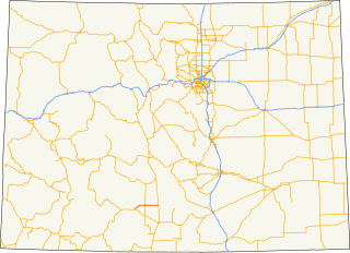
| Description | Map of Colorado highlighting State Highway 112. |
| Date | |
| Source | State and highway data |
| Author | Fredddie |
| SVG development |
This image or file is a work of a United States Census Bureau employee, taken or made as part of that person's official duties. As a work of the U.S. federal government, the image is in the public domain.
|
 |
File history
Click on a date/time to view the file as it appeared at that time.
| Date/Time | Thumbnail | Dimensions | User | Comment | |
|---|---|---|---|---|---|
| current | 23:40, 31 August 2010 | | 1,000 × 723 (1.5 MB) | Fredddie (talk | contribs) | {{Information |Description=Map of Colorado highlighting State Highway 112.{{Inkscape}}{{QGIS}} |Source=[http://www.census.gov/geo/cob/bdy/st/st00shp/st08_d00_shp.zip State] and [http://www.fhwa.dot.gov/download/hep/nhpn/s08nhpn.zip highway data] |Date=201 |
You cannot overwrite this file.
File usage on Commons
The following page uses this file:
File usage on other wikis
The following other wikis use this file:
- Usage on bn.wikipedia.org
- Usage on www.wikidata.org