File:Close up of Earthquake House, Comrie. - geograph.org.uk - 242045.jpg
Jump to navigation
Jump to search

Size of this preview: 450 × 600 pixels. Other resolutions: 180 × 240 pixels | 480 × 640 pixels.
Original file (480 × 640 pixels, file size: 80 KB, MIME type: image/jpeg)
Captions
Captions
Add a one-line explanation of what this file represents
Summary
[edit]
| Description |
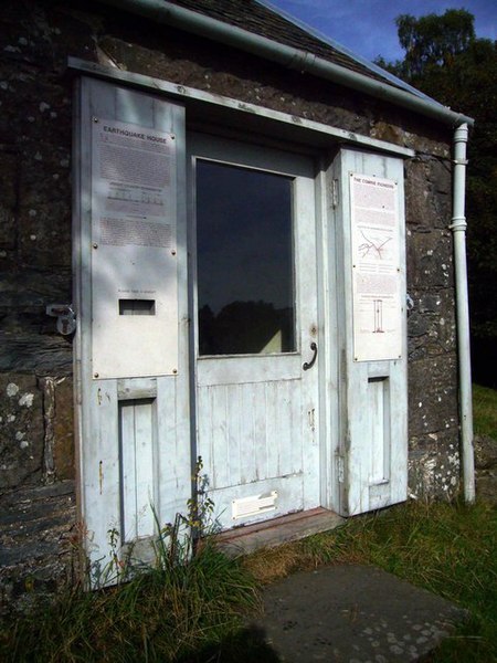
English: Close up of Earthquake House, Comrie. Lying on the Highland Boundary Fault, Comrie has experienced many tremors in the past, hence its nickname, "Shaky Town". The World's first seismometer was set up here in 1840 and housed in this building in 1869. |
| Date | |
| Source | From geograph.org.uk |
| Author | Bill Cresswell |
| Attribution (required by the license) | Bill Cresswell / Close up of Earthquake House, Comrie. / |
| Object location | | View this and other nearby images on: OpenStreetMap |
|---|
_heading:22.00&language=en)
Licensing
[edit]

|
This image was taken from the Geograph project collection. See this photograph's page on the Geograph website for the photographer's contact details. The copyright on this image is owned by Bill Cresswell and is licensed for reuse under the Creative Commons Attribution-ShareAlike 2.0 license.
|
This file is licensed under the Creative Commons Attribution-Share Alike 2.0 Generic license.
Attribution: Bill Cresswell
- You are free:
- to share – to copy, distribute and transmit the work
- to remix – to adapt the work
- Under the following conditions:
- attribution – You must give appropriate credit, provide a link to the license, and indicate if changes were made. You may do so in any reasonable manner, but not in any way that suggests the licensor endorses you or your use.
- share alike – If you remix, transform, or build upon the material, you must distribute your contributions under the same or compatible license as the original.
- Remove redundant categories and try to put this image in the most specific category/categories
- Remove this template
- The location categories are based on information from this geonames tool and this OpenStreetMap tool combined with a database. You can also have a look at this tool from mysociety.
- The topic category from Geograph was Museum / Heritage Centre (find similar images / Heritage Centre at Geograph)
File history
Click on a date/time to view the file as it appeared at that time.
| Date/Time | Thumbnail | Dimensions | User | Comment | |
|---|---|---|---|---|---|
| current | 23:15, 31 January 2010 | | 480 × 640 (80 KB) | GeographBot (talk | contribs) | == {{int:filedesc}} == {{Information |description={{en|1=Close up of Earthquake House, Comrie. Lying on the Highland Boundary Fault, Comrie has experienced many tremors in the past, hence its nickname, "Shaky Town". The World's first seismometer was set |
You cannot overwrite this file.
File usage on Commons
There are no pages that use this file.
File usage on other wikis
The following other wikis use this file:
- Usage on simple.wikipedia.org