File:Civitates Orbis Terrarum-Maastricht (kleur).jpg
Jump to navigation
Jump to search

Size of this preview: 685 × 599 pixels. Other resolutions: 274 × 240 pixels | 549 × 480 pixels | 878 × 768 pixels | 1,170 × 1,024 pixels | 2,341 × 2,048 pixels | 2,657 × 2,325 pixels.
Original file (2,657 × 2,325 pixels, file size: 1.87 MB, MIME type: image/jpeg)
Captions
Captions
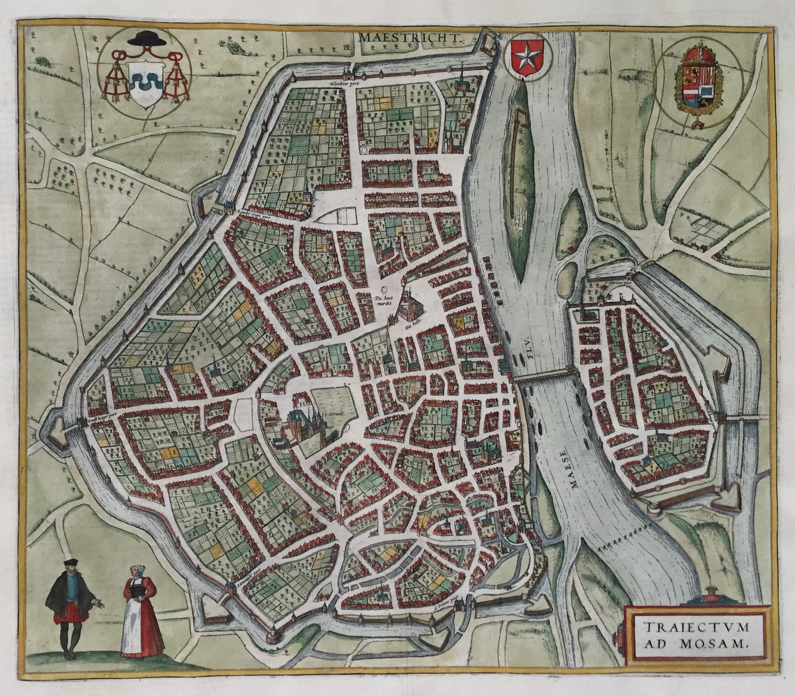
Map of Maastricht from the atlas ''Civitates orbis Terrarum'' published in 1588 by Braun & Hogenberg.
Summary
[edit]| Description |
Nederlands: Plattegrond van Maastricht ("MAESTRICHT / TRAIECTVM AD MOSAM"), omstreeks 1575 getekend. Handgekleurde kopergravure in het Stedenboek van Braun & Hogenberg, uitgegeven in 1588 te Keulen als deel 3 van: Civitates orbis Terrarum: Urbium praecipuarum totius mundi Liber tertius (...). Afmetingen: 35,5 x 41 cm. |
| Date | circa 1575 |
| Source | https://datnarrenschip.s3.amazonaws.com/9439.jpg |
| Author | Georg Braun (1541-1622) and Frans Hogenberg (1535-1590) |
| Other versions |
.jpg)
.jpg)
.jpg)
.jpg)
_(detail_Markt).jpg)
.jpg&action=edit§ion=1)
Licensing
[edit].jpg&action=edit§ion=2)
|
This work is in the public domain in its country of origin and other countries and areas where the copyright term is the author's life plus 100 years or fewer. | |
| This file has been identified as being free of known restrictions under copyright law, including all related and neighboring rights. | |
File history
Click on a date/time to view the file as it appeared at that time.
| Date/Time | Thumbnail | Dimensions | User | Comment | |
|---|---|---|---|---|---|
| current | 06:59, 26 May 2019 | | 2,657 × 2,325 (1.87 MB) | Kleon3 (talk | contribs) | User created page with UploadWizard |
You cannot overwrite this file.
File usage on Commons
The following 8 pages use this file:
- User:Anton-kurt/Tyrol new files/2019 May 21-31
- User:J budissin/Uploads/BiH/2019 May 21-31
- File:Civitates Orbis Terrarum-Maastricht (Wyck).jpg
- File:Civitates Orbis Terrarum-Maastricht (Wyck2).jpg
- File:Civitates Orbis Terrarum-Maastricht (kleur) (detail Markt).jpg
- File:Civitates Orbis Terrarum-Maastricht (kleur, detail1).jpg
- File:Civitates Orbis Terrarum-Maastricht (kleur, detail2).jpg
- File:Civitates Orbis Terrarum-Maastricht (kleur, detail3).jpg
.jpg)
.jpg&oldid=861572975)