File:City Plans Hozan.jpg
Jump to navigation
Jump to search

Size of this preview: 405 × 600 pixels. Other resolutions: 162 × 240 pixels | 324 × 480 pixels | 519 × 768 pixels | 691 × 1,024 pixels | 1,383 × 2,048 pixels | 5,106 × 7,560 pixels.
Original file (5,106 × 7,560 pixels, file size: 9.1 MB, MIME type: image/jpeg)
Captions
Captions
Add a one-line explanation of what this file represents
Summary
[edit]
| Description |
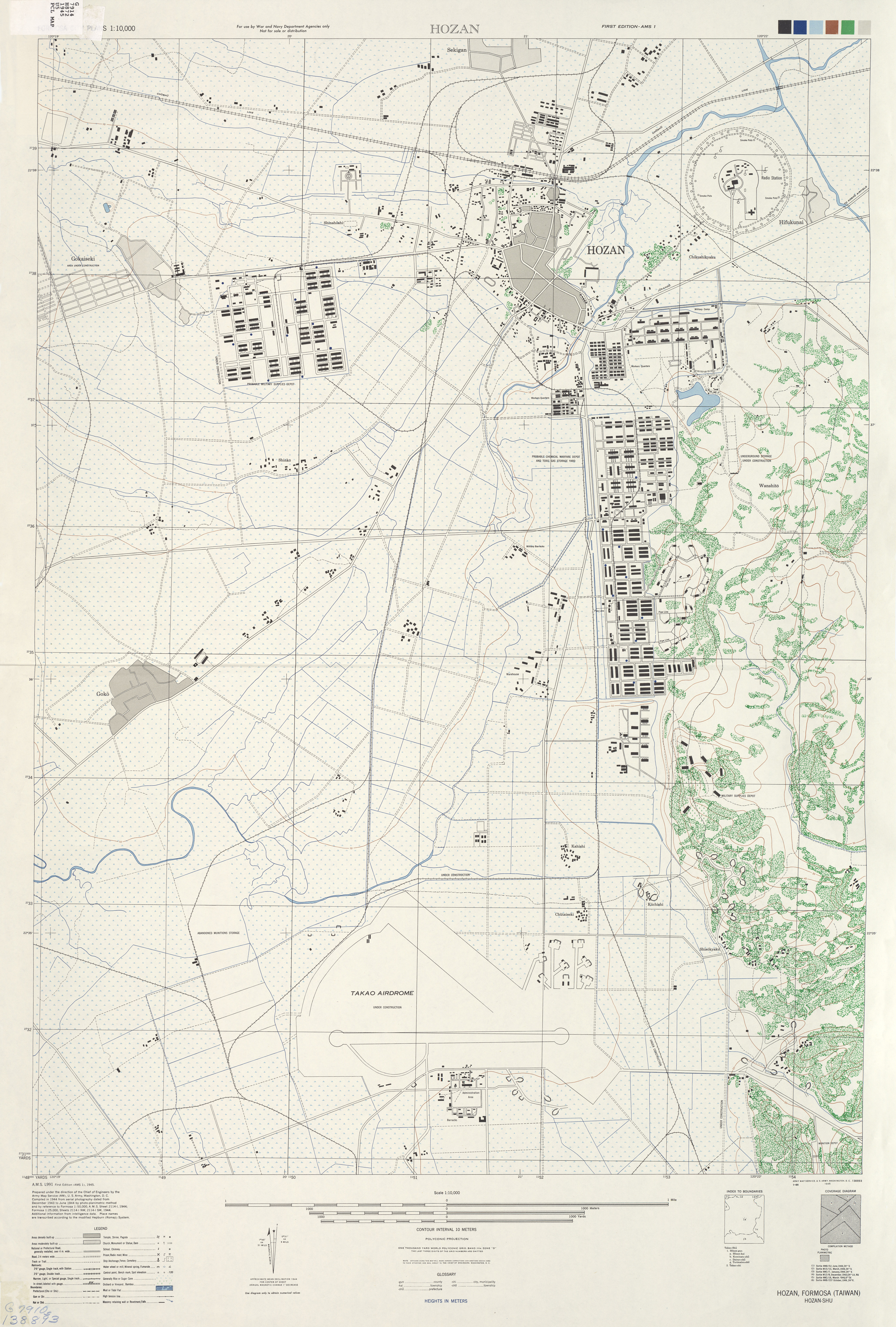
English: Map of Hozan. |
| Date | circa 1944-45 |
| Source | www.lib.utexas.edu |
| Author | U.S. Army |
| Other versions | Derivative works of this file: 鳳山無線通信所平面圖.jpg |
Licensing
[edit]
This file is a work of a U.S. Army soldier or employee, taken or made as part of that person's official duties. As a work of the U.S. federal government, it is in the public domain in the United States.
|
 |
File history
Click on a date/time to view the file as it appeared at that time.
| Date/Time | Thumbnail | Dimensions | User | Comment | |
|---|---|---|---|---|---|
| current | 06:46, 1 September 2010 | | 5,106 × 7,560 (9.1 MB) | A-lú-mih (talk | contribs) | {{Information |Description={{en|1=Map of Hozan.}} |Source=[http://www.lib.utexas.edu/maps/ams/formosa_city_plans/txu-oclc-6594432.jpg www.lib.utexas.edu] |Author=U.S. Army |Date=c. 1944-45 |Permission= |other_versions= }} [[Category:History of Kaohsiung] |
You cannot overwrite this file.
File usage on Commons
The following page uses this file:
File usage on other wikis
The following other wikis use this file:
- Usage on ja.wikipedia.org
- Usage on zh-min-nan.wikipedia.org
- Usage on zh.wikipedia.org