File:Cherry and Broad Philly.JPG
Jump to navigation
Jump to search
Size of this preview: 800 × 600 pixels. Other resolutions: 320 × 240 pixels | 640 × 480 pixels | 1,024 × 768 pixels | 1,280 × 960 pixels | 2,560 × 1,920 pixels | 3,944 × 2,958 pixels.
Original file (3,944 × 2,958 pixels, file size: 4.07 MB, MIME type: image/jpeg)
Captions
Captions
Add a one-line explanation of what this file represents
|
This is an image of a place or building that is listed on the National Register of Historic Places in the United States of America. Its reference number is 86001688. |
Summary
[edit]
| Description |
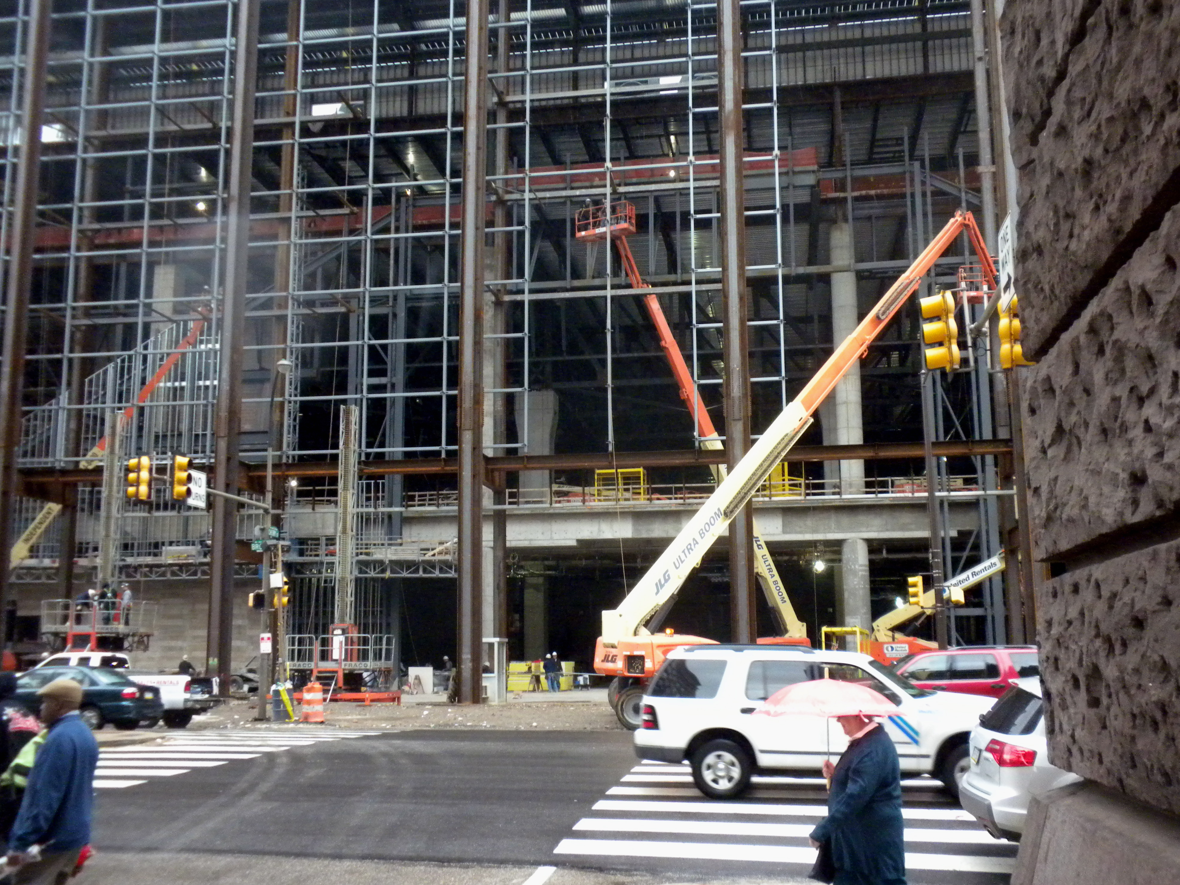
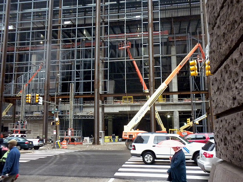
English: Pennsylvania Convention Center expansion, looking east across Broad Street from Cherry Street.
Two sites of NRHPs were near this location and are presumably destroyed, including the Gilbert Building |
| Date | Taken on 13 April 2010 |
| Source | Own work |
| Author | Smallbones |
| Camera location | | View this and other nearby images on: OpenStreetMap |
|---|
Licensing
[edit]
| I, the copyright holder of this work, release this work into the public domain. This applies worldwide. In some countries this may not be legally possible; if so: I grant anyone the right to use this work for any purpose, without any conditions, unless such conditions are required by law. |
File history
Click on a date/time to view the file as it appeared at that time.
| Date/Time | Thumbnail | Dimensions | User | Comment | |
|---|---|---|---|---|---|
| current | 14:54, 15 April 2010 | | 3,944 × 2,958 (4.07 MB) | Smallbones (talk | contribs) | {{Information |Description={{en|1=Pennsylvania Convention Center expansion, looking east across Broad Street from Cherry Street. Two sites of NRHPs were near this location and are presumably destroyed, including the Gilbert Building}} |Source=Own work |Au |
You cannot overwrite this file.
File usage on Commons
There are no pages that use this file.
File usage on other wikis
The following other wikis use this file:
- Usage on en.wikipedia.org