File:Charte der Lænder am Rhein , von Coblenz der Mosel und Lahne südlich bis Mannheim , nach den besten Hilfsmitteln und ast - urn-nbn-de-0128-1-12014.jpg
Jump to navigation
Jump to search

Size of this preview: 769 × 599 pixels. Other resolutions: 308 × 240 pixels | 616 × 480 pixels | 986 × 768 pixels | 1,280 × 997 pixels | 2,560 × 1,995 pixels | 7,271 × 5,666 pixels.
Original file (7,271 × 5,666 pixels, file size: 12.43 MB, MIME type: image/jpeg)
Captions
Captions
Add a one-line explanation of what this file represents
Summary[edit]
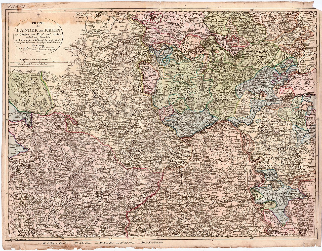
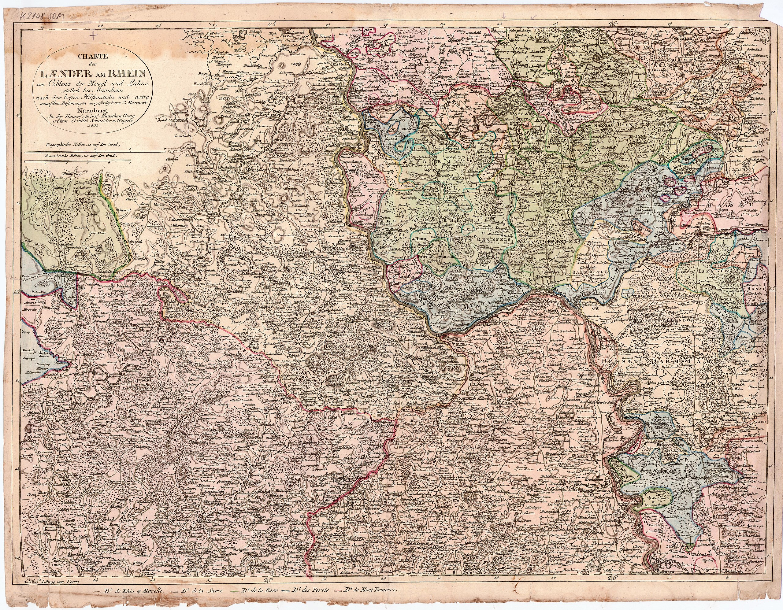
| Charte der Lænder am Rhein : von Coblenz der Mosel und Lahne südlich bis Mannheim ; nach den besten Hilfsmitteln und astronomischen Bestimmungen
( |
||||||||||||||
|---|---|---|---|---|---|---|---|---|---|---|---|---|---|---|
| Title |
Charte der Lænder am Rhein : von Coblenz der Mosel und Lahne südlich bis Mannheim ; nach den besten Hilfsmitteln und astronomischen Bestimmungen |
|||||||||||||
| Description |
Nürnberg : Kunsthandlung Adam Gottlieb Schneider u. Weigels, 1801; [Electronic ed.] Koblenz : Landesbibliothekszentrum Rheinland-Pfalz, 2010. |
|||||||||||||
| Date | [1801] | |||||||||||||
| Dimensions | 1 Kt., Kupferst. : grenzkolor., flächenkolor. ; 1 Bl., 65 x 49 cm | |||||||||||||
| Collection |
|
|||||||||||||
| Accession number | ||||||||||||||
| Credit line | dilibri Rheinland-Pfalz / Europeana | |||||||||||||
| Source/Photographer |
dilibri Rheinland-Pfalz / Europeana
|
|||||||||||||
| Permission (Reusing this file) |
This file is licensed under the Creative Commons Attribution-Share Alike 2.0 Germany license. Attribution: dilibri Rheinland-Pfalz
 |
|||||||||||||
File history
Click on a date/time to view the file as it appeared at that time.
| Date/Time | Thumbnail | Dimensions | User | Comment | |
|---|---|---|---|---|---|
| current | 02:44, 25 January 2013 | | 7,271 × 5,666 (12.43 MB) | Slick-o-bot (talk | contribs) | Bot: convert to a non-interlaced jpeg (see bug #17645) |
| 14:01, 1 April 2011 |  | 7,271 × 5,666 (11.42 MB) | BotMultichill (talk | contribs) | {{User:Multichill/Europeana |europeana:uri=http://www.europeana.eu/resolve/record/09428/3D3E735582D3B129862B6C3A6D5691BA640E888D |dc:language=de |enrichment:period_begin=Thu Jan 01 00:00:00 CET 1801 |europeana:hasObject=false |dc:title=Charte der Lænder |
You cannot overwrite this file.
File usage on Commons
The following page uses this file: