File:Chapelle St Julien Ensemble.jpg
Original file (5,261 × 3,491 pixels, file size: 19.86 MB, MIME type: image/jpeg)
Captions
Summary[edit]
DescriptionChapelle St Julien Ensemble.jpg |
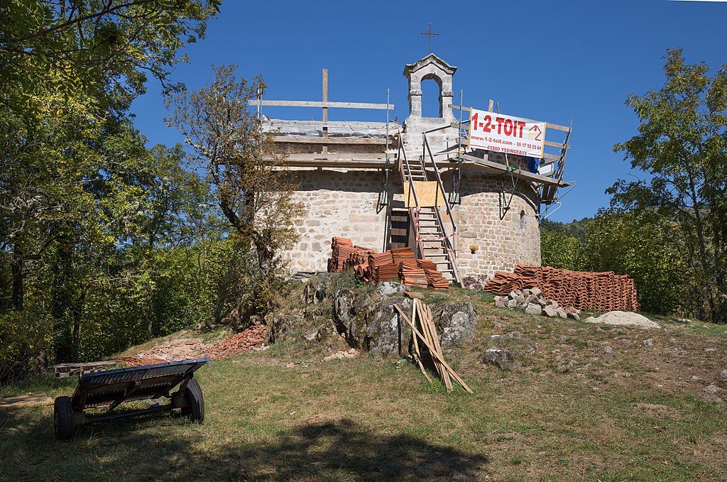
Français : Réfection du toit de la chapelle Saint-Julien-la-Tourette en septembre 2017, vallée de la Dunières. Saint-Pal-de-Mons, Haute-Loire.
English: Repairing the roof of the Chapelle Saint-Julien-la-Tourette, september 2017, valley of the Dunières River. Saint-Pal-de-Mons, Haute-Loire.
|
|
Date | ||
Source | Own work | |
Author | Hélène Rival | |
Permission (Reusing this file) |
I, the copyright holder of this work, hereby publish it under the following license: This file is licensed under the Creative Commons Attribution-Share Alike 4.0 International license. Attribution: Wikimedia Commons : Hélène Rival
|
|
Other versions |
|
|
Attribution (required by the license) InfoField | Hélène Rival / Wikimedia Commons / | |
InfoField | Hélène Rival / Wikimedia Commons |
Camera location | 45° 12′ 57.18″ N, 4° 14′ 43.4″ E | View this and other nearby images on: OpenStreetMap | 45.215883; 4.245388 |
---|
This image was uploaded as part of Wiki Loves Monuments 2017.
Afrikaans ∙ Alemannisch ∙ azərbaycanca ∙ Bahasa Indonesia ∙ Bahasa Melayu ∙ Bikol Central ∙ bosanski ∙ brezhoneg ∙ català ∙ čeština ∙ Cymraeg ∙ dansk ∙ davvisámegiella ∙ Deutsch ∙ eesti ∙ English ∙ español ∙ Esperanto ∙ euskara ∙ français ∙ Frysk ∙ Gaeilge ∙ galego ∙ hrvatski ∙ Ido ∙ italiano ∙ latviešu ∙ Lëtzebuergesch ∙ Malagasy ∙ magyar ∙ Malti ∙ Nederlands ∙ norsk ∙ norsk nynorsk ∙ norsk bokmål ∙ polski ∙ português ∙ português do Brasil ∙ română ∙ shqip ∙ sicilianu ∙ slovenčina ∙ slovenščina ∙ suomi ∙ svenska ∙ Tagalog ∙ Türkçe ∙ Yorùbá ∙ Zazaki ∙ Ελληνικά ∙ беларуская ∙ беларуская (тарашкевіца) ∙ български ∙ кыргызча ∙ македонски ∙ русский ∙ српски / srpski ∙ українська ∙ ქართული ∙ հայերեն ∙ नेपाली ∙ हिन्दी ∙ বাংলা ∙ മലയാളം ∙ ไทย ∙ 한국어 ∙ +/− |
File history
Click on a date/time to view the file as it appeared at that time.
Date/Time | Thumbnail | Dimensions | User | Comment | |
---|---|---|---|---|---|
current | 20:02, 25 September 2017 | 5,261 × 3,491 (19.86 MB) | MirandaAdramin (talk | contribs) | User created page with UploadWizard |
You cannot overwrite this file.
File usage on Commons
The following page uses this file:
File usage on other wikis
The following other wikis use this file:
- Usage on fr.wikipedia.org
Metadata
This file contains additional information such as Exif metadata which may have been added by the digital camera, scanner, or software program used to create or digitize it. If the file has been modified from its original state, some details such as the timestamp may not fully reflect those of the original file. The timestamp is only as accurate as the clock in the camera, and it may be completely wrong.
Camera manufacturer | Canon |
---|---|
Camera model | Canon EOS 6D |
Exposure time | 1/400 sec (0.0025) |
F-number | f/8 |
ISO speed rating | 100 |
Date and time of data generation | 12:33, 24 September 2017 |
Lens focal length | 32 mm |
Latitude | 45° 12′ 57.18″ N |
Longitude | 4° 14′ 43.4″ E |
Altitude | 694.9 meters above sea level |
City shown | Saint-Pal-de-Mons |
Horizontal resolution | 72 dpi |
Vertical resolution | 72 dpi |
Software used | Adobe Photoshop Lightroom 4.4 (Macintosh) |
File change date and time | 18:58, 25 September 2017 |
Exposure Program | Manual |
Exif version | 2.3 |
Date and time of digitizing | 12:33, 24 September 2017 |
APEX shutter speed | 8.643856 |
APEX aperture | 6 |
APEX exposure bias | 0 |
Maximum land aperture | 4 APEX (f/4) |
Metering mode | Pattern |
Flash | Flash did not fire, compulsory flash suppression |
DateTimeOriginal subseconds | 00 |
DateTimeDigitized subseconds | 00 |
Focal plane X resolution | 152 |
Focal plane Y resolution | 152 |
Focal plane resolution unit | 4 |
Custom image processing | Normal process |
Exposure mode | Manual exposure |
White balance | Auto white balance |
Scene capture type | Standard |
GPS time (atomic clock) | 10:31 |
Satellites used for measurement | 12 |
Receiver status | Measurement in progress |
Measurement mode | 3-dimensional measurement |
Measurement precision | Poor (8.5) |
Geodetic survey data used | WGS-84 |
GPS date | 24 September 2017 |
GPS tag version | 0.0.3.2 |
Serial number of camera | 103053004982 |
Lens used | EF24-70mm f/4L IS USM |
Date metadata was last modified | 20:58, 25 September 2017 |
Unique ID of original document | 689B2C17EFB8CBE61941D363A6EA4175 |
Province or state shown | Auvergne-Rhône-Alpes |
Country shown | France |
IIM version | 4 |
Structured data
Items portrayed in this file
depicts
24 September 2017
45°12'57.179"N, 4°14'43.397"E
0.0025 second
32 millimetre
100
image/jpeg
3f8eef890ff8a84212b2fc11d685ed52fc02f5c0
20,827,645 byte
3,491 pixel
5,261 pixel
- Base Mérimée
- Mérimée without type parameter
- Mérimée with PA parameter
- Cultural heritage monuments in France with known IDs
- CC-BY-SA-4.0
- Self-published work
- Information field template with formatting
- Images from Wiki Loves Monuments 2017
- Images from Wiki Loves Monuments 2017 in France
- Uploaded via Campaign:wlm-fr
- France photographs taken on 2017-09-24
- Pages with maps