File:Central Asia - political map 2008.svg
Jump to navigation
Jump to search

Size of this PNG preview of this SVG file: 756 × 600 pixels. Other resolutions: 303 × 240 pixels | 605 × 480 pixels | 968 × 768 pixels | 1,280 × 1,015 pixels | 2,560 × 2,031 pixels | 996 × 790 pixels.
Original file (SVG file, nominally 996 × 790 pixels, file size: 164 KB)
Captions
Captions
Add a one-line explanation of what this file represents
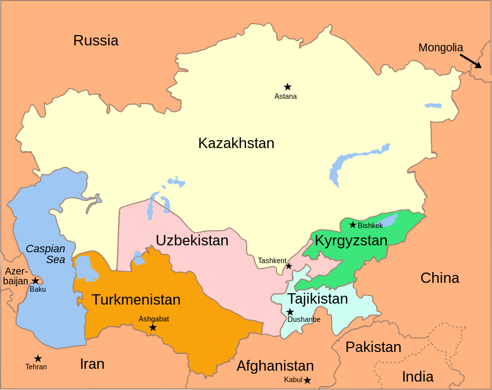
| Description | Political Map of the Caucasus and Central Asia, 2008 |
| Date |
(UTC) 2008-10-05 |
| Source | |
| Author |
|
| Other versions |
[]
|
| SVG development |


This file is licensed under the Creative Commons Attribution-Share Alike 3.0 Unported license.
- You are free:
- to share – to copy, distribute and transmit the work
- to remix – to adapt the work
- Under the following conditions:
- attribution – You must give appropriate credit, provide a link to the license, and indicate if changes were made. You may do so in any reasonable manner, but not in any way that suggests the licensor endorses you or your use.
- share alike – If you remix, transform, or build upon the material, you must distribute your contributions under the same or compatible license as the original.

|
This SVG file contains embedded text that can be translated into your language, using any capable SVG editor, text editor or the SVG Translate tool. For more information see: About translating SVG files. |
Original upload log[edit]
This image is a derivative work of the following images:
- Image:Central_Asia_-_political_map_-_2000.svg licensed with Cc-by-sa-3.0
- 2008-11-09T19:42:55Z Themightyquill 995x790 (163806 Bytes) {{Information |Description=Political Map of the Caucasus and Central Asia |Source=*[[:Image:Caucasus_central_asia_political_map_2000.jpg|]] |Date=2008-11-09 19:41 (UTC) |Author=*derivative work: ~~~ *[[:Image:Caucasus_central
- Image:Caspian_Sea_from_orbit.jpg licensed with PD-USGov-NASA, PD-USGov-NASA/copyright
- 2005-02-08T15:10:25Z Pixeltoo 550x700 (68127 Bytes) Caspian sea by space [[Nasa]]
- Image:Aral_Sea_05_October_2008.jpg licensed with PD-USGov-NASA, PD-USGov-NASA/copyright
- 2008-10-08T09:48:46Z Chesnok 1179x1530 (243013 Bytes) {{Information |Description={{en|1=Aral Sea}} |Source=http://rapidfire.sci.gsfc.nasa.gov/ |Author=NASA |Date=October 5, 2008 |Permission= |other_versions= }} [[Category:Aral Sea]]
File history
Click on a date/time to view the file as it appeared at that time.
| Date/Time | Thumbnail | Dimensions | User | Comment | |
|---|---|---|---|---|---|
| current | 10:42, 1 November 2021 | | 996 × 790 (164 KB) | Dcastor (talk | contribs) | Reverted to version as of 16:42, 25 January 2009 (UTC) |
| 10:41, 1 November 2021 |  | 996 × 790 (177 KB) | Dcastor (talk | contribs) | File uploaded using svgtranslate tool (https://svgtranslate.toolforge.org/). Added translation for sv. | |
| 16:42, 25 January 2009 |  | 996 × 790 (164 KB) | Themightyquill (talk | contribs) | ||
| 19:50, 9 November 2008 |  | 995 × 790 (157 KB) | Themightyquill (talk | contribs) | {{Information |Description={{en|1=Blah}} |Source=Own work by uploader |Author=Themightyquill |Date= |Permission= |other_versions= }} <!--{{ImageUpload|full}}--> |
You cannot overwrite this file.
File usage on Commons
The following 20 pages use this file:
- WGSRPD maps
- User:Themightyquill
- File:Central Asia - political map 2008-es.svg
- File:Central Asia - political map 2008-fr.svg
- File:Central Asia - political map 2008-gu.svg
- File:Central Asia - political map 2008-kn.svg
- File:Central Asia - political map 2008-mr.svg
- File:Central Asia - political map 2008-pa.svg
- File:Central Asia - political map 2008-sv.svg
- File:Central Asia - political map 2008-te.svg
- File:Central Asia - political map 2008.svg
- File:Central Asia - political map 2008 -hi.svg
- File:Central Asia - political map 2008 as.svg
- File:Central Asia - political map 2008 hu.svg
- File:Central Asia - political map 2008 it.svg
- File:Central Asia - political map 2008 ml.svg
- File:Central Asia - political map 2008 sr.svg
- File:Central Asia - political map 2008 ur.svg
- File talk:Central Asia - political map 2008.svg
- Template:Other versions/Central Asia - political map 2008
File usage on other wikis
The following other wikis use this file:
- Usage on ar.wikipedia.org
- Usage on bn.wikipedia.org
- Usage on de.wiktionary.org
- Usage on en.wikipedia.org
- Category:Fish of Central Asia
- Category:Fauna of Central Asia
- Human rights in Asia
- Category:Flora of Central Asia
- Category:Jews and Judaism in Central Asia
- Wikipedia talk:WikiProject Central Asia/Archive 3
- Category:History of the Jews in Central Asia
- Wikipedia:WikiProject Plants/World Geographical Scheme for Recording Plant Distributions
- Category:Flora of temperate Asia
- Category:Biota of Central Asia
- Category:Birds of Central Asia
- User:DexDor/Categorization of organisms by geography
- Category:Reptiles of Central Asia
- Category:Mammals of Central Asia
- Category:Insects of Central Asia
- Category:Invertebrates of Central Asia
- Category:Endemic fauna of Central Asia
- Category:Arthropods of Central Asia
- Category:Spiders of Central Asia
- Eastern culture
- Category:Lichens of temperate Asia
- Category:Lichens of Central Asia
- Usage on eo.wikipedia.org
- Usage on hr.wikipedia.org
- Usage on id.wikipedia.org
- Usage on io.wikipedia.org
- Usage on pl.wikipedia.org
- Usage on pl.wiktionary.org
- Usage on pt.wikipedia.org
- Usage on rue.wikipedia.org
- Usage on ru.wikipedia.org
- Usage on si.wikipedia.org
- Usage on tr.wikipedia.org
- Usage on uz.wikipedia.org
- Usage on zh.wikipedia.org