File:Celtic Sea and Bay of Biscay bathymetric map-fr.svg
Jump to navigation
Jump to search

Size of this PNG preview of this SVG file: 548 × 599 pixels. Other resolutions: 219 × 240 pixels | 439 × 480 pixels | 702 × 768 pixels | 936 × 1,024 pixels | 1,872 × 2,048 pixels | 3,478 × 3,804 pixels.
Original file (SVG file, nominally 3,478 × 3,804 pixels, file size: 4.93 MB)
Captions
Captions
Add a one-line explanation of what this file represents
Summary[edit]
| Description |
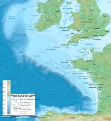
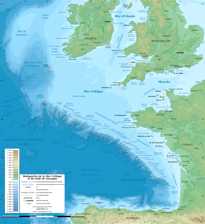
English: Bathymetric map in French of the Celtic Sea and the Bay of Biscay. Limits of the seas as specified by the International Hydrographic Organization.
Note: the background map is a raster image embedded in the SVG file. Français : Carte bathymétrique en français de la Mer Celtique et du Golfe de Gascogne. Limites des mers telles que définies par l'Organisation Hydrographique Internationale. Note : le fond de carte est une image bitmap embarquée dans le fichier SVG.
|
||
| Date | January 2011, upgraded 2019-10 | ||
| Source |
Own work
|
||
| Author | Eric Gaba (Sting - fr:Sting) | ||
| Permission (Reusing this file) |
|
||
| Other versions |
[]
|
||
| SVG development |


| Camera location | | View this and other nearby images on: OpenStreetMap |
|---|
Licensing[edit]
Eric Gaba (Wikimedia Commons user Sting), the copyright holder of this work, hereby publishes it under the following license:
This file is licensed under the Creative Commons Attribution-Share Alike 3.0 Unported license.
Attribution: Eric Gaba (Wikimedia Commons user Sting)
- You are free:
- to share – to copy, distribute and transmit the work
- to remix – to adapt the work
- Under the following conditions:
- attribution – You must give appropriate credit, provide a link to the license, and indicate if changes were made. You may do so in any reasonable manner, but not in any way that suggests the licensor endorses you or your use.
- share alike – If you remix, transform, or build upon the material, you must distribute your contributions under the same or compatible license as the original.
File history
Click on a date/time to view the file as it appeared at that time.
| Date/Time | Thumbnail | Dimensions | User | Comment | |
|---|---|---|---|---|---|
| current | 13:11, 4 November 2019 | | 3,478 × 3,804 (4.93 MB) | Sting (talk | contribs) | Correction of a name |
| 20:56, 28 October 2019 |  | 3,478 × 3,804 (4.92 MB) | Sting (talk | contribs) | New map using GEBCO 15 Sec topographic data ; rivers from ECRINS ; added names | |
| 18:15, 24 January 2011 |  | 1,749 × 1,913 (613 KB) | Sting (talk | contribs) | A few more names | |
| 16:54, 23 January 2011 |  | 1,749 × 1,913 (610 KB) | Sting (talk | contribs) | Added maritim features names | |
| 03:26, 23 January 2011 |  | 1,749 × 1,913 (559 KB) | Sting (talk | contribs) | == {{int:filedesc}} == {{Information |Description={{en|Bathymetric map in French of the Celtic Sea and the Bay of Biscay.<br/> ''Note: the background map is a raster image embedded in the SVG file.''}} {{fr|Carte b |
You cannot overwrite this file.
File usage on Commons
The following 11 pages use this file:
- User:Sting
- User:Sting/Gallery: Maps of the world, of seas and about history
- File:Batimetriezh ar Mor Keltiek ha Pleg-mor Gwaskogn.svg
- File:Celtic Sea and Bay of Biscay bathymetric map-en.svg
- File:Celtic Sea and Bay of Biscay bathymetric map-es.svg
- File:Celtic Sea and Bay of Biscay bathymetric map-fr.svg
- File:Celtic Sea and Bay of Biscay bathymetric map-mk.svg
- Template:Other versions/Celtic Sea and Bay of Biscay bathymetric map
- Category:Celtic Sea
- Category:Tributaries of the Celtic Sea
- Category:Édouard le Danois
File usage on other wikis
The following other wikis use this file:
- Usage on ar.wikipedia.org
- Usage on bs.wikipedia.org
- Usage on cs.wikipedia.org
- Usage on de.wikipedia.org
- Usage on eo.wikipedia.org
- Usage on fr.wikipedia.org
- Usage on gv.wikipedia.org
- Usage on hr.wikipedia.org
- Usage on mr.wikipedia.org
- Usage on oc.wikipedia.org
- Usage on pl.wiktionary.org
- Usage on sh.wikipedia.org
- Usage on sr.wikipedia.org
- Usage on sv.wikipedia.org
- Usage on ta.wikipedia.org
- Usage on th.wikipedia.org
- Usage on ur.wikipedia.org
- Usage on www.wikidata.org