File:Cavendish Square and environs, 1764.jpg
Cavendish_Square_and_environs,_1764.jpg (309 × 333 pixels, file size: 455 KB, MIME type: image/jpeg)
Captions
Captions
Summary[edit]
| Part of a map of the City of Westminster and the immediate e | |||
|---|---|---|---|
| Title |
Part of a map of the City of Westminster and the immediate e |
||
| Description |
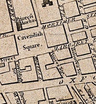
Part of a map of the City of Westminster and the immediate environs. Engraving, 1764. Iconographic Collections |
||
| Credit line |
|
||
| References |
|
||
| Source/Photographer |
https://wellcomeimages.org/indexplus/obf_images/24/fc/7d04fb941ffd40b84a78e5b0ca53.jpg
|
||
| Other versions | |||

Licensing[edit]
- You are free:
- to share – to copy, distribute and transmit the work
- to remix – to adapt the work
- Under the following conditions:
- attribution – You must give appropriate credit, provide a link to the license, and indicate if changes were made. You may do so in any reasonable manner, but not in any way that suggests the licensor endorses you or your use.
File history
Click on a date/time to view the file as it appeared at that time.
| Date/Time | Thumbnail | Dimensions | User | Comment | |
|---|---|---|---|---|---|
| current | 16:34, 22 May 2018 | | 309 × 333 (455 KB) | Belbury (talk | contribs) | Cropped 56 % horizontally, 53 % vertically using CropTool with lossless mode. |
| 12:21, 22 May 2018 |  | 702 × 703 (692 KB) | Belbury (talk | contribs) | File:Part of a map of the City of Westminster and the immediate e Wellcome V0012879.jpg cropped 73 % horizontally, 78 % vertically using CropTool with lossless mode. |
You cannot overwrite this file.
File usage on Commons
The following 2 pages use this file:
File usage on other wikis
The following other wikis use this file:
- Usage on en.wikipedia.org