File:Cathédrale de Paris 04.JPG
Jump to navigation
Jump to search

Size of this preview: 800 × 450 pixels. Other resolutions: 320 × 180 pixels | 640 × 360 pixels | 1,024 × 576 pixels | 1,280 × 720 pixels | 1,920 × 1,080 pixels.
Original file (1,920 × 1,080 pixels, file size: 372 KB, MIME type: image/jpeg)
Captions
Captions
Add a one-line explanation of what this file represents
Summary
[edit]
| Description |
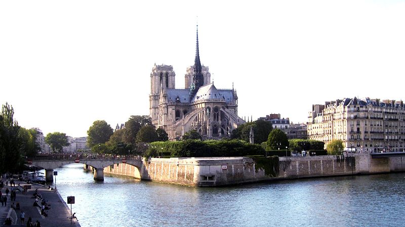
Français : La Cathédrale Notre-Dame de Paris est cathédrale d’archidiocèse. Située dans l’île de la Cité, 4ème arrondissement de Paris, sa façade domine le parvis Notre-Dame devenu place Jean-Paul-II. Sa construction sous l'impulsion de l’évêque Maurice de Sully dura plus de deux siècles, de 1163 au milieu du XIVème siècle. Son style n’est pas uniforme. Il va du gothique primitif au gothique flamboyant. Avec 13 mètres de diamètre chacune, deux rosaces ornant les bras du transept sont parmi les plus grandes d’Europe. Elle fut l'une des plus grandes cathédrales d'Occident. Après la révolution française, sa restauration dirigée par l’architecte Viollet-le-Duc dura vingt ans. Italiano: Il Notre Dame di Parigi è arcidiocesi. Situato sulla isola de la Cité, 4 ° arrondissement di Parigi, la sua facciata domina la piazza di Notre Dame è diventato Giovanni Paolo II. La sua costruzione sotto la guida del vescovo Maurice de Sully è durato più di due secoli, dal 1163 alla metà del XIV secolo. Il suo stile non è uniforme, dal gotico primitivo al gotico fiorito. Con 13 metri di diametro ciascuno, due rosette che decorano il transetto sono tra i più grandi d'Europa. Era una delle più grandi cattedrali in Occidente. Dopo la Rivoluzione Francese, il suo restauro condotto dall'architetto Viollet-le-Duc durata vent'anni.
|
|
| Date | ||
| Source | Own work | |
| Author | RUMANI |
| Camera location | | View this and other nearby images on: OpenStreetMap |
|---|
Licensing
[edit]
I, the copyright holder of this work, hereby publish it under the following license:
This file is licensed under the Creative Commons Attribution-Share Alike 4.0 International license.
- You are free:
- to share – to copy, distribute and transmit the work
- to remix – to adapt the work
- Under the following conditions:
- attribution – You must give appropriate credit, provide a link to the license, and indicate if changes were made. You may do so in any reasonable manner, but not in any way that suggests the licensor endorses you or your use.
- share alike – If you remix, transform, or build upon the material, you must distribute your contributions under the same or compatible license as the original.

|
This image was uploaded as part of Wiki Loves Monuments 2015.
|
File history
Click on a date/time to view the file as it appeared at that time.
| Date/Time | Thumbnail | Dimensions | User | Comment | |
|---|---|---|---|---|---|
| current | 18:40, 28 September 2015 | | 1,920 × 1,080 (372 KB) | RUMANI (talk | contribs) | User created page with UploadWizard |
You cannot overwrite this file.
File usage on Commons
The following 2 pages use this file: