File:Caspian Sea (MODIS 2016-04-26).jpg

Original file (4,545 × 3,336 pixels, file size: 1.32 MB, MIME type: image/jpeg)
Captions
Captions
Summary[edit]
.jpg&action=edit§ion=1)
| Description |
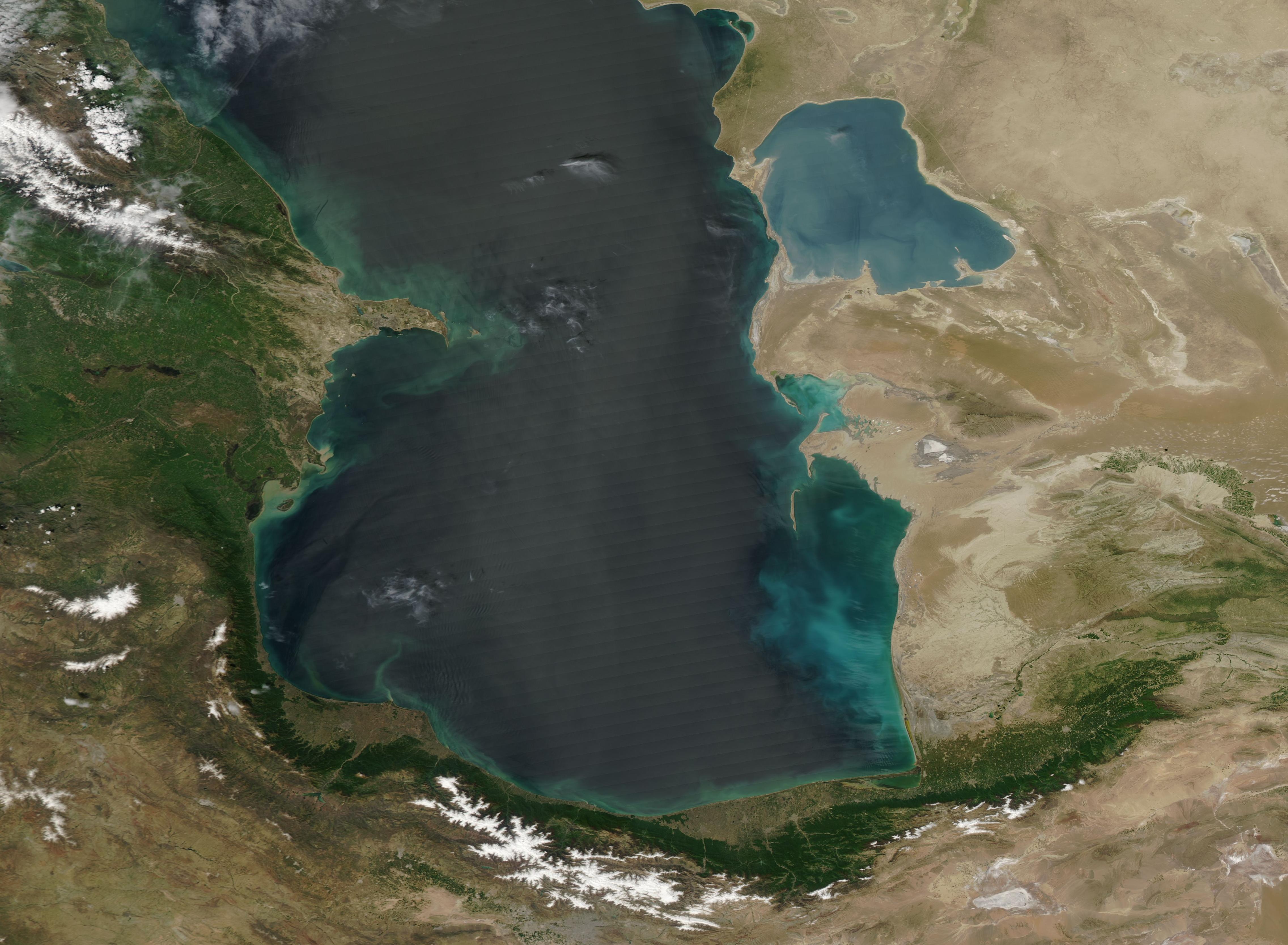
English: The Caspian Sea covers about 371,000 square kilometers (143,200 square miles), making it the world's largest inland body of water. To the ancient Greeks and Persians, the vast size suggested it was an ocean, hence the name in classical antiquity was the Hyrcanian Ocean or Hyrcanian Sea.
The Moderate Resolution Imaging Spectroradiometer (MODIS) aboard NASA's Aqua satellite captured this true-color image of the southern Caspian Sea on April 21, 2016. The image captures most of the area once known as Hyrcania, which became part of the Achaemenid Empire during the reign of King Cyrus the Great or Cambyses (558-522 B.C.) and had become Persian by 533 B.C. It was situated between the Caspian Sea in the north and the Elburz mountains in the south and west and stretched to the open steppe in the west. The Elburz Mountains (also known as Alborz Mountains) form a green ridge rising close to the shores of the Caspian Sea. Hyrcania became part of modern-day Iran, which lies in the south and west of the Caspian Sea and Turkmenistan which sits to Iran's east. The image also captures part of Azerbaijan on the west coast of the Caspian Sea and Kazakhstan on the east coast, north of Turkmenistan. |
||
| Date | Taken on 21 April 2016 | ||
| Source |
|
||
| Author | Jeff Schmaltz, MODIS Land Rapid Response Team, NASA GSFC |
| This media is a product of the Aqua mission Credit and attribution belongs to the mission team, if not already specified in the "author" row |
Licensing[edit]
.jpg&action=edit§ion=2)
| This file is in the public domain in the United States because it was solely created by NASA. NASA copyright policy states that "NASA material is not protected by copyright unless noted". (See Template:PD-USGov, NASA copyright policy page or JPL Image Use Policy.) | ||
 |
Warnings:
|
File history
Click on a date/time to view the file as it appeared at that time.
| Date/Time | Thumbnail | Dimensions | User | Comment | |
|---|---|---|---|---|---|
| current | 19:37, 15 February 2024 | | 4,545 × 3,336 (1.32 MB) | OptimusPrimeBot (talk | contribs) | #Spacemedia - Upload of http://modis.gsfc.nasa.gov/gallery/images/image04262016_250m.jpg via Commons:Spacemedia |
You cannot overwrite this file.
File usage on Commons
There are no pages that use this file.
.jpg&oldid=852072287)