File:Carte routière et administrative de la France... - par Charle... - btv1b53027590v.jpg
Jump to navigation
Jump to search

Size of this preview: 800 × 568 pixels. Other resolutions: 320 × 227 pixels | 640 × 454 pixels | 1,024 × 727 pixels | 1,280 × 908 pixels | 2,560 × 1,817 pixels | 10,281 × 7,296 pixels.
Original file (10,281 × 7,296 pixels, file size: 16.38 MB, MIME type: image/jpeg)
Captions
Captions
Add a one-line explanation of what this file represents
Summary
[edit]| Warning | The original file is very high-resolution. It might not load properly or could cause your browser to freeze when opened at full size. |
|---|
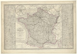
| Carte routière et administrative de la France... / par Charle,...
( |
|||||||||||||||||||||||||||
|---|---|---|---|---|---|---|---|---|---|---|---|---|---|---|---|---|---|---|---|---|---|---|---|---|---|---|---|
| Author |
Charle, Jean Baptiste Louis. Auteur du texte |
||||||||||||||||||||||||||
| Title |
Carte routière et administrative de la France... / par Charle,... |
||||||||||||||||||||||||||
| Description |
Français : Sujet : France
Couverture : France Langue : français Éditeur : Dopler (Paris) |
||||||||||||||||||||||||||
| Date | 1849 | ||||||||||||||||||||||||||
| Dimensions | height: 52 cm (20.4 in); width: 78 cm (30.7 in) | ||||||||||||||||||||||||||
| Collection |
|
||||||||||||||||||||||||||
| References |
Français : Notice du catalogue : http://catalogue.bnf.fr/ark:/12148/cb40688323k |
||||||||||||||||||||||||||
| Source/Photographer |
Français : Bibliothèque nationale de France, département Cartes et plans, GE C-1833
Bibliothèque nationale de France |
||||||||||||||||||||||||||
| Permission (Reusing this file) |
|
||||||||||||||||||||||||||

File history
Click on a date/time to view the file as it appeared at that time.
| Date/Time | Thumbnail | Dimensions | User | Comment | |
|---|---|---|---|---|---|
| current | 10:18, 8 July 2022 | | 10,281 × 7,296 (16.38 MB) | Gzen92Bot (talk | contribs) | Gallica btv1b53027590v |
You cannot overwrite this file.
File usage on Commons
The following page uses this file: