File:Carte parc Tzoumerka.png
Jump to navigation
Jump to search
Size of this preview: 648 × 599 pixels. Other resolutions: 260 × 240 pixels | 519 × 480 pixels | 906 × 838 pixels.
Original file (906 × 838 pixels, file size: 1.01 MB, MIME type: image/png)
Captions
Captions
Add a one-line explanation of what this file represents
Summary
[edit]
| Description |
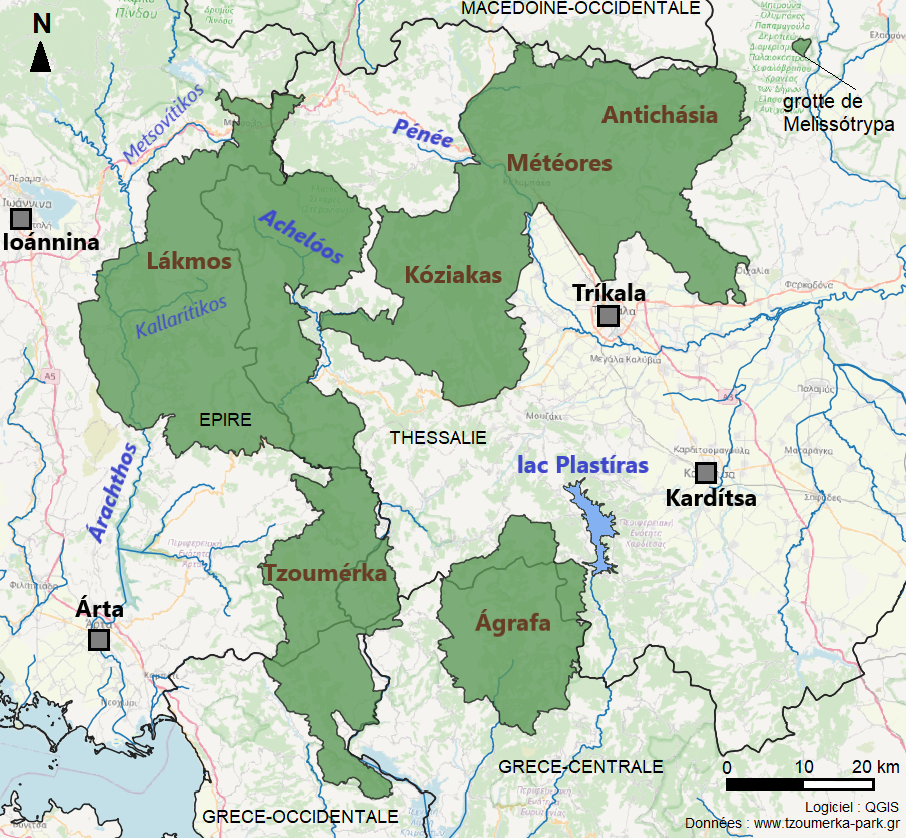
Français : Emprise du parc national des Tzoumérka, de la vallée de l'Achelóos, des Ágrafa et des Météores. Les villes environnantes sont légendées en noir, les massifs en marron et le réseau hydrographique en bleu. Data provided by the Tzoumerka, Acheloos valley, Agrafa and Meteora Management Body (Φορέας Διαχείρισης Εθνικού Πάρκου Τζουμέρκων, Κοιλάδας Αχελώου Αγράφων και Μετεώρων). Available at: www.tzoumerka-park.gr. Basemap: OpenStreetMap. Free software: QGIS. Creation: Iolchos07. |
| Date | |
| Source | Own work |
| Author | Iolchos07 |
Licensing
[edit]
I, the copyright holder of this work, hereby publish it under the following license:
This file is licensed under the Creative Commons Attribution-Share Alike 4.0 International license.
- You are free:
- to share – to copy, distribute and transmit the work
- to remix – to adapt the work
- Under the following conditions:
- attribution – You must give appropriate credit, provide a link to the license, and indicate if changes were made. You may do so in any reasonable manner, but not in any way that suggests the licensor endorses you or your use.
- share alike – If you remix, transform, or build upon the material, you must distribute your contributions under the same or compatible license as the original.
File history
Click on a date/time to view the file as it appeared at that time.
| Date/Time | Thumbnail | Dimensions | User | Comment | |
|---|---|---|---|---|---|
| current | 14:01, 19 December 2020 | | 906 × 838 (1.01 MB) | Iolchos07 (talk | contribs) | Cross-wiki upload from fr.wikipedia.org |
You cannot overwrite this file.
File usage on Commons
There are no pages that use this file.
File usage on other wikis
The following other wikis use this file:
- Usage on fr.wikipedia.org