File:Carte du Moyen-Orient2.svg
Jump to navigation
Jump to search

Size of this PNG preview of this SVG file: 624 × 600 pixels. Other resolutions: 250 × 240 pixels | 499 × 480 pixels | 799 × 768 pixels | 1,065 × 1,024 pixels | 2,130 × 2,048 pixels | 936 × 900 pixels.
Original file (SVG file, nominally 936 × 900 pixels, file size: 5.15 MB)
Captions
Captions
Add a one-line explanation of what this file represents
Summary[edit]
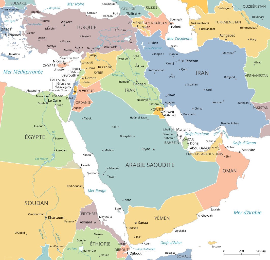
| Description |
Français : Carte politique du Moyen-Orient (Asie de l'Ouest et Afrique du Nord-Ouest).
English: Political map of the Middle East (West Asia and Northeast Africa) in French. |
| Date | |
| Source | Own work based on: Middle East Endonyms.svg by Bethmallory |
| Author | GrandEscogriffe |
| Other versions |
|

Licensing[edit]
I, the copyright holder of this work, hereby publish it under the following license:
This file is licensed under the Creative Commons Attribution-Share Alike 4.0 International license.
- You are free:
- to share – to copy, distribute and transmit the work
- to remix – to adapt the work
- Under the following conditions:
- attribution – You must give appropriate credit, provide a link to the license, and indicate if changes were made. You may do so in any reasonable manner, but not in any way that suggests the licensor endorses you or your use.
- share alike – If you remix, transform, or build upon the material, you must distribute your contributions under the same or compatible license as the original.
File history
Click on a date/time to view the file as it appeared at that time.
| Date/Time | Thumbnail | Dimensions | User | Comment | |
|---|---|---|---|---|---|
| current | 17:06, 28 October 2022 | | 936 × 900 (5.15 MB) | GrandEscogriffe (talk | contribs) | un peu plus large à l'est pour avoir tout l'Iran |
| 16:27, 28 October 2022 |  | 936 × 900 (5.15 MB) | GrandEscogriffe (talk | contribs) | Uploaded own work with UploadWizard |
You cannot overwrite this file.
File usage on Commons
The following 3 pages use this file:
File usage on other wikis
The following other wikis use this file:
- Usage on eu.wikipedia.org
- Usage on fr.wikipedia.org
- Jordanie
- Syrie
- Moyen-Orient
- Accords Sykes-Picot
- Histoire de la Syrie
- Irak
- Histoire de la Jordanie
- Présidence de George W. Bush
- Protagonistes de la guerre israélo-arabe de 1948
- Frontière entre l'Égypte et le Soudan
- Frontière entre l'Irak et la Syrie
- Triangle de Hala'ib
- Wikipédia:Atelier graphique/Cartes/Archives/octobre 2022
- Usage on mg.wikipedia.org