File:Carte des soufflaculs en France.svg
Jump to navigation
Jump to search

Size of this PNG preview of this SVG file: 512 × 492 pixels. Other resolutions: 250 × 240 pixels | 500 × 480 pixels | 799 × 768 pixels | 1,066 × 1,024 pixels | 2,131 × 2,048 pixels.
Original file (SVG file, nominally 512 × 492 pixels, file size: 355 KB)
Captions
Captions
Add a one-line explanation of what this file represents
Summary[edit]
| Description |
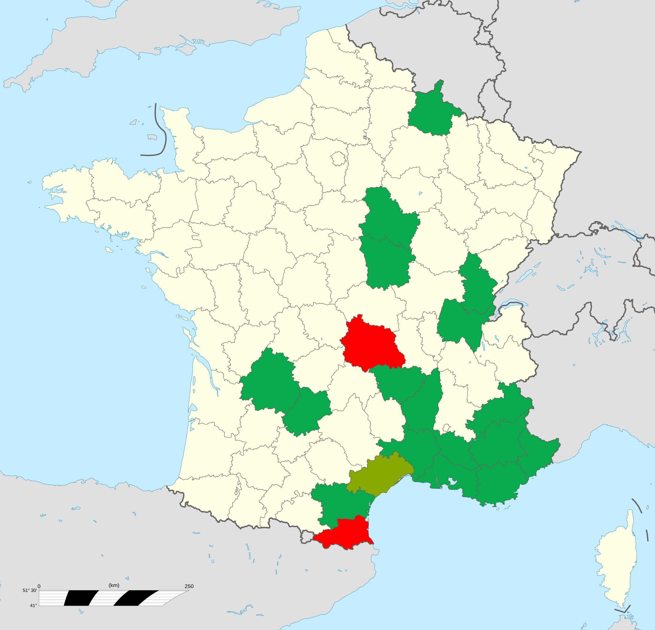
Français : Carte des soufflaculs en France.
Soufflaculs : la Dordogne, le Lot, les Ardennes, l'Yonne, la Nièvre, le Jura, l'Ain, la Haute-Loire, l'Ardèche, le Gard, le Vaucluse, les Alpes de Haute Provence, les Hautes Alpes, les Bouches du Rhône, le Var, les Alpes Maritimes, l'Aude
Soufflaculs + danse du feu aux fesses (« Tiou-Tiou ») : l'Hérault
Danse du feu aux fesses uniquement : les Pyréenes-Orientales et le Puy de Dôme |
| Date | |
| Source | Own work sur la base d' "Arnold Van Gennep, Manuel de folklore, t. III, Paris, A. et J. Picard, 1947" |
| Author | PBrieux |
Licensing[edit]
I, the copyright holder of this work, hereby publish it under the following license:
This file is licensed under the Creative Commons Attribution-Share Alike 4.0 International license.
- You are free:
- to share – to copy, distribute and transmit the work
- to remix – to adapt the work
- Under the following conditions:
- attribution – You must give appropriate credit, provide a link to the license, and indicate if changes were made. You may do so in any reasonable manner, but not in any way that suggests the licensor endorses you or your use.
- share alike – If you remix, transform, or build upon the material, you must distribute your contributions under the same or compatible license as the original.
File history
Click on a date/time to view the file as it appeared at that time.
| Date/Time | Thumbnail | Dimensions | User | Comment | |
|---|---|---|---|---|---|
| current | 21:36, 28 October 2020 | | 512 × 492 (355 KB) | PBrieux (talk | contribs) | Uploaded own work with UploadWizard |
You cannot overwrite this file.
File usage on Commons
There are no pages that use this file.
File usage on other wikis
The following other wikis use this file:
- Usage on en.wikipedia.org
- Usage on fr.wikipedia.org