File:Carte des attaques du Monstre du Valais-fr.svg
Jump to navigation
Jump to search

Size of this PNG preview of this SVG file: 799 × 600 pixels. Other resolutions: 320 × 240 pixels | 640 × 480 pixels | 1,024 × 768 pixels | 1,280 × 961 pixels | 2,560 × 1,921 pixels | 1,719 × 1,290 pixels.
Original file (SVG file, nominally 1,719 × 1,290 pixels, file size: 538 KB)
Captions
Captions
Add a one-line explanation of what this file represents
Summary[edit]
| Description |
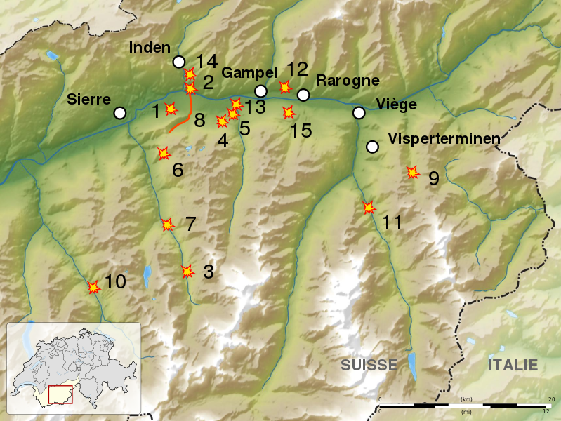
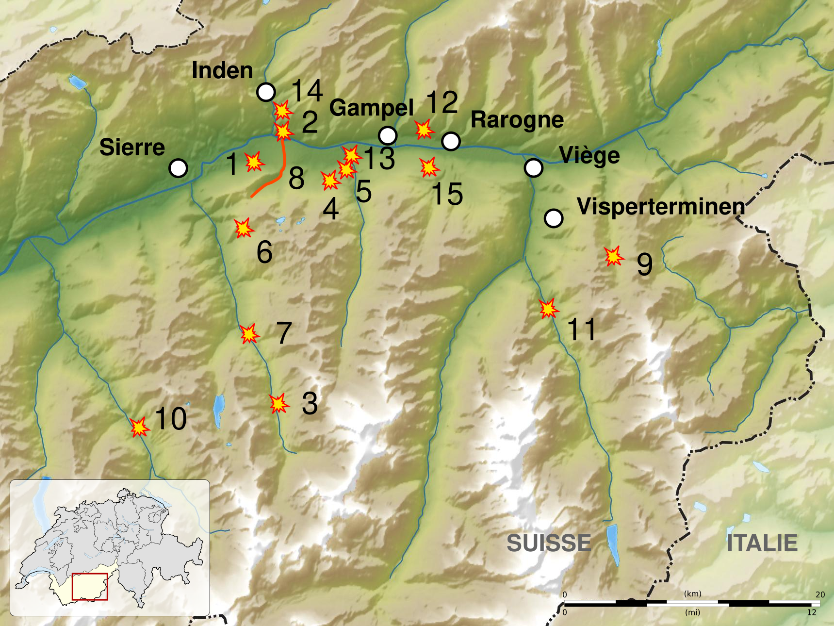
English: Map of the attacks of the Valais monster, from april 1946 to november 1947.
Français : Carte des attaques du Monstre du Valais, d'avril 1946 à novembre 1947. |
| Date | (UTC) |
| Source |
English: * Attacks location given by Tsaag Valren
Français : * Lieux des attaques donnés par Tsaag Valren :
|
| Author | Sémhur (talk) |
| SVG development | |
| Attribution (required by the license) | © Sémhur / Wikimedia Commons / |
| Object location | | View this and other nearby images on: OpenStreetMap |
|---|
Licensing[edit]
I, the copyright holder of this work, hereby publish it under the following licenses:
| Copyleft: This work of art is free; you can redistribute it and/or modify it according to terms of the Free Art License. You will find a specimen of this license on the Copyleft Attitude site as well as on other sites. |
This file is licensed under the Creative Commons Attribution-Share Alike Attribution-Share Alike 4.0 International, 3.0 Unported, 2.5 Generic, 2.0 Generic and 1.0 Generic license.
- You are free:
- to share – to copy, distribute and transmit the work
- to remix – to adapt the work
- Under the following conditions:
- attribution – You must give appropriate credit, provide a link to the license, and indicate if changes were made. You may do so in any reasonable manner, but not in any way that suggests the licensor endorses you or your use.
- share alike – If you remix, transform, or build upon the material, you must distribute your contributions under the same or compatible license as the original.
You may select the license of your choice.
File history
Click on a date/time to view the file as it appeared at that time.
| Date/Time | Thumbnail | Dimensions | User | Comment | |
|---|---|---|---|---|---|
| current | 21:12, 15 January 2016 | | 1,719 × 1,290 (538 KB) | Sémhur (talk | contribs) | == {{int:filedesc}} == {{Information |Description= {{en|1= Map of the attacks of the en:Valais monster, from april 1946 to november 1947.}} {{fr|1= Carte des attaques du fr:Monstre du Valais, d'avril 1946 à novembre 1947.}} |Source= {{en|1... |
You cannot overwrite this file.
File usage on Commons
The following page uses this file:
File usage on other wikis
The following other wikis use this file:
- Usage on fr.wikipedia.org