File:Carte de la mer du Nord.png
Jump to navigation
Jump to search

Size of this preview: 446 × 599 pixels. Other resolutions: 179 × 240 pixels | 357 × 480 pixels | 777 × 1,043 pixels.
Original file (777 × 1,043 pixels, file size: 185 KB, MIME type: image/png)
Captions
Captions
Add a one-line explanation of what this file represents
| Description |
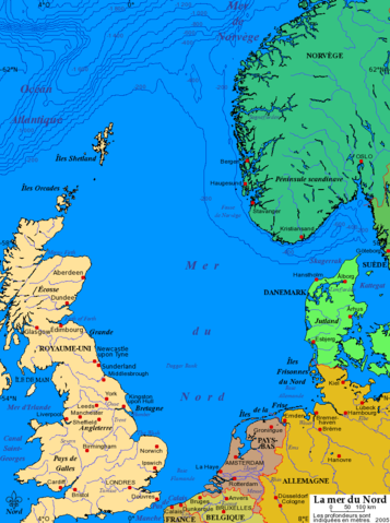
Carte de la mer du Nord, ses villes et ports principaux. Données de 2005. Projection de Mercator. Fond de carte provenant du fichier fr:commons:Image:Mer du Nord-vierge.png. 2005 Bra |
| Source | File:Mer du Nord-vierge.png |
| Author | User Idarvol on fr.wikipedia |
| Permission (Reusing this file) |
Released under the GNU Free Documentation License. |
| Other versions |
Originally from fr.wikipedia; description page is (was) here |

|
Permission is granted to copy, distribute and/or modify this document under the terms of the GNU Free Documentation License, Version 1.2 or any later version published by the Free Software Foundation; with no Invariant Sections, no Front-Cover Texts, and no Back-Cover Texts. A copy of the license is included in the section entitled GNU Free Documentation License. |
| This file is licensed under the Creative Commons Attribution-Share Alike 3.0 Unported license. | ||
| ||
| This licensing tag was added to this file as part of the GFDL licensing update. |
(Uploaded using CommonsHelper or PushForCommons archive copy at the Wayback Machine)
File history
Click on a date/time to view the file as it appeared at that time.
| Date/Time | Thumbnail | Dimensions | User | Comment | |
|---|---|---|---|---|---|
| current | 23:34, 3 November 2006 | | 777 × 1,043 (185 KB) | Korrigan (talk | contribs) | {{Information| |Description= Carte de la mer du Nord, ses villes et ports principaux. Données de 2005. Projection de Mercator. ''Fond de carte provenant du fichier fr::commons:Image:Mer du Nord-vierge.png. 2005 Bra |Sour |
You cannot overwrite this file.
File usage on Commons
The following 2 pages use this file:
File usage on other wikis
The following other wikis use this file:
- Usage on en.wikipedia.org
- Usage on en.wiktionary.org
- Usage on es.wikipedia.org
- Usage on fi.wikinews.org
- Usage on fr.wikipedia.org
- Pas de Calais
- Mer du Nord
- Catégorie:Royaume-Uni
- Phare d'Ostende
- Zeebruges
- Principauté de Sealand
- Portail:Maritime
- Texel (Pays-Bas)
- Ostende
- Zwin (bras de mer)
- Comté de Rogaland
- Catégorie:Plan Delta
- Frigg (gisement)
- Brent (champs de pétrole)
- Portail:Maritime/Voir aussi
- Fanø
- Sylt
- Föhr
- Amrum
- Pellworm
- Borkum
- Juist
- Norderney
- Baltrum
- Langeoog
- Spiekeroog
- Wangerooge
- Memmert
- Lütje Hörn
- Schéveningue
- Mer des Wadden
- Stavanger
- Phare de Blankenberghe
- Frison oriental
- Lindisfarne
- Incident du Dogger Bank
- Herald of Free Enterprise
- Portail:Mer
- Cratère de Silverpit
- Bataille du Jutland
- Piper Alpha
- Styrsö
- Auskerry
- Archipel de Göteborg
- Rømø
View more global usage of this file.