File:Carta geologica dell’isola d’Elba. Roma, Tip. Nazionale, 1884 - 1886.jpg
Jump to navigation
Jump to search
Size of this preview: 784 × 600 pixels. Other resolutions: 314 × 240 pixels | 628 × 480 pixels | 1,004 × 768 pixels | 1,280 × 979 pixels | 2,560 × 1,959 pixels | 3,273 × 2,504 pixels.
Original file (3,273 × 2,504 pixels, file size: 1.69 MB, MIME type: image/jpeg)
Captions
Captions
Add a one-line explanation of what this file represents
Summary
[edit]
| Description |
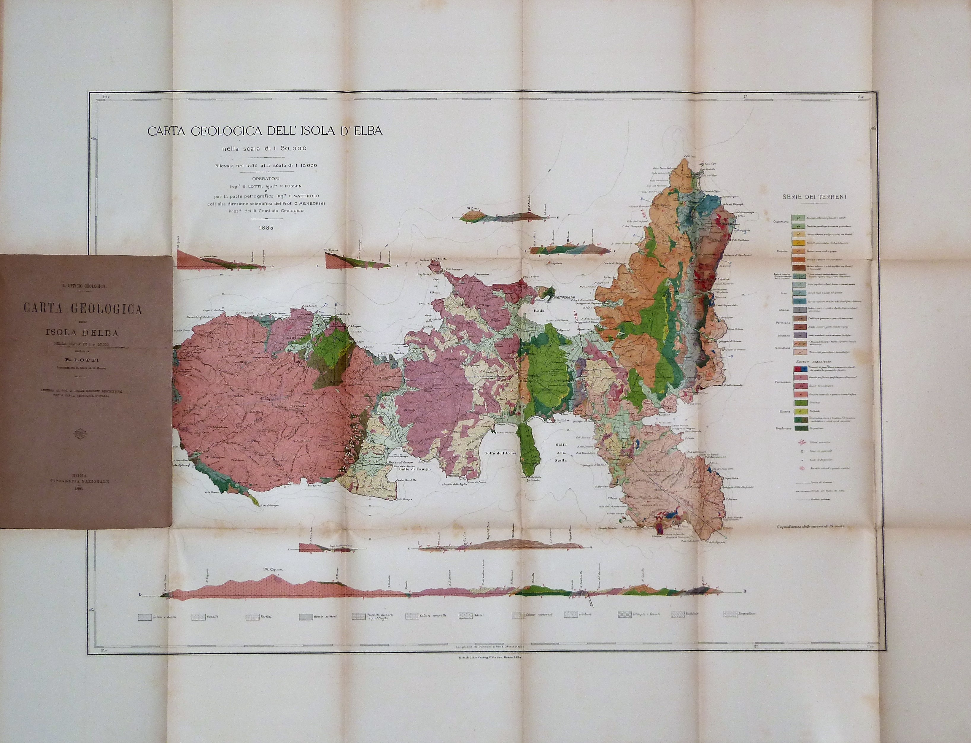
Italiano: Grande carta dell’Isola d’Elba, più volte ripiegata, rilevata dall’Ing. B. Lotti, con la collaborazione del geologo Meneghini e dell'Ing. Mattirolo.
La carta, raffigurata in scala 1:50 000, vede rappresentati, a colori differenti, i diversi terreni isolani e presenta in calce il suo profilo visto dal mare. |
| Date | |
| Source | Archivio Libreria Antiquaria Bourlot - Torino |
| Author | Argonitros |
Licensing
[edit]
I, the copyright holder of this work, hereby publish it under the following license:
This file is licensed under the Creative Commons Attribution-Share Alike 4.0 International license.
- You are free:
- to share – to copy, distribute and transmit the work
- to remix – to adapt the work
- Under the following conditions:
- attribution – You must give appropriate credit, provide a link to the license, and indicate if changes were made. You may do so in any reasonable manner, but not in any way that suggests the licensor endorses you or your use.
- share alike – If you remix, transform, or build upon the material, you must distribute your contributions under the same or compatible license as the original.
File history
Click on a date/time to view the file as it appeared at that time.
| Date/Time | Thumbnail | Dimensions | User | Comment | |
|---|---|---|---|---|---|
| current | 14:29, 16 February 2019 | | 3,273 × 2,504 (1.69 MB) | Argonitros (talk | contribs) | User created page with UploadWizard |
You cannot overwrite this file.
File usage on Commons
There are no pages that use this file.