File:Carta del Departamento de Ecuador.jpg
Jump to navigation
Jump to search

Size of this preview: 653 × 600 pixels. Other resolutions: 261 × 240 pixels | 523 × 480 pixels | 836 × 768 pixels | 1,115 × 1,024 pixels | 2,230 × 2,048 pixels | 4,214 × 3,871 pixels.
Original file (4,214 × 3,871 pixels, file size: 4.9 MB, MIME type: image/jpeg)
Captions
Captions
Add a one-line explanation of what this file represents
Summary[edit]
| Description |
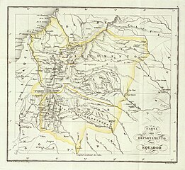
Español: Carta del Departamento de Ecuador (Gran Colombia), 1827 |
| Date | |
| Source | Carta del Departamento de Ecuador, from David Rumsey Collection |
| Author | Jose Manuel Restrepo, 1781-1863 |
Licensing[edit]
|
This work is in the public domain in its country of origin and other countries and areas where the copyright term is the author's life plus 70 years or fewer. This work is in the public domain in the United States because it was published (or registered with the U.S. Copyright Office) before January 1, 1929. | |
| This file has been identified as being free of known restrictions under copyright law, including all related and neighboring rights. | |
File history
Click on a date/time to view the file as it appeared at that time.
| Date/Time | Thumbnail | Dimensions | User | Comment | |
|---|---|---|---|---|---|
| current | 23:12, 18 December 2023 | | 4,214 × 3,871 (4.9 MB) | Milenioscuro (talk | contribs) | Uploaded a work by Jose Manuel Restrepo, 1781-1863 from David Rumsey Collection with UploadWizard |
You cannot overwrite this file.
File usage on Commons
The following page uses this file:
- File:Carta del Departamento de Quito.png (file redirect)
File usage on other wikis
The following other wikis use this file:
- Usage on de.wikisource.org
- Usage on es.wikipedia.org
Categories:
- Maps of departments of Gran Colombia
- 1820s maps of Ecuador
- Old maps of Bolívar Province
- Old maps of Carchi Province
- Old maps of Chimborazo Province
- Old maps of Cotopaxi Province
- Old maps of Esmeraldas Province
- Old maps of Imbabura Province
- Old maps of Morona-Santiago Province
- Old maps of Napo Province
- Old maps of Orellana Province
- Old maps of Pastaza Province
- Old maps of Pichincha Province
- Old maps of Santo Domingo de los Tsáchilas Province
- Old maps of Sucumbíos Province
- Old maps of Tungurahua Province
- Atlas de Colombia, 1827