File:Carrollton,Georgia-Topo.png
Jump to navigation
Jump to search
No higher resolution available.
Carrollton,Georgia-Topo.png (576 × 393 pixels, file size: 84 KB, MIME type: image/png)
Captions
Captions
Add a one-line explanation of what this file represents
Summary[edit]
| Description |
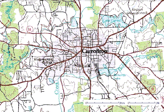
English: Topographic Map of Carrollton, Georgia. Circa 1975. Created by the U.S. Geological Survey (Department of the Interior).
External LinkU.S. Geological Survey |
| Source | USGS |
| Author | USGS |
Licensing[edit]
This image is in the public domain in the United States because it only contains materials that originally came from the United States Geological Survey, an agency of the United States Department of the Interior. For more information, see the official USGS copyright policy.
|
Original upload log[edit]
The original description page was here. All following user names refer to en.wikipedia.
- 2004-04-20 15:36 Maclyn611 576×393× (86295 bytes) Topographic Map of Carrollton, Georgia. Circa 1975
File history
Click on a date/time to view the file as it appeared at that time.
| Date/Time | Thumbnail | Dimensions | User | Comment | |
|---|---|---|---|---|---|
| current | 19:37, 19 December 2011 | | 576 × 393 (84 KB) | File Upload Bot (Magnus Manske) (talk | contribs) | {{BotMoveToCommons|en.wikipedia|year={{subst:CURRENTYEAR}}|month={{subst:CURRENTMONTHNAME}}|day={{subst:CURRENTDAY}}}} {{Information |Description={{en|Topographic Map of Carrollton, Georgia. Circa 1975. Created by the [[:en:United States Geological Sur |
You cannot overwrite this file.
File usage on Commons
There are no pages that use this file.
File usage on other wikis
The following other wikis use this file:
- Usage on en.wikipedia.org