File:Carbon Glacier, Hanging Glacier and Valley Rock Glacier, October 1, 1958 (GLACIERS 1640).jpg
Jump to navigation
Jump to search

Size of this preview: 776 × 600 pixels. Other resolutions: 311 × 240 pixels | 621 × 480 pixels | 994 × 768 pixels | 1,280 × 989 pixels | 2,560 × 1,978 pixels | 3,800 × 2,936 pixels.
Original file (3,800 × 2,936 pixels, file size: 1.08 MB, MIME type: image/jpeg)
Captions
Captions
Add a one-line explanation of what this file represents

|
The categories of this image need checking. You can do so here.
|
.jpg&action=edit&withJS=MediaWiki:Catcheck.js)
Summary[edit]
.jpg&action=edit§ion=1)
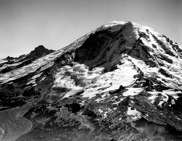
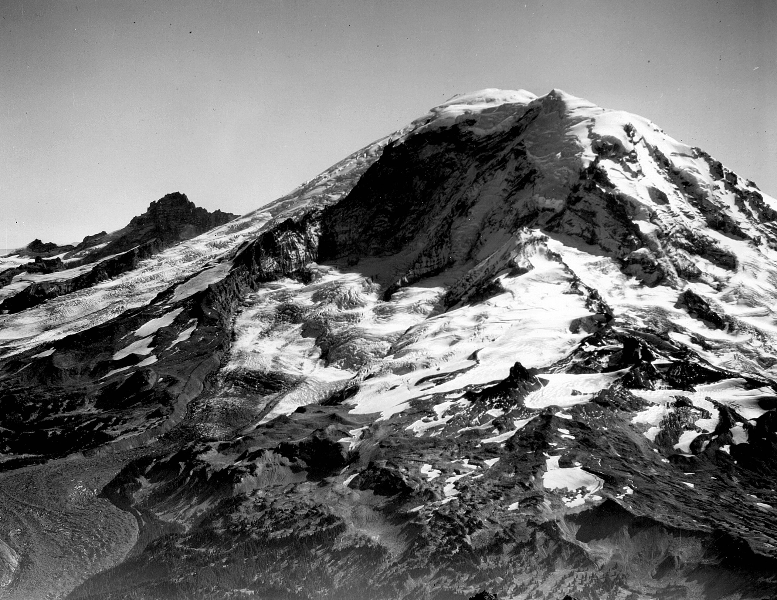
| English: Carbon Glacier, Hanging Glacier and Valley Rock Glacier, October 1, 1958
( |
||||||||||||||||||||||||
|---|---|---|---|---|---|---|---|---|---|---|---|---|---|---|---|---|---|---|---|---|---|---|---|---|
| Photographer |
|
|||||||||||||||||||||||
| Title |
English: Carbon Glacier, Hanging Glacier and Valley Rock Glacier, October 1, 1958 |
|||||||||||||||||||||||
| Description |
English: Carbon Glacier, Hanging Glacier and Valley Rock Glacier, October 1, 1958
|
|||||||||||||||||||||||
| Depicted place | Carbon Glacier | |||||||||||||||||||||||
| Date | Taken on 1 October 1958 | |||||||||||||||||||||||
| Dimensions | height: 9 in (22.8 cm); width: 9 in (22.8 cm) | |||||||||||||||||||||||
| Collection |
|
|||||||||||||||||||||||
| Current location | ||||||||||||||||||||||||
| Accession number | ||||||||||||||||||||||||
| Source | ||||||||||||||||||||||||
| Permission (Reusing this file) |
|
|||||||||||||||||||||||
| Order Number | EAS0786 | |||||||||||||||||||||||
| Reference Number on Photograph | PH Coll 734.HH4 | |||||||||||||||||||||||
| Judicial District | Pierce County | |||||||||||||||||||||||
| Preserve or Park | Mount Rainier National Park | |||||||||||||||||||||||
| Additional Glaciers | Mt. Rainier | |||||||||||||||||||||||
| Object location | | View this and other nearby images on: OpenStreetMap |
|---|
.jpg¶ms=046.941667_N_-121.775000_E_globe:Earth_class:object_type:object__&language=en)
File history
Click on a date/time to view the file as it appeared at that time.
| Date/Time | Thumbnail | Dimensions | User | Comment | |
|---|---|---|---|---|---|
| current | 19:34, 14 June 2019 | | 3,800 × 2,936 (1.08 MB) | BMacZeroBot (talk | contribs) | Batch upload (Commons:Batch uploading/University of Washington Digital Collections) |
You cannot overwrite this file.
File usage on Commons
The following page uses this file:
.jpg)
.jpg&oldid=848287186)