File:Cape Dezhnev USCGS 1937.PNG
Jump to navigation
Jump to search
Size of this preview: 800 × 350 pixels. Other resolutions: 320 × 140 pixels | 816 × 357 pixels.
Original file (816 × 357 pixels, file size: 567 KB, MIME type: image/png)
Captions
Captions
Add a one-line explanation of what this file represents
Summary
[edit]
| Description |
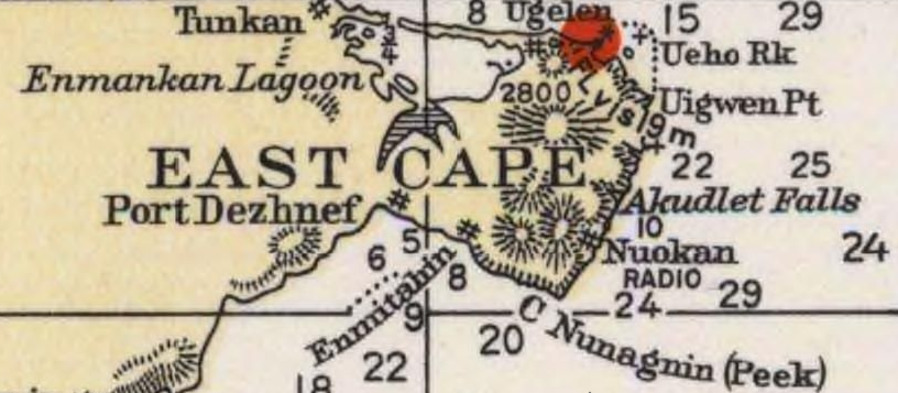
English: Detail of 1937 USCGS Bering Sea ahowing Cape Dezhnev aka East Cape with geographical features and villages marked. |
| Date | |
| Source | Historical Maps and Charts Project, Office of Coast Survey, US NOAA Bering Sea Chart 9302 6_1937 http://historicalcharts.noaa.gov/historicals/historical_zoom.asp |
| Author | USCGS |
Licensing
[edit]
This image is in the public domain because it contains materials that originally came from the U.S. National Oceanic and Atmospheric Administration, taken or made as part of an employee's official duties.
|
File history
Click on a date/time to view the file as it appeared at that time.
| Date/Time | Thumbnail | Dimensions | User | Comment | |
|---|---|---|---|---|---|
| current | 00:20, 21 December 2009 | | 816 × 357 (567 KB) | Dankarl (talk | contribs) | {{Information |Description={{en|1=Detail of 1937 USCGS Bering Sea ahowing Cape Dezhnev aka East Cape with geographical features and villages marked. }} |Source=Historical Maps and Charts Project, Office of Coast Survey, US NOAA Bering Sea Chart 9302 6_19 |
You cannot overwrite this file.
File usage on Commons
There are no pages that use this file.
File usage on other wikis
The following other wikis use this file:
- Usage on de.wikipedia.org
- Usage on en.wikipedia.org
- Usage on et.wikipedia.org
- Usage on fi.wikipedia.org
- Usage on fr.wikipedia.org
- Usage on ja.wikipedia.org
- Usage on nl.wikipedia.org
- Usage on zh.wikipedia.org