File:Cape D’Or Lighthouse.jpg

Original file (4,288 × 2,848 pixels, file size: 9.83 MB, MIME type: image/jpeg)
Captions
Captions
| Description |
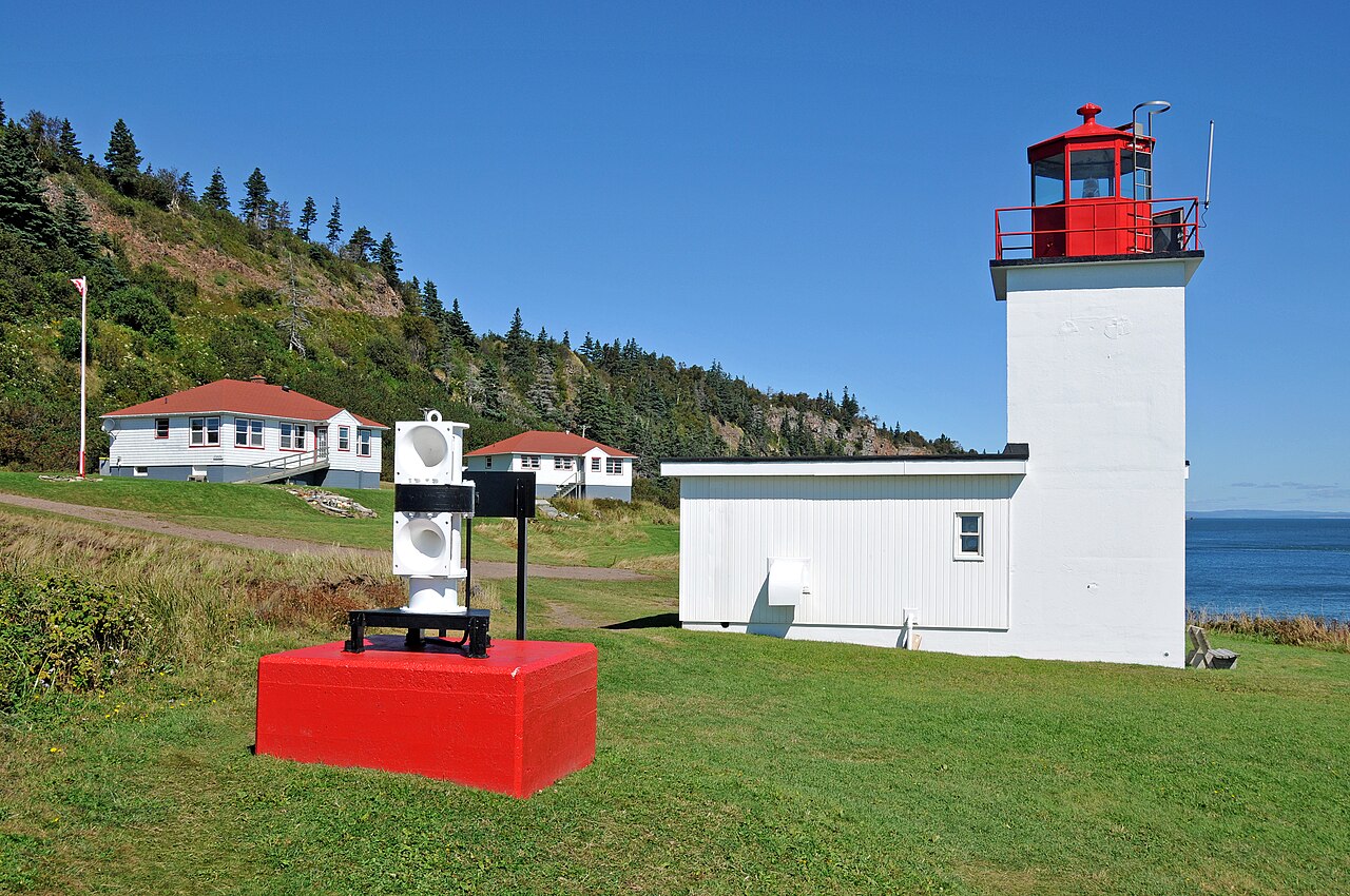
French explorer Smauel de Champlain named Cape D’Or (Cape of Gold) when he sailed by here in 1607. Originally established as a fog horn station in 1875, the Cape d'Or lightstation is perched halfway up the dramatic cliffs rising out of the turbulent Minas Channel. The cape received its first lighthouse in 1922. The present lighthouse, is a one-story fog signal building with a light tower rising from one corner, it was built in 1965. After automation in 1989, the two keeper’s dwellings, completed in 1959, sat vacant until being leased by the Advocate District Development Association in 1995 and converted into a tearoom and hostel. This is the only lighthouse in Nova Scotia to offer overnight accommodations. |
||
| Date | |||
| Source | Flickr: DGJ_4293 - Cape D’Or Lighthouse | ||
| Author | Dennis Jarvis | ||
| Permission (Reusing this file) |
This file is licensed under the Creative Commons Attribution-Share Alike 2.0 Generic license.
|
| Camera location | | View this and other nearby images on: OpenStreetMap |
|---|
File history
Click on a date/time to view the file as it appeared at that time.
| Date/Time | Thumbnail | Dimensions | User | Comment | |
|---|---|---|---|---|---|
| current | 00:44, 7 October 2011 | | 4,288 × 2,848 (9.83 MB) | Flickr upload bot (talk | contribs) | Uploaded from http://flickr.com/photo/22490717@N02/6211295462 using Flickr upload bot |
You cannot overwrite this file.
File usage on Commons
The following 3 pages use this file:
- File:Cape D’Or Lighthouse (1).jpg (file redirect)
- File:DGJ 4293 - Cape D’Or Lighthouse (6211295462).jpg (file redirect)
- Category:Cape D'Or Lighthouse
.jpg&redirect=no)
.jpg&redirect=no)
File usage on other wikis
The following other wikis use this file:
- Usage on de.wikipedia.org
- Usage on de.wikivoyage.org
- Usage on en.wikipedia.org
- Usage on www.wikidata.org