File:Canada Vancouver Island relief map.jpg
Jump to navigation
Jump to search

Size of this preview: 634 × 599 pixels. Other resolutions: 254 × 240 pixels | 508 × 480 pixels | 813 × 768 pixels | 1,084 × 1,024 pixels | 2,167 × 2,048 pixels | 3,017 × 2,851 pixels.
Original file (3,017 × 2,851 pixels, file size: 1.74 MB, MIME type: image/jpeg)
Captions
Captions
Add a one-line explanation of what this file represents
Summary[edit]
| Description |
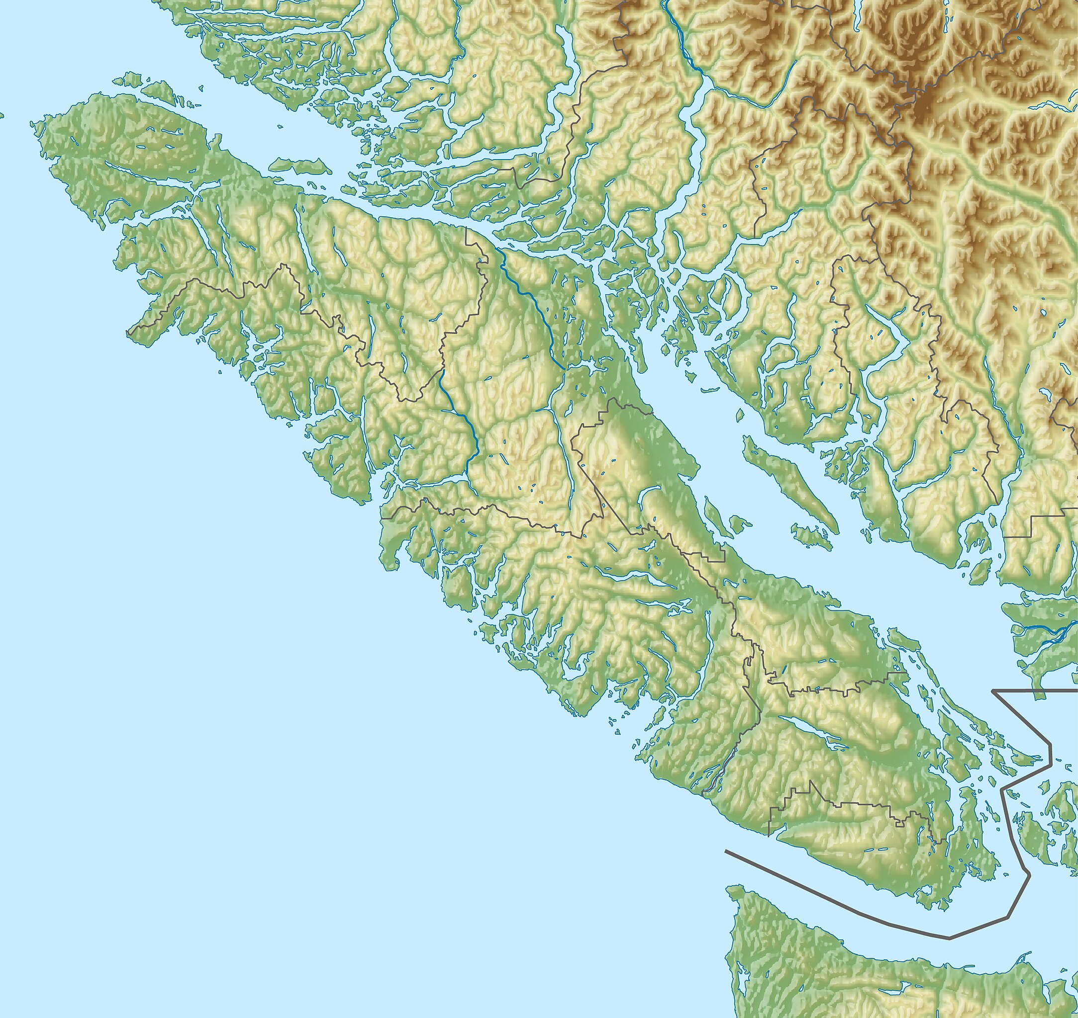
English: Relief map of Vancouver Island, Canada.
Equirectangular projection, N/S stretching 170 %. Geographic limits of the map:
|
| Date | |
| Source |
Own work using:
|
| Author | Isochrone |
| Other versions |
|

Licensing[edit]
I, the copyright holder of this work, hereby publish it under the following license:
This file is licensed under the Creative Commons Attribution-Share Alike 4.0 International license.
- You are free:
- to share – to copy, distribute and transmit the work
- to remix – to adapt the work
- Under the following conditions:
- attribution – You must give appropriate credit, provide a link to the license, and indicate if changes were made. You may do so in any reasonable manner, but not in any way that suggests the licensor endorses you or your use.
- share alike – If you remix, transform, or build upon the material, you must distribute your contributions under the same or compatible license as the original.
File history
Click on a date/time to view the file as it appeared at that time.
| Date/Time | Thumbnail | Dimensions | User | Comment | |
|---|---|---|---|---|---|
| current | 19:43, 4 June 2023 | | 3,017 × 2,851 (1.74 MB) | Isochrone (talk | contribs) | oopd |
| 19:42, 4 June 2023 |  | 3,017 × 2,516 (1.59 MB) | Isochrone (talk | contribs) | better | |
| 19:28, 4 June 2023 |  | 3,017 × 2,851 (2.06 MB) | Isochrone (talk | contribs) | =={{int:filedesc}}== {{Information |description={{en|1=Relief map of {{W|Vancouver Island}}, {{W|Canada}}. Equirectangular projection, N/S stretching 170 %. Geographic limits of the map: * N: 51.2° N * S: 48.0° N * W: 128.6° W * E: 122.9° W}} |date=2023-06-04 |source={{own using}} * STRM-30 data for the relief * United States National Imagery and Mapping Agency data * World Data Base II data * [https://www12.statcan.gc.ca/census-recensement/2021/geo/sip-pis/boundary-limites/index2021-eng.cfm?... |
You cannot overwrite this file.
File usage on Commons
The following 2 pages use this file:
File usage on other wikis
The following other wikis use this file:
- Usage on en.wikipedia.org
- Saysutshun (Newcastle Island Marine) Park
- Gulf Islands National Park Reserve
- Cowichan Lake
- Petroglyph Provincial Park
- Mount Douglas, Saanich
- Arbutus Grove Provincial Park
- Artlish Caves Provincial Park
- Bamberton Provincial Park
- Bellhouse Provincial Park
- Burgoyne Bay Provincial Park
- Broughton Archipelago Provincial Park
- Brooks Peninsula Provincial Park
- Bodega Ridge Provincial Park
- Big Bunsby Marine Provincial Park
- Bligh Island Marine Provincial Park
- Catala Island Marine Provincial Park
- Carmanah Walbran Provincial Park
- Cape Scott Provincial Park
- Vargas Island Provincial Park
- Quatsino Provincial Park
- Cormorant Channel Marine Provincial Park
- Cowichan River Provincial Park
- Collinson Point Provincial Park
- Claud Elliott Lake Provincial Park
- Chemainus River Provincial Park
- Drumbeg Provincial Park
- Dixie Cove Marine Provincial Park
- Discovery Island Marine Provincial Park
- Dionisio Point Provincial Park
- Echo Bay Marine Provincial Park
- Elk Falls Provincial Park
- Englishman River Falls Provincial Park
- Fossli Provincial Park
- French Beach Provincial Park
- Gabriola Sands Provincial Park
- God's Pocket Marine Provincial Park
- Gold Muchalat Provincial Park
- Goldstream Provincial Park
- Gordon Bay Provincial Park
- Gowlland Tod Provincial Park
- Háthayim Marine Provincial Park
- Hemer Provincial Park
- Horne Lake Caves Provincial Park
- Juan de Fuca Provincial Park
- John Dean Provincial Park
- Octopus Islands Marine Provincial Park
- Koksilah River Provincial Park
- Lawn Point Provincial Park
- Wakes Cove Provincial Park
- Little Qualicum Falls Provincial Park
View more global usage of this file.