File:Camp Fire oli 2018312 Landsat.jpg
Jump to navigation
Jump to search
Size of this preview: 800 × 533 pixels. Other resolutions: 320 × 213 pixels | 640 × 427 pixels | 1,024 × 683 pixels | 1,280 × 853 pixels | 3,017 × 2,011 pixels.
Original file (3,017 × 2,011 pixels, file size: 1.28 MB, MIME type: image/jpeg)
Captions
Captions
Add a one-line explanation of what this file represents
Summary[edit]
| Description |
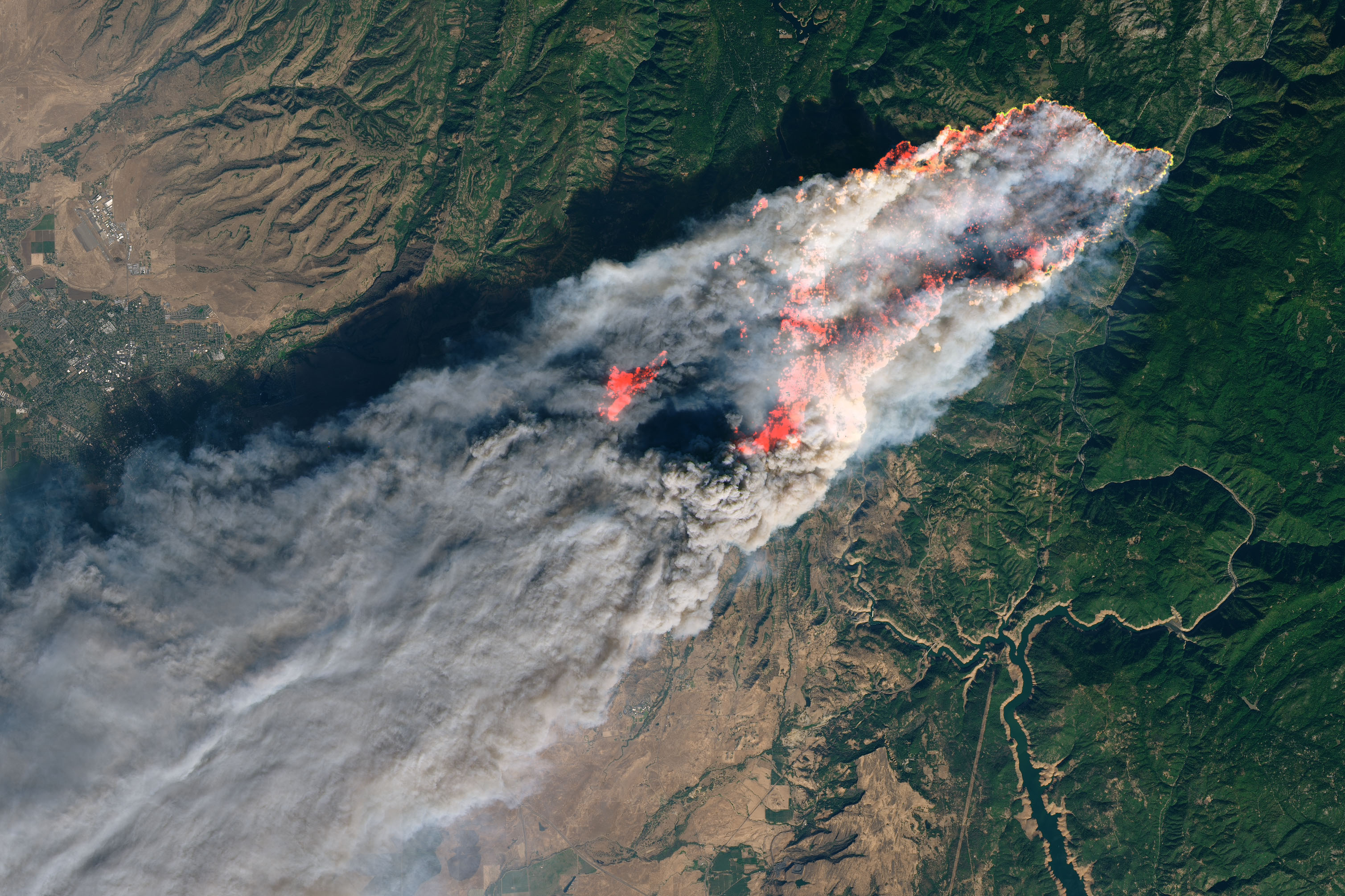
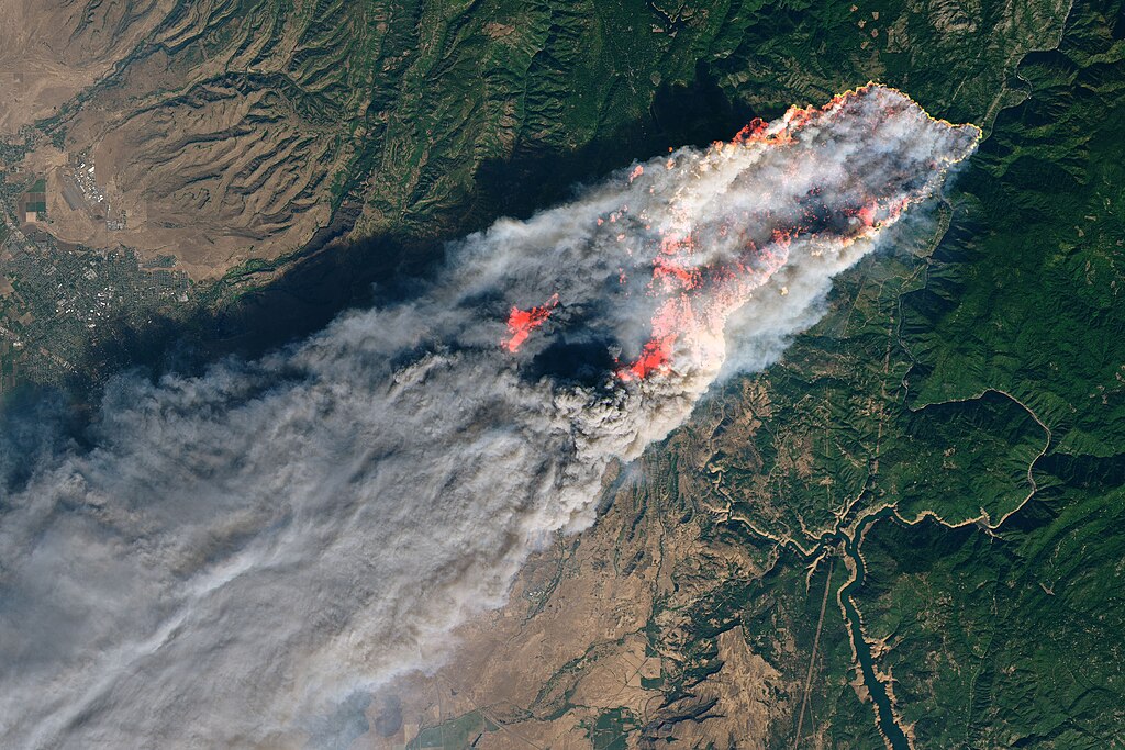
English: On the morning of November 8, 2018, the Camp Fire erupted 90 miles (140 kilometers) north of Sacramento, California. By evening, the fast-moving fire had charred around 18,000 acres and remained zero percent contained, according to news reports.
The Operational Land Imager on Landsat 8 acquired this image on November 8, 2018, around 10:45 a.m. local time (06:45 Universal Time). The natural-color image was created using bands 4-3-2, along with shortwave infrared light to highlight the active fire. Officials evacuated several towns, including Paradise. They also closed several major highways. |
| Date | UT |
| Source | https://earthobservatory.nasa.gov/images/144225/camp-fire-rages-in-california |
| Author | NASA, Joshua Stevens |
Licensing[edit]
| This file is in the public domain in the United States because it was solely created by NASA. NASA copyright policy states that "NASA material is not protected by copyright unless noted". (See Template:PD-USGov, NASA copyright policy page or JPL Image Use Policy.) | ||
 |
Warnings:
|
File history
Click on a date/time to view the file as it appeared at that time.
| Date/Time | Thumbnail | Dimensions | User | Comment | |
|---|---|---|---|---|---|
| current | 17:46, 9 November 2018 | | 3,017 × 2,011 (1.28 MB) | Sevgonlernassau (talk | contribs) | User created page with UploadWizard |
You cannot overwrite this file.
File usage on Commons
The following 4 pages use this file:
File usage on other wikis
The following other wikis use this file:
- Usage on cs.wikipedia.org
- Usage on de.wikipedia.org
- Usage on en.wikipedia.org
- Usage on es.wikinews.org
- Usage on fa.wikipedia.org
- Usage on fi.wikipedia.org
- Usage on fi.wikinews.org
- Usage on fr.wikipedia.org
- Usage on he.wikipedia.org
- Usage on it.wikinews.org
- Usage on nl.wikipedia.org
- Usage on nl.wikinews.org
- Usage on no.wikipedia.org
- Usage on simple.wikipedia.org
- Usage on www.wikidata.org
- Usage on zh.wikipedia.org