File:Cambodia provinces named.png
Jump to navigation
Jump to search
Size of this preview: 743 × 600 pixels. Other resolutions: 298 × 240 pixels | 595 × 480 pixels | 1,000 × 807 pixels.
Original file (1,000 × 807 pixels, file size: 154 KB, MIME type: image/png)
Captions
Captions
Add a one-line explanation of what this file represents

|
This locator map image could be re-created using vector graphics as an SVG file. This has several advantages; see Commons:Media for cleanup for more information. If an SVG form of this image is available, please upload it and afterwards replace this template with
{{vector version available|new image name}}.
It is recommended to name the SVG file “Cambodia provinces named.svg”—then the template Vector version available (or Vva) does not need the new image name parameter. |
Summary[edit]
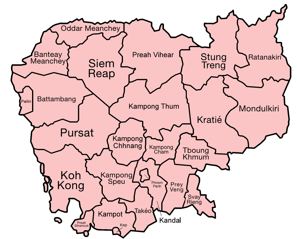
Map of the provinces of Cambodia, with ISO standard names.
Carte des provinces du Cambodge utilisant la norme ISO pour les noms de lieux.
Made by User:Golbez, based on a map by Morwen on en.wikipedia.org.
Licensing[edit]

|
Permission is granted to copy, distribute and/or modify this document under the terms of the GNU Free Documentation License, Version 1.2 or any later version published by the Free Software Foundation; with no Invariant Sections, no Front-Cover Texts, and no Back-Cover Texts. A copy of the license is included in the section entitled GNU Free Documentation License. |
| This file is licensed under the Creative Commons Attribution-Share Alike 3.0 Unported license. | ||
| ||
| This licensing tag was added to this file as part of the GFDL licensing update. |
File history
Click on a date/time to view the file as it appeared at that time.
| Date/Time | Thumbnail | Dimensions | User | Comment | |
|---|---|---|---|---|---|
| current | 09:50, 27 July 2023 | | 1,000 × 807 (154 KB) | Whistler Mapping (talk | contribs) | The provinces have been named with the official system used on license plates and by the Cambodian Government. This also adds a new province, Tboung Khmum. As this map is from 2005, that would need to have been updated after 2013 but no one did. |
| 07:23, 28 December 2005 |  | 1,000 × 807 (45 KB) | Golbez (talk | contribs) | Map of the provinces of Cambodia, with ISO names. Made by User:Golbez, based on a map by Morwen on en.wikipedia.org. Category:Maps of Cambodia |
You cannot overwrite this file.
File usage on Commons
The following 2 pages use this file:
File usage on other wikis
The following other wikis use this file:
- Usage on br.wikipedia.org
- Usage on fr.wikipedia.org
- Usage on gl.wikipedia.org
- Usage on hu.wikipedia.org
- Usage on it.wikipedia.org
- Usage on km.wikipedia.org
- Usage on sv.wikipedia.org
- Usage on tr.wikipedia.org