File:Calgary-CTrain stations.png
Jump to navigation
Jump to search
Size of this preview: 483 × 600 pixels. Other resolutions: 193 × 240 pixels | 386 × 480 pixels | 960 × 1,192 pixels.
Original file (960 × 1,192 pixels, file size: 553 KB, MIME type: image/png)
Captions
Captions
Add a one-line explanation of what this file represents
Summary[edit]
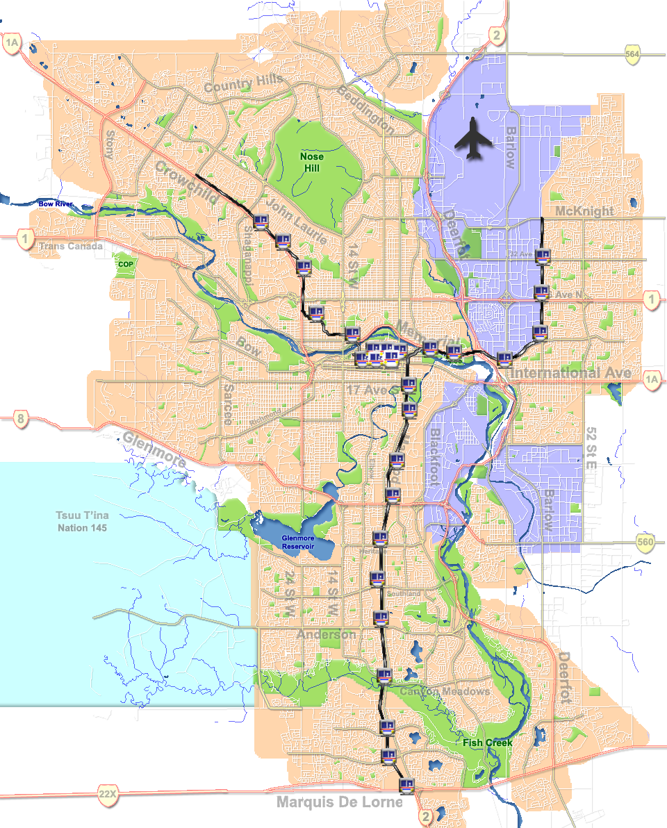
C-Train route and stations on Calgary map.
| Description | C-Train route on Calgary map |
| Date | |
| Source | GIS data |
| Author | Qyd (talk · contribs) |
| Permission (Reusing this file) |
All |
| Other versions | Image:CalgaryAB-map-CTrain.png; Image:Calgary street map.png |
Licensing[edit]
| I, the copyright holder of this work, release this work into the public domain. This applies worldwide. In some countries this may not be legally possible; if so: I grant anyone the right to use this work for any purpose, without any conditions, unless such conditions are required by law. |
File history
Click on a date/time to view the file as it appeared at that time.
| Date/Time | Thumbnail | Dimensions | User | Comment | |
|---|---|---|---|---|---|
| current | 19:00, 4 July 2015 | | 960 × 1,192 (553 KB) | Cmdrjameson (talk | contribs) | Compressed with pngout. Reduced by 237kB (30% decrease). |
| 19:21, 20 December 2006 |  | 960 × 1,192 (790 KB) | Qyd (talk | contribs) | wash out parks and streams | |
| 16:29, 20 December 2006 |  | 960 × 1,192 (741 KB) | Qyd (talk | contribs) | sharper colors | |
| 16:19, 20 December 2006 |  | 960 × 1,192 (833 KB) | Qyd (talk | contribs) | C-Train route and stations on Calgary map. {{Information |Description=C-Train route on Calgary map |Source=GIS data |Date=Dec 2006 |Author={{User|Qyd}} |Permission=All |other_versions=Image:CalgaryAB-map-CTrain.png }} Category:Calgary |
You cannot overwrite this file.
File usage on Commons
The following 5 pages use this file:
.svg)