File:Caddo Indian Communities in the Cypress Creek Drainage, Titus County, Texas Historical Marker (7353417666).jpg
Jump to navigation
Jump to search

Size of this preview: 400 × 600 pixels. Other resolutions: 160 × 240 pixels | 320 × 480 pixels | 512 × 768 pixels | 682 × 1,024 pixels | 1,365 × 2,048 pixels | 3,456 × 5,184 pixels.
Original file (3,456 × 5,184 pixels, file size: 7.33 MB, MIME type: image/jpeg)
Captions
Captions
Add a one-line explanation of what this file represents
Summary
[edit].jpg&action=edit§ion=1)
| Description |
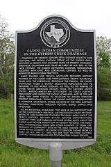
My final East Texas Road Trip picture! Comprised of various groups with distinct dialects and customs, the people known today as the Caddo once occupied a region that included parts of present Louisiana, Arkansas, Oklahoma and Texas as early as A.D. 800. By the 16th century, the Caddo developed complex, hierarchical societies with civic and ceremonial centers, as well as advanced agricultural practices. Early Spanish and French accounts provided historic records of the Caddo and their customs. Despite successful trade with the Europeans, especially the French, the Caddo eventually faced a rapidly declining population due to exposure to Old World diseases, as well as the arrival of other Native American groups from the eastern United States. Anglo-American settlement in Texas further threatened and limited the Caddo homeland, and by the late 1850s they were forced to relocate to Indian Territory (present Oklahoma). Today, the Caddo nation headquarters is in Binger, Oklahoma, where members of the tribe maintain cultural traditions through pottery, song, dance and language. As an ancestral homeland, this area is an important part of the Caddo's rich heritage. Archeologists utilize records, artifacts and landscape features to learn more about the tribe's history. Pottery styles, mound construction, cemetery types and farming methods reveal much about the Caddo and provide insight on settlement patterns, the family unit, interregional trade and other elements of tribal life. Research at community sites in the area drained by Cypress Creek reveal elements of Caddo occupation dating from as early as A.D. 800 to 1680, an era that included cultural contact with Europeans and Southeastern Indian groups. (2004) |
| Date | |
| Source |
Caddo Indian Communities in the Cypress Creek Drainage, Titus County, Texas Historical Marker
|
| Author | Nicolas Henderson from Coppell, Texas |
Licensing
[edit].jpg&action=edit§ion=2)
This file is licensed under the Creative Commons Attribution 2.0 Generic license.
- You are free:
- to share – to copy, distribute and transmit the work
- to remix – to adapt the work
- Under the following conditions:
- attribution – You must give appropriate credit, provide a link to the license, and indicate if changes were made. You may do so in any reasonable manner, but not in any way that suggests the licensor endorses you or your use.
| This image, originally posted to Flickr, was reviewed on 16 November 2013 by the administrator or reviewer File Upload Bot (Magnus Manske), who confirmed that it was available on Flickr under the stated license on that date. |
File history
Click on a date/time to view the file as it appeared at that time.
| Date/Time | Thumbnail | Dimensions | User | Comment | |
|---|---|---|---|---|---|
| current | 01:52, 16 November 2013 | | 3,456 × 5,184 (7.33 MB) | File Upload Bot (Magnus Manske) (talk | contribs) | Transferred from Flickr by User:AlbertHerring |
You cannot overwrite this file.
File usage on Commons
There are no pages that use this file.
Metadata
.jpg&oldid=845215360)
Categories:
- Titus County, Texas
- Recorded Texas Historic Landmarks plaques
- Caddo (tribe)
- Native American history of Texas
- History of indigenous peoples of the Southeastern United States
- 16th-century Native American history
- 17th-century Native American history
- Woodland period in North America
- Texas in the 16th century
- Texas in the 17th century