File:CP 5617 + "Connecting Europe Express" (51418904649).jpg
Jump to navigation
Jump to search

Size of this preview: 800 × 533 pixels. Other resolutions: 320 × 213 pixels | 640 × 427 pixels | 1,024 × 682 pixels | 1,280 × 853 pixels | 2,560 × 1,706 pixels | 3,400 × 2,266 pixels.
Original file (3,400 × 2,266 pixels, file size: 6.03 MB, MIME type: image/jpeg)
Captions
Captions
Add a one-line explanation of what this file represents
Summary[edit]
.jpg&action=edit§ion=1)
| Description |
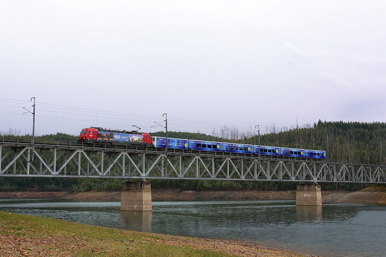
English: CP 5617 with an empty Renfe Talgo IV trainset from Vilar Formoso to Lisbon, from where it will depart tomorrow (September 2nd) with the "Connecting Europe Express", a special train within the scope of the European Year of Rail 2021 celebrations. This trainset will run the Iberian gauge section of the planed journey, where in Hendaye it will meet the European gauge consist that will travel across all Europe until it reaches Paris on October 7th, its final destination. Português: CP 5617 com um comboio Renfe Talgo IV vazio de Vilar Formoso para Lisboa, de onde partirá amanhã (2 de Setembro) com o "Connecting Europe Express" um comboio especial no âmbito das celebrações do Ano Europeu do Caminho-de-Ferro 2021. Este comboio percorrerá a secção ibérica da bitola da viagem planeada, onde em Hendaye se encontrará com a bitola europeia constituída que percorrerá toda a Europa até chegar a Paris no dia 7 de Outubro, o seu destino final. Deutsch: CP 5617 mit einem leeren Renfe Talgo IV-Zug von Vilar Formoso nach Lissabon, von wo aus er morgen (2. September) mit dem "Connecting Europe Express", einem Sonderzug im Rahmen der Feierlichkeiten zum Europäischen Jahr der Eisenbahn 2021, abfahren wird. Dieser Zug wird den iberischen Abschnitt der geplanten Reise fahren, wo er in Hendaye auf den europäischen Zug trifft, der ganz Europa durchqueren wird, bis er am 7. Oktober Paris, sein Endziel, erreicht.
<a href="https://www.photrain.net/photos/photo/10315" rel="noreferrer nofollow">www.photrain.net/photos/photo/10315</a> |
| Date | |
| Source | CP 5617 + "Connecting Europe Express" |
| Author | Nelso Silva from Porto, Portugal |
| Camera location | | View this and other nearby images on: OpenStreetMap |
|---|
.jpg¶ms=040.389671_N_-008.166382_E_globe:Earth_type:camera_source:Flickr_&language=en)
Licensing[edit]
.jpg&action=edit§ion=2)
This file is licensed under the Creative Commons Attribution-Share Alike 2.0 Generic license.
- You are free:
- to share – to copy, distribute and transmit the work
- to remix – to adapt the work
- Under the following conditions:
- attribution – You must give appropriate credit, provide a link to the license, and indicate if changes were made. You may do so in any reasonable manner, but not in any way that suggests the licensor endorses you or your use.
- share alike – If you remix, transform, or build upon the material, you must distribute your contributions under the same or compatible license as the original.
| This image was originally posted to Flickr by Nelso M. Silva at https://flickr.com/photos/53768422@N08/51418904649. It was reviewed on 7 September 2021 by FlickreviewR 2 and was confirmed to be licensed under the terms of the cc-by-sa-2.0. |
File history
Click on a date/time to view the file as it appeared at that time.
| Date/Time | Thumbnail | Dimensions | User | Comment | |
|---|---|---|---|---|---|
| current | 20:23, 7 September 2021 | | 3,400 × 2,266 (6.03 MB) | Tm (talk | contribs) | Transferred from Flickr via #flickr2commons |
You cannot overwrite this file.
File usage on Commons
The following page uses this file:
.jpg&oldid=867479424)