File:Bury Knowsley Street railway station (site), Lancashire (geograph 4273632).jpg
Jump to navigation
Jump to search
Size of this preview: 800 × 600 pixels. Other resolutions: 320 × 240 pixels | 640 × 480 pixels | 1,024 × 768 pixels.
Original file (1,024 × 768 pixels, file size: 206 KB, MIME type: image/jpeg)
Captions
Captions
Add a one-line explanation of what this file represents
Summary
[edit],_Lancashire_(geograph_4273632).jpg&action=edit§ion=1)
| Description |
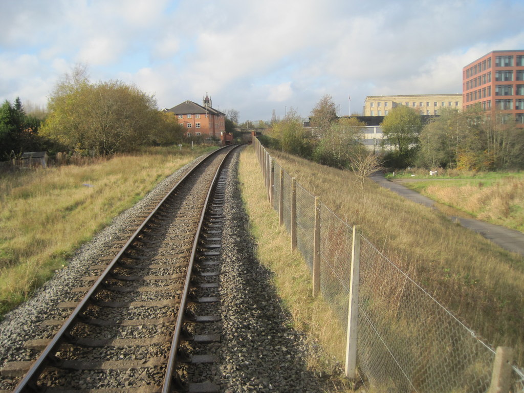
English: Bury Knowsley Street railway station (site), Lancashire Opened in 1848 on the Lancashire & Yorkshire Railway's line from Rochdale to Bolton, this station closed in 1970. View west towards Bury Bolton Street on the preserved East Lancashire Railway. When the line was reopened, it was raised over the Metrolink tramlines that had been laid at right angles through the middle of the closed station's site. Hence, although on the original alignment, the image is taken from several metres higher up than the original line. |
| Date | |
| Source | From geograph.org.uk |
| Author | Nigel Thompson |
| Permission (Reusing this file) |
Creative Commons Attribution Share-alike license 2.0 |
| Attribution (required by the license) | Nigel Thompson / Bury Knowsley Street railway station (site), Lancashire / |
| Camera location | | View this and other nearby images on: OpenStreetMap |
|---|
,_Lancashire_(geograph_4273632).jpg¶ms=053.588551_N_-002.297563_E_globe:Earth_type:camera_source:geograph-osgb36(SD80401026)_heading:292.00&language=en)
| Object location | | View this and other nearby images on: OpenStreetMap |
|---|
,_Lancashire_(geograph_4273632).jpg¶ms=053.588910_N_-002.298620_E_globe:Earth_class:object_type:object_source:geograph-osgb36(SD80331030)_heading:292.00&language=en)
Licensing
[edit],_Lancashire_(geograph_4273632).jpg&action=edit§ion=2)

|
This image was taken from the Geograph project collection. See this photograph's page on the Geograph website for the photographer's contact details. The copyright on this image is owned by Nigel Thompson and is licensed for reuse under the Creative Commons Attribution-ShareAlike 2.0 license.
|
This file is licensed under the Creative Commons Attribution-Share Alike 2.0 Generic license.
Attribution: Nigel Thompson
- You are free:
- to share – to copy, distribute and transmit the work
- to remix – to adapt the work
- Under the following conditions:
- attribution – You must give appropriate credit, provide a link to the license, and indicate if changes were made. You may do so in any reasonable manner, but not in any way that suggests the licensor endorses you or your use.
- share alike – If you remix, transform, or build upon the material, you must distribute your contributions under the same or compatible license as the original.
File history
Click on a date/time to view the file as it appeared at that time.
| Date/Time | Thumbnail | Dimensions | User | Comment | |
|---|---|---|---|---|---|
| current | 20:19, 13 August 2019 | | 1,024 × 768 (206 KB) | Lamberhurst (talk | contribs) | Transferred from geograph.co.uk using [https://tools.wmflabs.org/geograph2commons/ geograph2commons] |
You cannot overwrite this file.
File usage on Commons
The following page uses this file:
,_Lancashire_(geograph_4273632).jpg&oldid=839494234)