File:Bullhead City, Arizona southern city limits sign (2012).jpg
Jump to navigation
Jump to search

Size of this preview: 800 × 600 pixels. Other resolutions: 320 × 240 pixels | 640 × 480 pixels | 1,024 × 768 pixels | 1,280 × 960 pixels | 2,560 × 1,920 pixels | 3,648 × 2,736 pixels.
Original file (3,648 × 2,736 pixels, file size: 5.21 MB, MIME type: image/jpeg)
Captions
Captions
Add a one-line explanation of what this file represents
Summary[edit]
.jpg&action=edit§ion=1)
| Description |
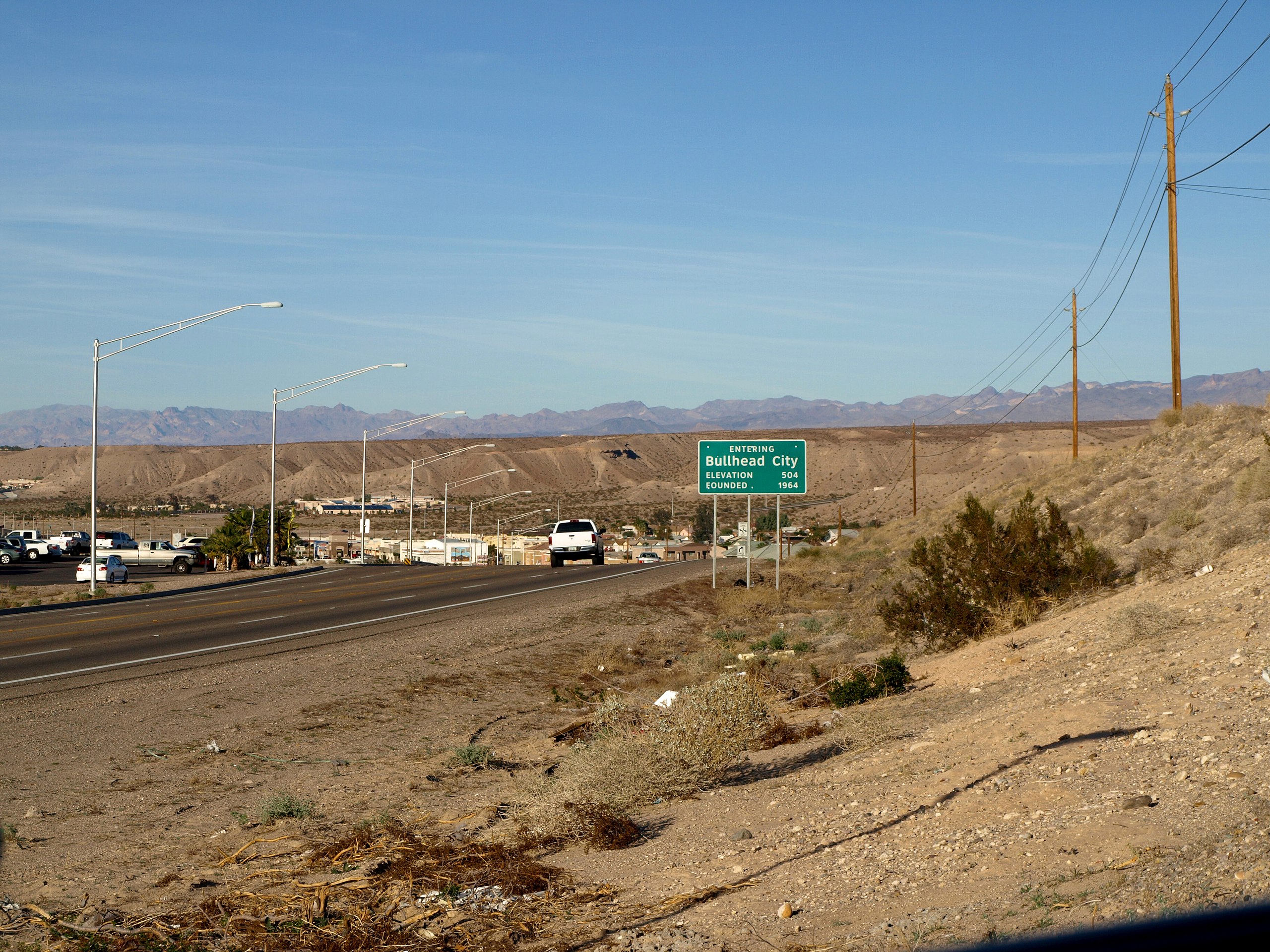
English: Southern city limits sign for the city of Bullhead City, Arizona as seen from the northbound lane of State Route 95 (Mohave Valley Highway) near East Sterling Road. View looking northeast. This photograph was taken with an Olympus E-510 DSLR camera and edited (brightness, contrast, saturation) using ArcSoft PhotoStudio 5.5) |
| Date | |
| Source | Own work |
| Author | Amin Eshaiker |
| Permission (Reusing this file) |
If you use this photograph outside Wikimedia, I would highly appreciate if you let me know by email or on my talk page, as I'm curious where my work is used. |
| Other versions | Derivative works of this file: Bullhead City, Arizona southern city limits sign (2012) (crop).jpg |
_(crop).jpg)
| This is a retouched picture, which means that it has been digitally altered from its original version. Modifications: brightness, contrast, saturation. Modifications made by Amineshaker.
|
| Camera location | | View this and other nearby images on: OpenStreetMap |
|---|
.jpg¶ms=035.042000_N_-114.589000_E_globe:Earth_type:camera_type:landmark_region:US-AZ_scale:10560_heading:45.00&language=en)
Licensing[edit]
.jpg&action=edit§ion=2)
This file is licensed under the Creative Commons Attribution-Share Alike 3.0 Unported license.
- You are free:
- to share – to copy, distribute and transmit the work
- to remix – to adapt the work
- Under the following conditions:
- attribution – You must give appropriate credit, provide a link to the license, and indicate if changes were made. You may do so in any reasonable manner, but not in any way that suggests the licensor endorses you or your use.
- share alike – If you remix, transform, or build upon the material, you must distribute your contributions under the same or compatible license as the original.
File history
Click on a date/time to view the file as it appeared at that time.
| Date/Time | Thumbnail | Dimensions | User | Comment | |
|---|---|---|---|---|---|
| current | 20:05, 30 June 2012 | | 3,648 × 2,736 (5.21 MB) | Amineshaker (talk | contribs) | {{Information |Description ={{en|1=Southern city limits sign for the city of Bullhead City, Arizona as seen from the northbound lane of State Route 95 (Mohave Valley Highway) near East St... |
You cannot overwrite this file.
File usage on Commons
The following page uses this file:
.jpg&oldid=838049116)