File:Brussel hotel de la Kathédrale.jpg
Jump to navigation
Jump to search
Size of this preview: 446 × 599 pixels. Other resolutions: 178 × 240 pixels | 357 × 480 pixels | 571 × 768 pixels | 762 × 1,024 pixels | 1,490 × 2,002 pixels.
Original file (1,490 × 2,002 pixels, file size: 1.01 MB, MIME type: image/jpeg)
Captions
Captions
Add a one-line explanation of what this file represents
Summary[edit]
| Description |
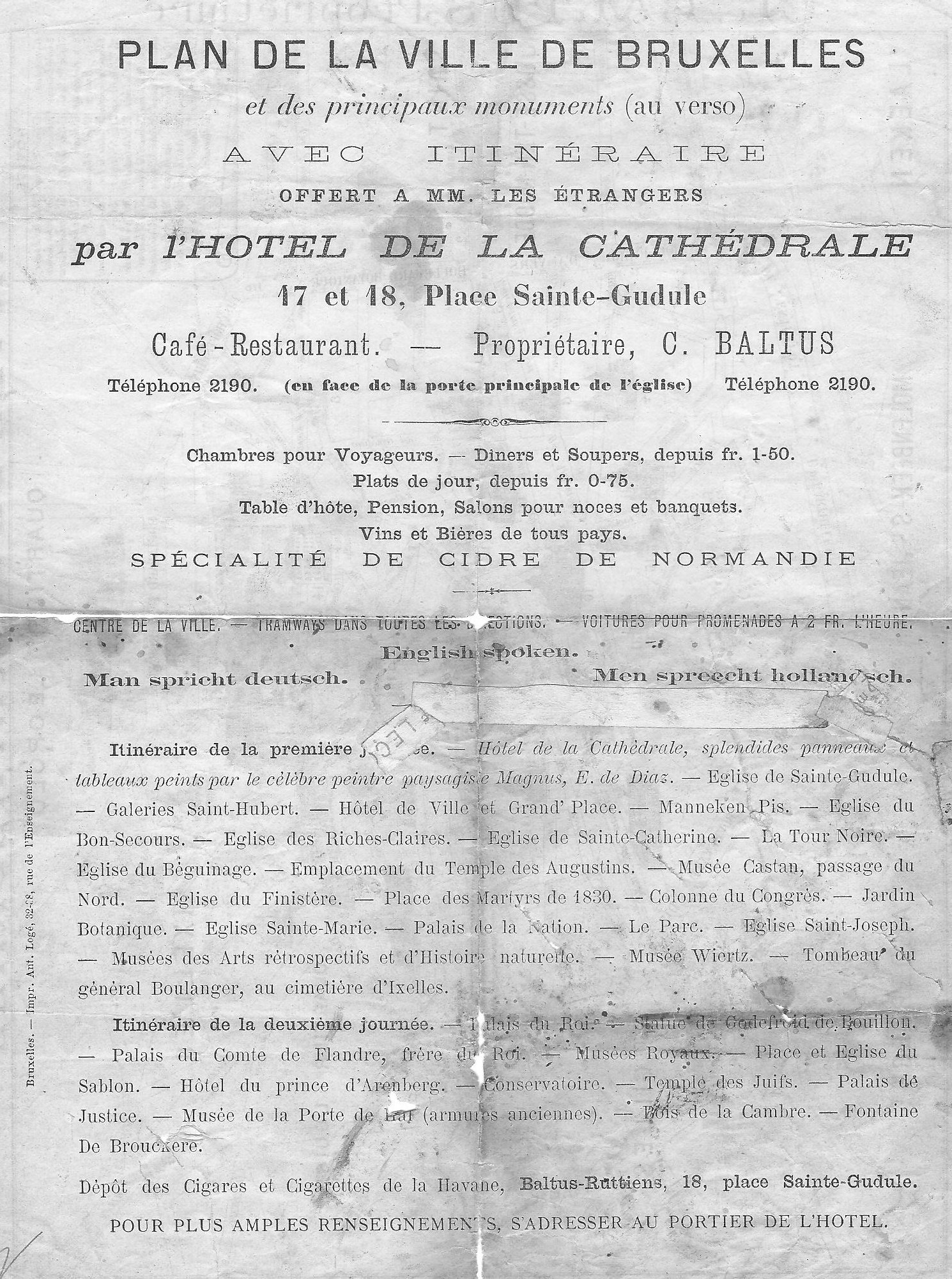
English: Introduction to a map on the backside and a reproduced 1830 map of Brussels. There are no dates on the document or maps. (except of course 1830, but the map was printed long after that. The clues are: a four digit telephone number (probably for the whole of Belgium, as there are no area codes). Tramways around the hotel. (could be horsedrawn) Not least style and language of the text. Research shows that the date would be between 1891 and 1905. (death of Général Boulanger, Prins Filips of Belgium) |
| Date | between 1891 and 1905 |
| Source | Guidemap introduction note given out by Hotel de la Kathédrale, owner C.Baltus |
| Author | Unknown (Hotel) |
Licensing[edit]
This image (or other media file) is in the public domain because its copyright has expired and its author is anonymous.
This applies to the European Union and those countries with a copyright term of 70 years after the work was made available to the public and the author never disclosed their identity. Important: Always mention where the image comes from, as far as possible, and make sure the author never claimed authorship. |
 | |
 |
Note: In Germany and possibly other countries, certain anonymous works published before July 1, 1995 are copyrighted until 70 years after the death of the author. See Übergangsrecht. Please use this template only if the author never claimed authorship or their authorship never became public in any other way. If the work is anonymous or pseudonymous (e.g., published only under a corporate or organization's name), use this template for images published more than 70 years ago.
For a work made available to the public in the United Kingdom, please use Template:PD-UK-unknown instead.
|
File history
Click on a date/time to view the file as it appeared at that time.
| Date/Time | Thumbnail | Dimensions | User | Comment | |
|---|---|---|---|---|---|
| current | 20:41, 6 September 2011 | | 1,490 × 2,002 (1.01 MB) | Smiley.toerist (talk | contribs) | {{Information |Description ={{en|1=Introduction to a map on the backside and a reproduced 1830 map of Brussels. There are no dates on the document or maps. (except of course 1830, but the map was printed long after that. The clues are: a four digit te |
You cannot overwrite this file.
File usage on Commons
There are no pages that use this file.