File:British Isles (MODIS 2019-09-23).jpg

Original file (6,106 × 5,008 pixels, file size: 5.04 MB, MIME type: image/jpeg)
Captions
Captions
Summary
[edit].jpg&action=edit§ion=1)
| Description |
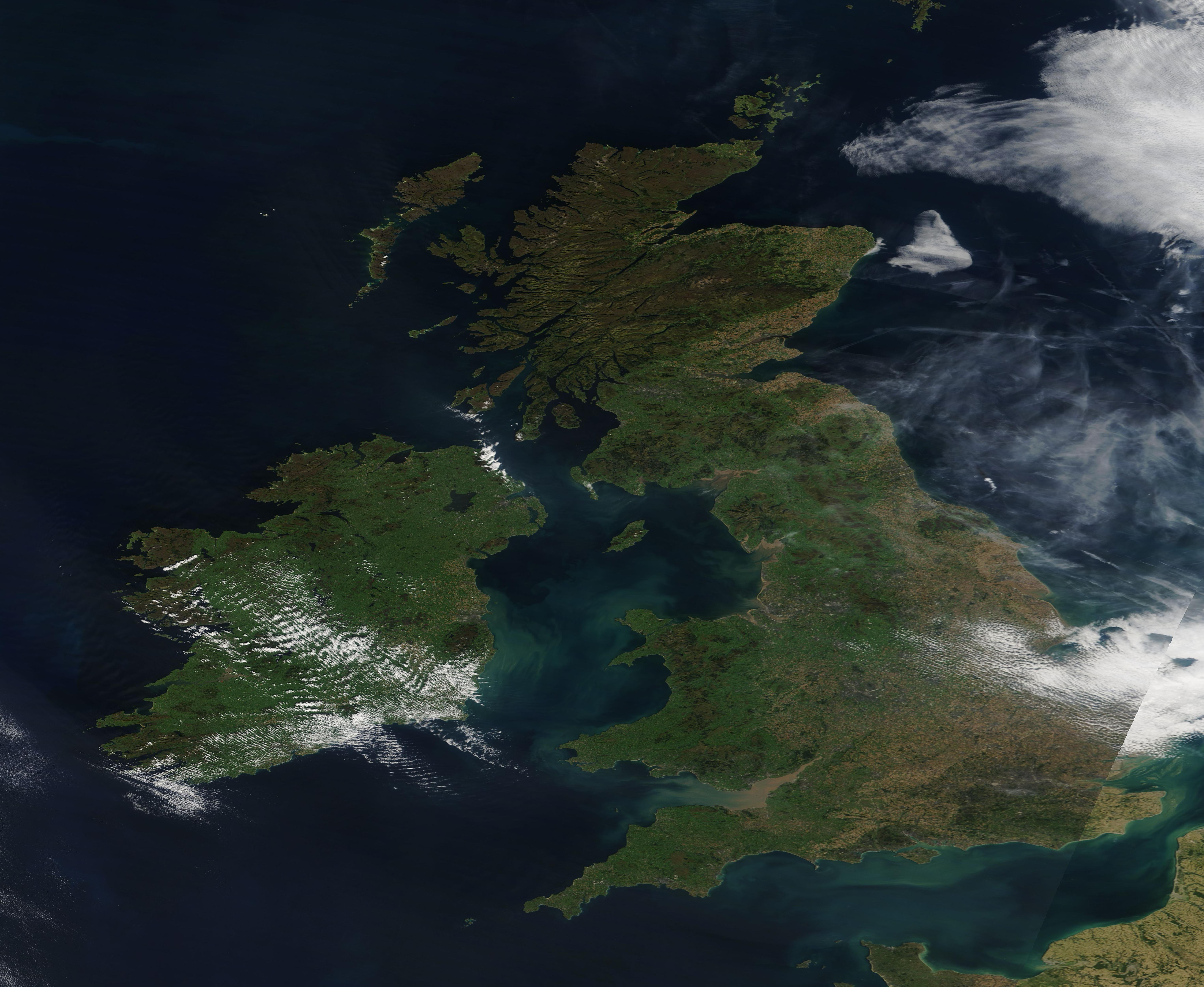
English: It has been said that the British Isles, of all of the locations in Europe, are the most exposed to the varying weather from the mobile westerly air flow off of the North Atlantic. This westerly air flow can also include the remnants of strong hurricanes that have formed off the coast of Africa, scooted across the Atlantic towards the United States, then bend to the “right” (northwest) and make a dash across the North Atlantic before dissipating.
The most recent hurricane to soak the islands was Hurricane Dorian. After battering the Bahamas on September 1-2 while carrying maximum sustained winds of 185 mph (295 km/h), the remnants arrived in the British Isles about ten days later, bringing soaking rain and strong winds. This was quickly followed by the remnants from Tropical Storm Gabrielle, another system to cross “the pond” as an extra-tropical storm with some long-lasting punch. On September 22, the British Isles were anticipating the impact of the remnants of another major storm, Hurricane Humberto. Humberto’s maximum sustained winds reached about 204 km/h (127 mph), or a Category 3 storm on the Saffir-Simpson Hurricane Wind Scale shortly before it passed by Bermuda on September 19. By September 20, the storm had become extra-tropical, prompting the National Hurricane Center to issue its final advisory. At that time, Humberto still possessed maximum sustained winds of 100 mph (155 mph). Two days later, Humberto was weakening as it headed northeast. The Sun Online quoted a Met Office spokesperson as stating “we are in for a wet wrath of it when it arrives”. The remnants are expected to effect the British Isles on Monday, September 23, bringing clouds and rain, but “nothing too severe”. On September 20, 2019, the British Isles were enjoying a sunny, warm late summer day between the soakings from North Atlantic systems as the Moderate Resolution Imaging Spectroradiometer (MODIS) on board NASA’s Terra satellite acquired a true-color image the scene. The gray wisps over the North Sea appear more typical of smoke than cloud, but no source for the smoke is readily evident. |
||
| Date | Taken on 20 September 2019 | ||
| Source |
|
||
| Author | MODIS Land Rapid Response Team, NASA GSFC |
| This media is a product of the Terra mission Credit and attribution belongs to the mission team, if not already specified in the "author" row |
Licensing
[edit].jpg&action=edit§ion=2)
| This file is in the public domain in the United States because it was solely created by NASA. NASA copyright policy states that "NASA material is not protected by copyright unless noted". (See Template:PD-USGov, NASA copyright policy page or JPL Image Use Policy.) | ||
 |
Warnings:
|
File history
Click on a date/time to view the file as it appeared at that time.
| Date/Time | Thumbnail | Dimensions | User | Comment | |
|---|---|---|---|---|---|
| current | 03:02, 17 February 2024 | | 6,106 × 5,008 (5.04 MB) | OptimusPrimeBot (talk | contribs) | #Spacemedia - Upload of http://modis.gsfc.nasa.gov/gallery/images/image09232019_250m.jpg via Commons:Spacemedia |
You cannot overwrite this file.
File usage on Commons
There are no pages that use this file.
.jpg&oldid=852704260)