File:Bremen-(Steffensstadt)-Braun-Hogenberg.png

Original file (1,450 × 1,003 pixels, file size: 3.85 MB, MIME type: image/png)
Captions
Captions
| Description |
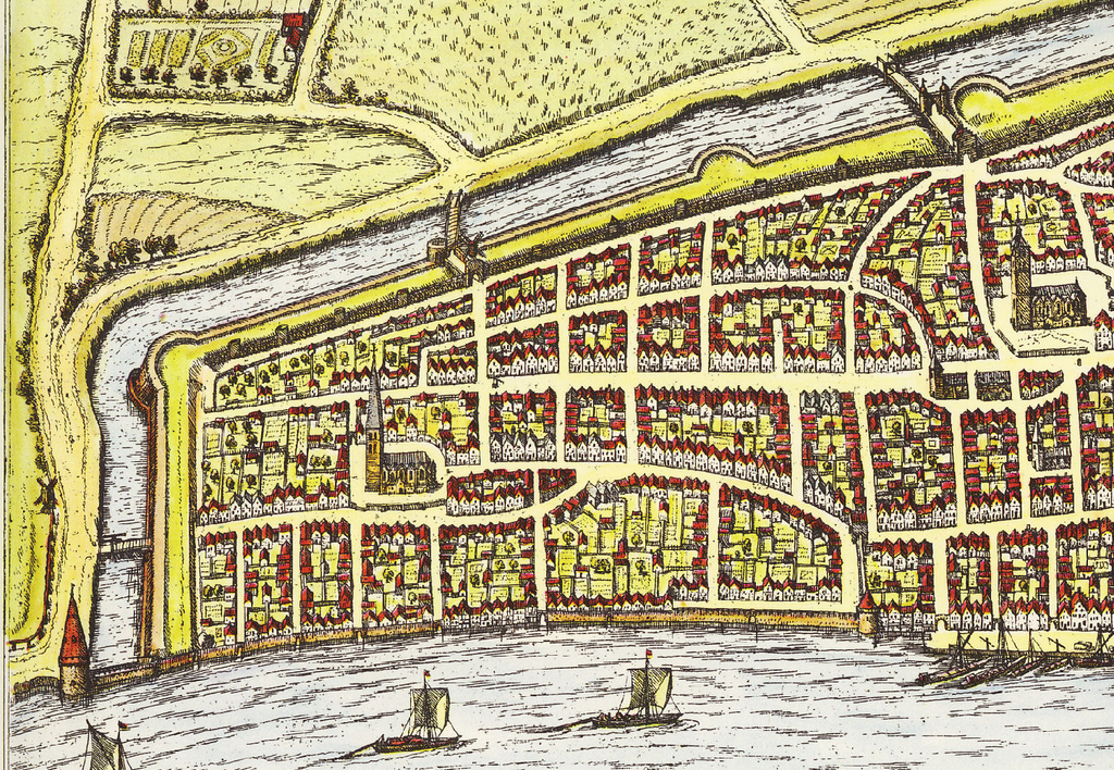
English: historical sight of the German town of Bremen (between 1572 and 1618)
Deutsch: Historische Karte von Bremen zwischen 1572 und 1618. Ausschnitt Steffensstadt bis Ansgarii-Kirche |
||||
| Source | Frans Hogenberg | ||||
| Author | Georg Braun and Frans Hogenberg | ||||
| Permission (Reusing this file) |
|
||||
| Other versions | Image:Bremen_Braun-Hogenberg.jpg | ||||
| Camera location | | View this and other nearby images on: OpenStreetMap |
|---|
-Braun-Hogenberg.png¶ms=053.079722_N_0008.798611_E_globe:Earth_type:camera_region:DE-HB_scale:6000_&language=en)
File history
Click on a date/time to view the file as it appeared at that time.
| Date/Time | Thumbnail | Dimensions | User | Comment | |
|---|---|---|---|---|---|
| current | 10:05, 23 October 2015 | | 1,450 × 1,003 (3.85 MB) | Ulamm (talk | contribs) | Cut extended to the left and top |
| 12:04, 2 February 2008 |  | 1,437 × 931 (3.38 MB) | Godewind (talk | contribs) | {{Information |Description= {{en|historical sight of the German town of Bremen (between 1572 and 1618)}} {{de|Historische Karte von Bremen zwischen 1572 und 1618. Ausschnitt Steffensstadt bis Ansgarii-Kirche}} |Source=[[Creator:Frans Hogenberg|Frans H |
You cannot overwrite this file.
File usage on Commons
There are no pages that use this file.
File usage on other wikis
The following other wikis use this file:
- Usage on de.wikipedia.org
- Usage on fy.wikipedia.org
-Braun-Hogenberg.png&oldid=845288470)