File:Bonfeld - Ortsplan aus dem 19. Jahrhundert.png
Original file (6,367 × 6,394 pixels, file size: 15.16 MB, MIME type: image/png)
Captions
Captions
Summary[edit]
| Description |
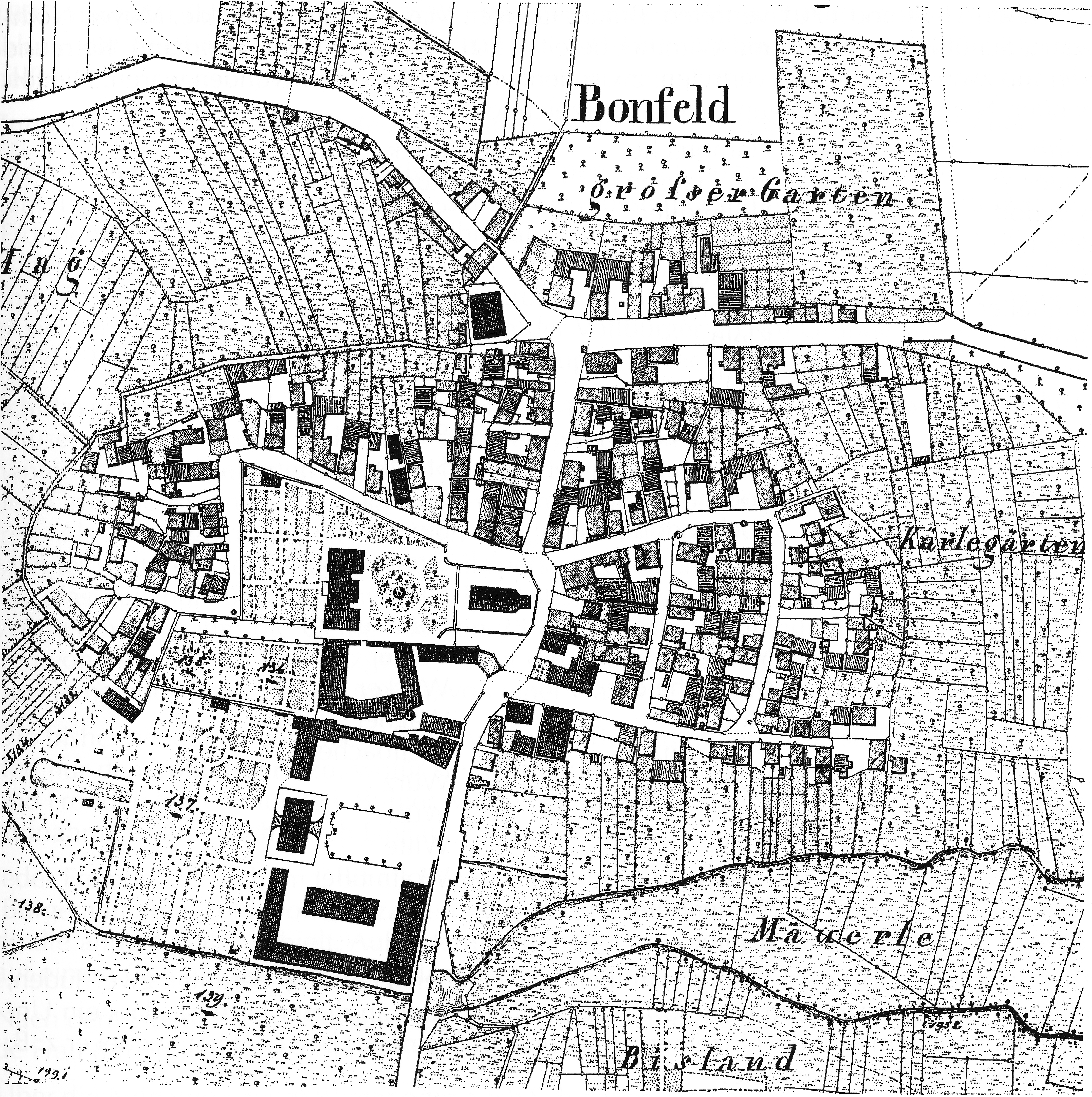
English: Map of the village Bonfeld (Baden-Württemberg, Germany) from the 19th century, probably a part of the Württembergische Flurkarte 1:2.5000, which was created about 1830. Reproduction after Heimatbuch Bonfeld (2000), fig. 119 on page 205. (There are no copyright problems, because the reproduction in the Heimatbuch is a simple reproduction which does not create any copyright, and the creator of the original map is definitely dead for more than 100 years.)
Deutsch: Ortsplan von Bonfeld (Baden-Württemberg) aus dem 19. Jahrhundert, wahrscheinlich aus der Württembergischen Flurkarte 1:2.5000, die um 1830 entstand. Abbildung aus dem Heimatbuch Bonfeld (2000), Abb. 119 auf Seite 205. (Es gibt keine Copyright-Probleme, da die Wiedergabe im Heimatbuch eine einfache Reproduktion ist, die keine neuen Rechte erzeugt, und der Urheber der originalen Karte auf jeden Fall über 100 Jahre tot ist.) |
| Date | 19th century, probably circa 1830 |
| Source | Scanned from Heimatbuch Bonfeld (2000), fig. 119 on page 205, by Aristeas |
| Author | Unknown author |
| Object location | | View this and other nearby images on: OpenStreetMap |
|---|
Licensing[edit]
This image is in the public domain because it is a mere mechanical scan or photocopy of a public domain original, or – from the available evidence – is so similar to such a scan or photocopy that no copyright protection can be expected to arise. The original itself is in the public domain for the following reason:
This tag is designed for use where there may be a need to assert that any enhancements (eg brightness, contrast, colour-matching, sharpening) are in themselves insufficiently creative to generate a new copyright. It can be used where it is unknown whether any enhancements have been made, as well as when the enhancements are clear but insufficient. For known raw unenhanced scans you can use an appropriate {{PD-old}} tag instead. For usage, see Commons:When to use the PD-scan tag.  | ||||
| Annotations | This image is annotated: View the annotations at Commons |
File history
Click on a date/time to view the file as it appeared at that time.
| Date/Time | Thumbnail | Dimensions | User | Comment | |
|---|---|---|---|---|---|
| current | 14:05, 19 March 2014 | | 6,367 × 6,394 (15.16 MB) | Aristeas (talk | contribs) | {{Information |Description ={{en|1=Map of the village Bonfeld (Baden-Württemberg, Germany) from the 19th century, probably a part of the Württembergische Flurkarte 1:2.5000, which w... |
You cannot overwrite this file.
File usage on Commons
The following 3 pages use this file:
File usage on other wikis
The following other wikis use this file:
- Usage on de.wikipedia.org