File:Bodleian Libraries, Oxonivm Comitatus, vulgo Oxford Shire.jpg

Original file (1,000 × 675 pixels, file size: 151 KB, MIME type: image/jpeg)
Captions
Captions
Summary
[edit]
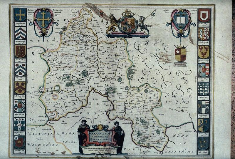
| Oxonivm Comitatus, vulgo Oxford Shire | ||||||
|---|---|---|---|---|---|---|
| Artist |
Blaeu, Joan, 1596-1673 [cartographer] |
|||||
| Title |
Oxonivm Comitatus, vulgo Oxford Shire |
|||||
| Description |
Map of Oxfordshire with hills, woods and parks; and arms of the Oxford colleges, from Joan Blaeu, Novus Atlas, 1645 |
|||||
| Date | circa 1645 | |||||
| Dimensions | 35mm slide | |||||
| Notes | Filmstrip Roll 243.9, frame 2; Source filename: mapsxx003-ako-0001-0 | |||||
| Source/Photographer |
|
|||||
| Permission (Reusing this file) |
|
|||||
File history
Click on a date/time to view the file as it appeared at that time.
| Date/Time | Thumbnail | Dimensions | User | Comment | |
|---|---|---|---|---|---|
| current | 21:30, 26 February 2016 | | 1,000 × 675 (151 KB) | MartinPoulter (talk | contribs) | GWToolset: Creating mediafile for MartinPoulter. Bulk upload of Maps collection from Digital Bodleian |
You cannot overwrite this file.
File usage on Commons
The following page uses this file: