File:Bodleian Libraries, Basic TO map 60.jpg
Original file (672 × 1,000 pixels, file size: 165 KB, MIME type: image/jpeg)
Captions
Captions
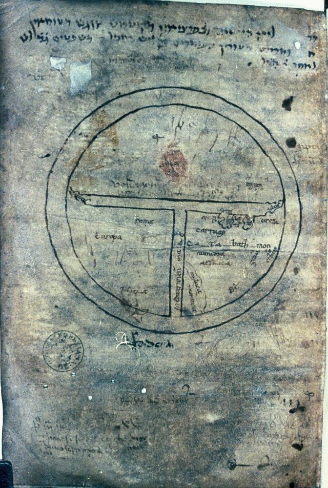
Summary[edit]
| Title |
[Basic T-O map] |
|||||
| Description |
Map with truncated rivers Nile and Don, in southern French manuscript of Sallust, Bellum Jugurthinum. |
|||||
| Date | early 12th century | |||||
| Source |
|
|||||
| Permission (Reusing this file) |
|
|||||
| Georeferencing | If inappropriate please set warp_status = skip to hide. | |||||
| Bibliographic data | ||||||
| Map sheet | Filmstrip Roll 177A, frame 4 | |||||
| Archival data | ||||||
| Accession number |
MS. Rawl. G. 43, fol. 56v |
|||||
| Dimensions | 96 diameter mm; 35mm slide | |||||
| Notes | Source filename: mapsxx003-aeq-0001-0 | |||||
File history
Click on a date/time to view the file as it appeared at that time.
| Date/Time | Thumbnail | Dimensions | User | Comment | |
|---|---|---|---|---|---|
| current | 02:03, 16 March 2016 | | 672 × 1,000 (165 KB) | SteinsplitterBot (talk | contribs) | Bot: Image rotated by 90° |
| 18:12, 14 March 2016 |  | 1,000 × 675 (166 KB) | MartinPoulter (talk | contribs) | GWToolset: Creating mediafile for MartinPoulter. Second upload of files from Bodleian Maps Collection |
You cannot overwrite this file.
File usage on Commons
There are no pages that use this file.