File:Black Necked Stork in Mary River National Park (NT).jpg
Jump to navigation
Jump to search

Size of this preview: 800 × 505 pixels. Other resolutions: 320 × 202 pixels | 640 × 404 pixels | 1,024 × 646 pixels | 1,280 × 808 pixels | 3,211 × 2,026 pixels.
Original file (3,211 × 2,026 pixels, file size: 3.89 MB, MIME type: image/jpeg)
Captions
Captions
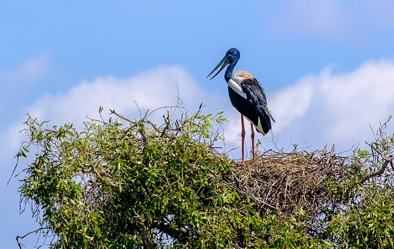
Black Necked Stork (called Jabiru locally) in Mary River National Park (NT)
Summary
[edit].jpg&action=edit§ion=1)
| Description |
English: The Black Neck Stork is Ephippiorhynchus asiaticus and is not the same as the Brazilian Jabiru although locals in NT Australia do call it the Jabiru. Mary River National Park
|
||
| Date | |||
| Source | Own work | ||
| Author | Longboardfella |
| Camera location | | View this and other nearby images on: OpenStreetMap |
|---|
.jpg¶ms=-12.706694_N_0131.643053_E_globe:Earth_type:camera_heading:315.00&language=en)
Licensing
[edit].jpg&action=edit§ion=2)
I, the copyright holder of this work, hereby publish it under the following license:
This file is licensed under the Creative Commons Attribution-Share Alike 4.0 International license.
- You are free:
- to share – to copy, distribute and transmit the work
- to remix – to adapt the work
- Under the following conditions:
- attribution – You must give appropriate credit, provide a link to the license, and indicate if changes were made. You may do so in any reasonable manner, but not in any way that suggests the licensor endorses you or your use.
- share alike – If you remix, transform, or build upon the material, you must distribute your contributions under the same or compatible license as the original.
This image was uploaded as part of Wiki Loves Earth 2022.
|
 |
File history
Click on a date/time to view the file as it appeared at that time.
| Date/Time | Thumbnail | Dimensions | User | Comment | |
|---|---|---|---|---|---|
| current | 21:08, 27 June 2022 | | 3,211 × 2,026 (3.89 MB) | Longboardfella (talk | contribs) | Uploaded own work with UploadWizard |
You cannot overwrite this file.
File usage on Commons
There are no pages that use this file.
.jpg&oldid=825125559)