File:Biafra independent state map-jp.svg
Jump to navigation
Jump to search

Size of this PNG preview of this SVG file: 776 × 600 pixels. Other resolutions: 311 × 240 pixels | 621 × 480 pixels | 994 × 768 pixels | 1,280 × 989 pixels | 2,560 × 1,978 pixels | 1,100 × 850 pixels.
Original file (SVG file, nominally 1,100 × 850 pixels, file size: 80 KB)
Captions
Captions
Add a one-line explanation of what this file represents
Summary[edit]
| Description |
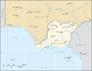
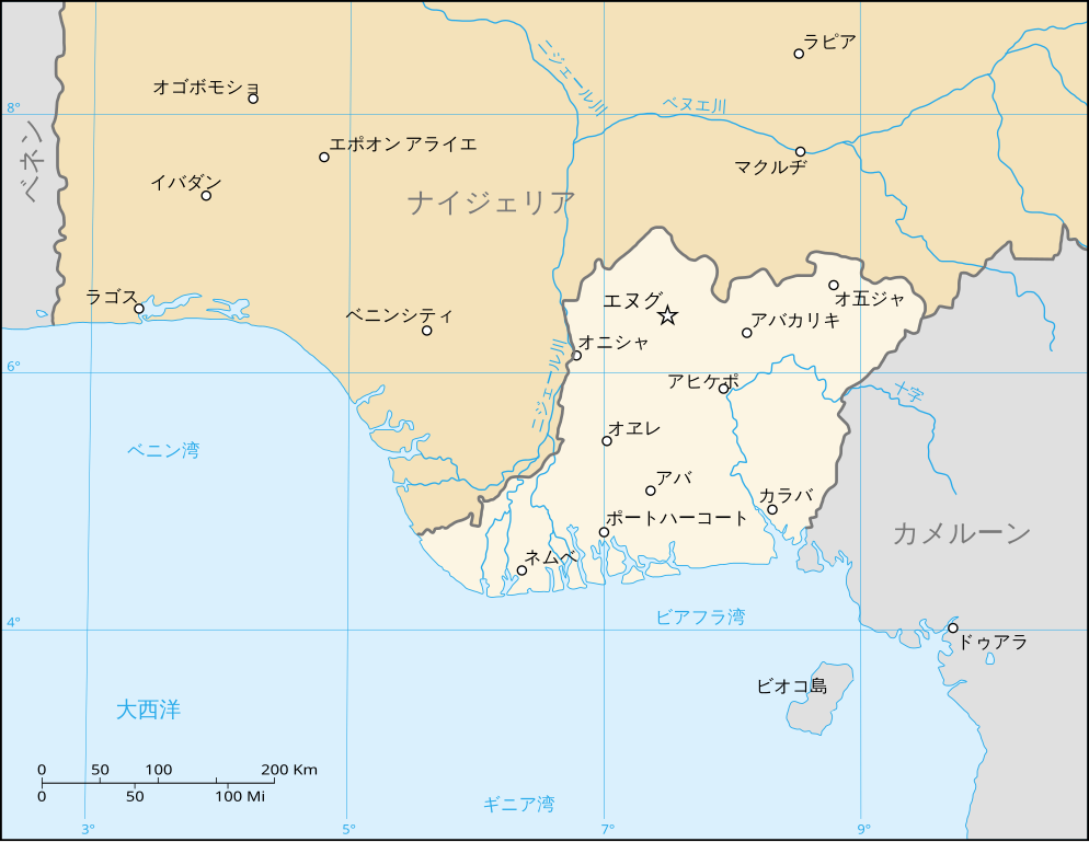
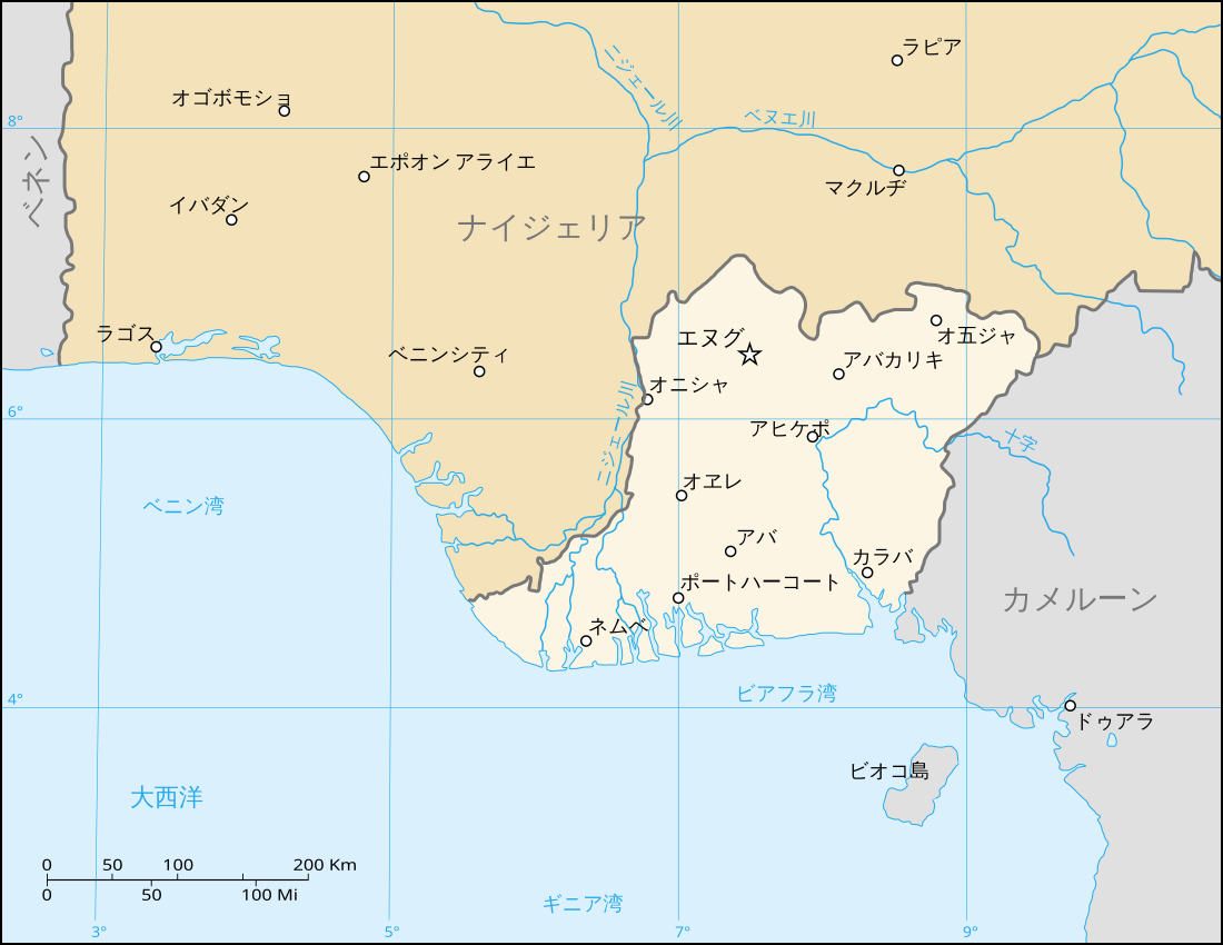
日本語: ビアフラの共和国の脱退論者状態〔州〕の地図 |
| Date | |
| Source | http://commons.wikimedia.org/wiki/Image:Biafra_independent_state_map-en.svg |
| Author | Eric Gaba (Sting), translated by User:Ukabia |
| Permission (Reusing this file) |
GFDL + CC-BY-SA |
| Other versions |
[]
|


Created from Image:Biafra independent state map-en.svg

|
This SVG file contains embedded text that can be translated into your language, using any capable SVG editor, text editor or the SVG Translate tool. For more information see: About translating SVG files. |
Licensing[edit]
| This file is licensed under the Creative Commons Attribution-Share Alike 3.0 Unported license. Subject to disclaimers. | ||
| ||
| This licensing tag was added to this file as part of the GFDL licensing update. |

|
Permission is granted to copy, distribute and/or modify this document under the terms of the GNU Free Documentation License, Version 1.2 or any later version published by the Free Software Foundation; with no Invariant Sections, no Front-Cover Texts, and no Back-Cover Texts. A copy of the license is included in the section entitled GNU Free Documentation License. Subject to disclaimers. |
File history
Click on a date/time to view the file as it appeared at that time.
| Date/Time | Thumbnail | Dimensions | User | Comment | |
|---|---|---|---|---|---|
| current | 22:54, 23 August 2008 | | 1,100 × 850 (80 KB) | Ukabia (talk | contribs) | {{Information |Description={{ja|1=ビアフラの共和国の脱退論者状態〔州〕の地図}} |Source=http://commons.wikimedia.org/wiki/Image:Biafra_independent_state_map-en.svg |Author=Eric Gaba (Sting), translated by User:Ukabia |
You cannot overwrite this file.
File usage on Commons
The following 9 pages use this file:
- File:Biafra independent state map-ar.svg
- File:Biafra independent state map-de.svg
- File:Biafra independent state map-en.svg
- File:Biafra independent state map-fr.svg
- File:Biafra independent state map-it.svg
- File:Biafra independent state map-jp.svg
- File:Biafra independent state map-mk.svg
- File:Biafra independent state map-ru.svg
- Template:Other versions/Biafra independent state map