File:Bergensbanen km210 Topographic map of Norway, E32 aust Gol, 1954 (cropped).jpg
Jump to navigation
Jump to search

Size of this preview: 800 × 450 pixels. Other resolutions: 320 × 180 pixels | 640 × 360 pixels | 1,024 × 576 pixels | 1,280 × 720 pixels | 2,203 × 1,240 pixels.
Original file (2,203 × 1,240 pixels, file size: 902 KB, MIME type: image/jpeg)
Captions
Captions
Add a one-line explanation of what this file represents
Summary
[edit].jpg&action=edit§ion=1)
| Description |
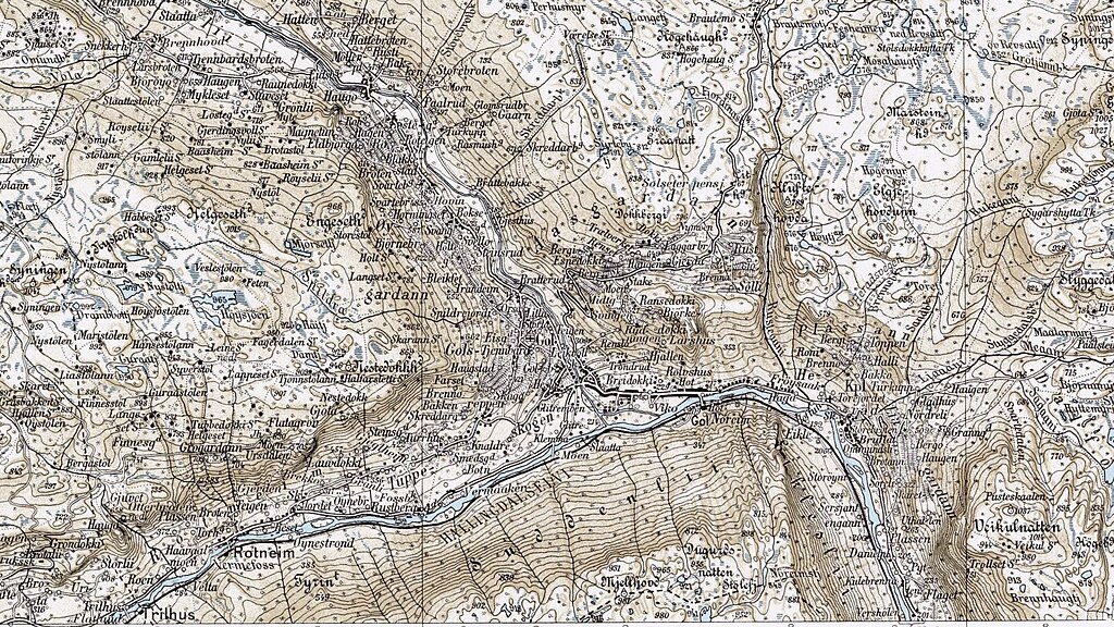
Deutsch: Bei Gol schwenkt das Hallingdal und damit auch die Bergenbahn wieder in die allgemeine Richtung von Osten nach Westen. https://www.norgeibilder.no/?x=172217&y=6744042&level=12&utm=33&projects=2605,2607,2610&layers=&plannedOmlop=0&plannedGeovekst=0
English: At Gol the Hallingdal and with it the Bergen Railway swings again in the general direction from east to west. https://www.norgeibilder.no/?x=172217&y=6744042&level=12&utm=33&projects=2605,2607,2610&layers=&plannedOmlop=0&plannedGeovekst=0
Norsk bokmål: Ved Gol svinger Hallingdal og med den Bergensbanen igjen i generell retning fra øst til vest. https://www.norgeibilder.no/?x=172217&y=6744042&level=12&utm=33&projects=2605,2607,2610&layers=&plannedOmlop=0&plannedGeovekst=0 |
| Date | |
| Source | https://commons.wikimedia.org/wiki/File:Topographic_map_of_Norway,_E32_aust_Gol,_1954.jpg |
| Author | Kartverket |
Licensing
[edit].jpg&action=edit§ion=2)
This file is licensed under the Creative Commons Attribution-Share Alike 4.0 International license.
- You are free:
- to share – to copy, distribute and transmit the work
- to remix – to adapt the work
- Under the following conditions:
- attribution – You must give appropriate credit, provide a link to the license, and indicate if changes were made. You may do so in any reasonable manner, but not in any way that suggests the licensor endorses you or your use.
- share alike – If you remix, transform, or build upon the material, you must distribute your contributions under the same or compatible license as the original.
File history
Click on a date/time to view the file as it appeared at that time.
| Date/Time | Thumbnail | Dimensions | User | Comment | |
|---|---|---|---|---|---|
| current | 08:54, 17 January 2024 | | 2,203 × 1,240 (902 KB) | OhneEisen (talk | contribs) | Uploaded a work by Kartverket from https://commons.wikimedia.org/wiki/File:Topographic_map_of_Norway,_E32_aust_Gol,_1954.jpg with UploadWizard |
You cannot overwrite this file.
File usage on Commons
The following 2 pages use this file:
.jpg&oldid=842840478)