File:Benjamin Smith House in Columbus.jpg
Jump to navigation
Jump to search

Size of this preview: 800 × 600 pixels. Other resolutions: 320 × 240 pixels | 640 × 480 pixels | 1,024 × 768 pixels | 1,280 × 960 pixels | 2,560 × 1,920 pixels | 2,816 × 2,112 pixels.
Original file (2,816 × 2,112 pixels, file size: 1.45 MB, MIME type: image/jpeg)
Captions
Captions
Add a one-line explanation of what this file represents
|
This is an image of a place or building that is listed on the National Register of Historic Places in the United States of America. Its reference number is 73001438. |
| Camera location | | View this and other nearby images on: OpenStreetMap |
|---|
| Description |
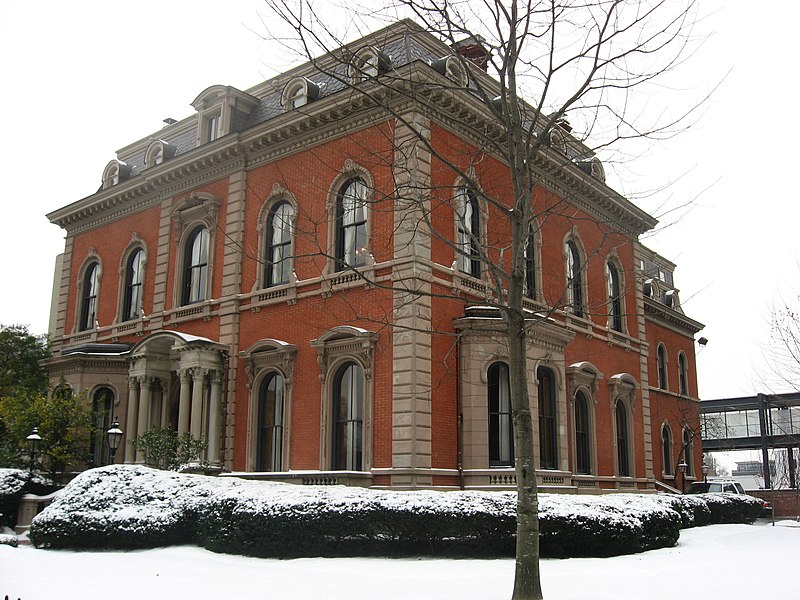
English: Front and western side of the Benjamin Smith House, located at 181 E. Broad Street (U.S. Route 40) in downtown Columbus, Ohio, United States. Built in 1860 and now occupied by the Columbus Club, it has been the residence of multiple Ohio governors, and it is listed on the National Register of Historic Places. Club website. |
||
| Date | Taken on 5 January 2010 | ||
| Source | Own work | ||
| Author | Nyttend | ||
| Permission (Reusing this file) |
|
File history
Click on a date/time to view the file as it appeared at that time.
| Date/Time | Thumbnail | Dimensions | User | Comment | |
|---|---|---|---|---|---|
| current | 16:35, 8 January 2010 | | 2,816 × 2,112 (1.45 MB) | Nyttend (talk | contribs) | {{Location|39|57|44.8|N|82|59|45.2|W}} {{Information |Description={{en|Front and western side of the {{w|Benjamin Smith House}}, located at 181 E. Broad Street ({{w|U.S. Route 40}}) in downtown {{w|Columbus, Ohio|Columbus}}, {{w|Ohio}}, {{w|United States} |
You cannot overwrite this file.
File usage on Commons
There are no pages that use this file.
File usage on other wikis
The following other wikis use this file:
- Usage on en.wikipedia.org