File:Belgian Railway Line 19.png
Jump to navigation
Jump to search

Size of this preview: 800 × 569 pixels. Other resolutions: 320 × 228 pixels | 640 × 455 pixels | 1,024 × 728 pixels | 1,280 × 910 pixels | 1,467 × 1,043 pixels.
Original file (1,467 × 1,043 pixels, file size: 1.72 MB, MIME type: image/png)
Captions
Captions
Add a one-line explanation of what this file represents
Summary
[edit]
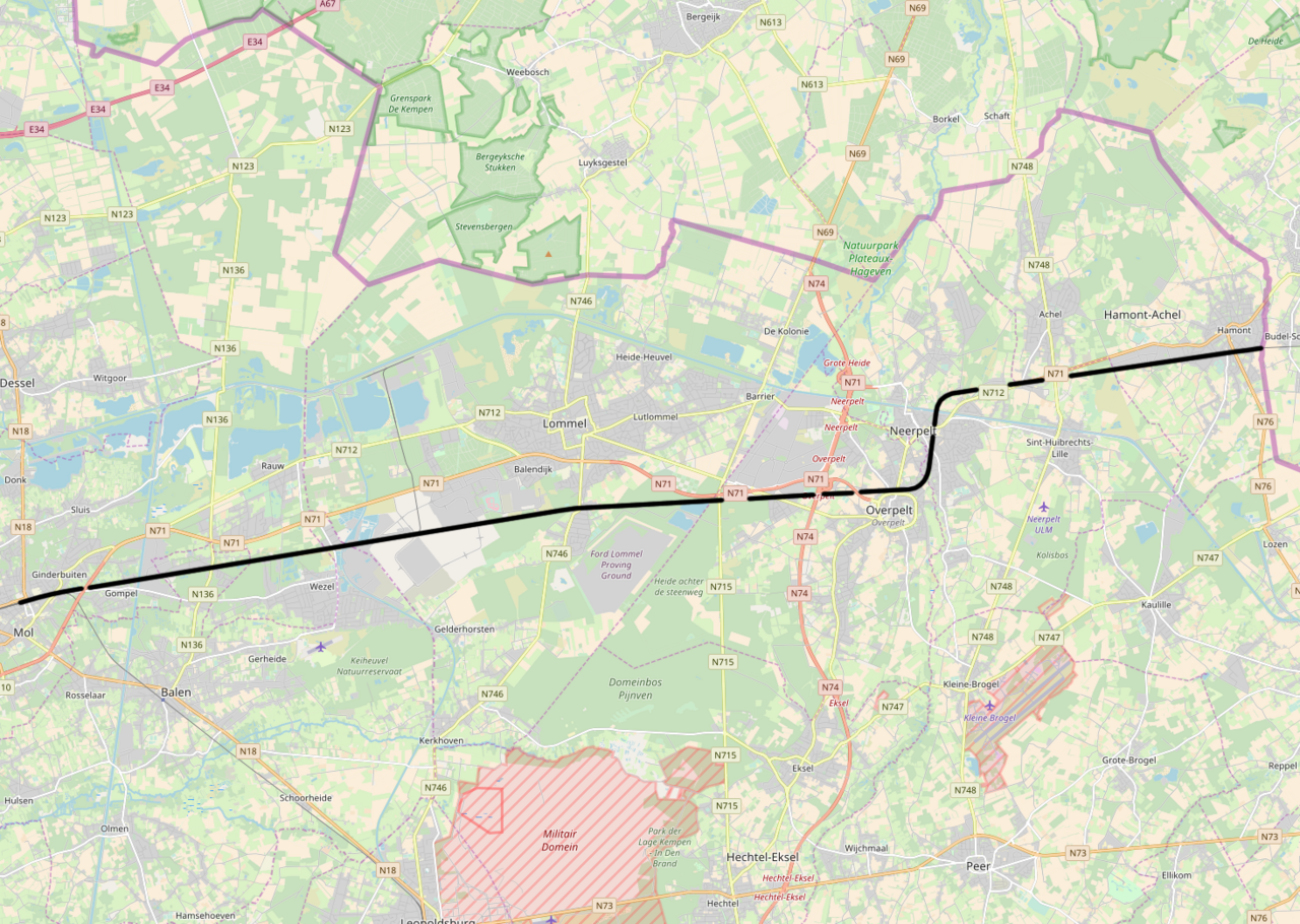
| Description | Belgian Railway Line 19, Mol - Hamont |
| Source | openstreetmap.org, see Relation: 88839 from the OpenStreetMap Belgium/Railways project. |
| Author | OpenStreetMap contributors |
| Permission (Reusing this file) |
All OpenStreetMap data and maps are Creative Commons "CC-BY-SA 2.0" licensed |
Licensing
[edit]
This file is licensed under the Creative Commons Attribution-Share Alike 2.0 Generic license.
- You are free:
- to share – to copy, distribute and transmit the work
- to remix – to adapt the work
- Under the following conditions:
- attribution – You must give appropriate credit, provide a link to the license, and indicate if changes were made. You may do so in any reasonable manner, but not in any way that suggests the licensor endorses you or your use.
- share alike – If you remix, transform, or build upon the material, you must distribute your contributions under the same or compatible license as the original.
File history
Click on a date/time to view the file as it appeared at that time.
| Date/Time | Thumbnail | Dimensions | User | Comment | |
|---|---|---|---|---|---|
| current | 09:02, 8 November 2017 | | 1,467 × 1,043 (1.72 MB) | Vunz (talk | contribs) | fix |
| 11:23, 13 May 2014 |  | 1,343 × 953 (1.83 MB) | Vunz (talk | contribs) | improved | |
| 15:22, 2 September 2010 |  | 1,046 × 796 (798 KB) | Vunz (talk | contribs) | ||
| 10:13, 1 October 2009 |  | 1,051 × 762 (649 KB) | Vunz (talk | contribs) | Spoorlijn 19 Category:Rail transport maps of Belgium | |
| 23:10, 3 January 2009 |  | 520 × 390 (27 KB) | Vunz (talk | contribs) | Blue lines Category:Rail transport maps of Belgium Category:Public domain maps from demis.nl | |
| 06:14, 30 April 2007 |  | 729 × 429 (32 KB) | Martijnvdputten (talk | contribs) | {{Information |Description=kaart van het tracé van spoorlijn 19 |Source=Gebaseerd op kaart van http://www.demis.nl/wms/mapclip.htm (vrije software gebaseerd op vrije database) |Date=2007-04-30 |Author=bewerkt door Martijn van der Putten |Permission={{PD- | |
| 05:55, 30 April 2007 |  | 743 × 401 (36 KB) | Martijnvdputten (talk | contribs) | {{Information |Description=kaart van het tracé van de Schiphollijn |Source=Gebaseerd op kaart van http://www.demis.nl/wms/mapclip.htm (vrije software gebaseerd op vrije database) |Date=2007-04-30 |Author=bewerkt door Martijn van der Putten |Permission={{ |
You cannot overwrite this file.
File usage on Commons
The following 9 pages use this file:
File usage on other wikis
The following other wikis use this file:
- Usage on fr.wikipedia.org
- Usage on nl.wikipedia.org
- Usage on www.wikidata.org