File:Banduri and Lisle. Imperii Orientalis et Circumjacentium Regionum.C (Chazaria, Alania, Zichia, Uzia, Abasgia).jpg
Jump to navigation
Jump to search
Size of this preview: 800 × 470 pixels. Other resolutions: 320 × 188 pixels | 640 × 376 pixels | 1,024 × 601 pixels | 1,280 × 752 pixels | 2,748 × 1,614 pixels.
Original file (2,748 × 1,614 pixels, file size: 867 KB, MIME type: image/jpeg)
Captions
Captions
Add a one-line explanation of what this file represents
|
|

Summary[edit]
| Description |
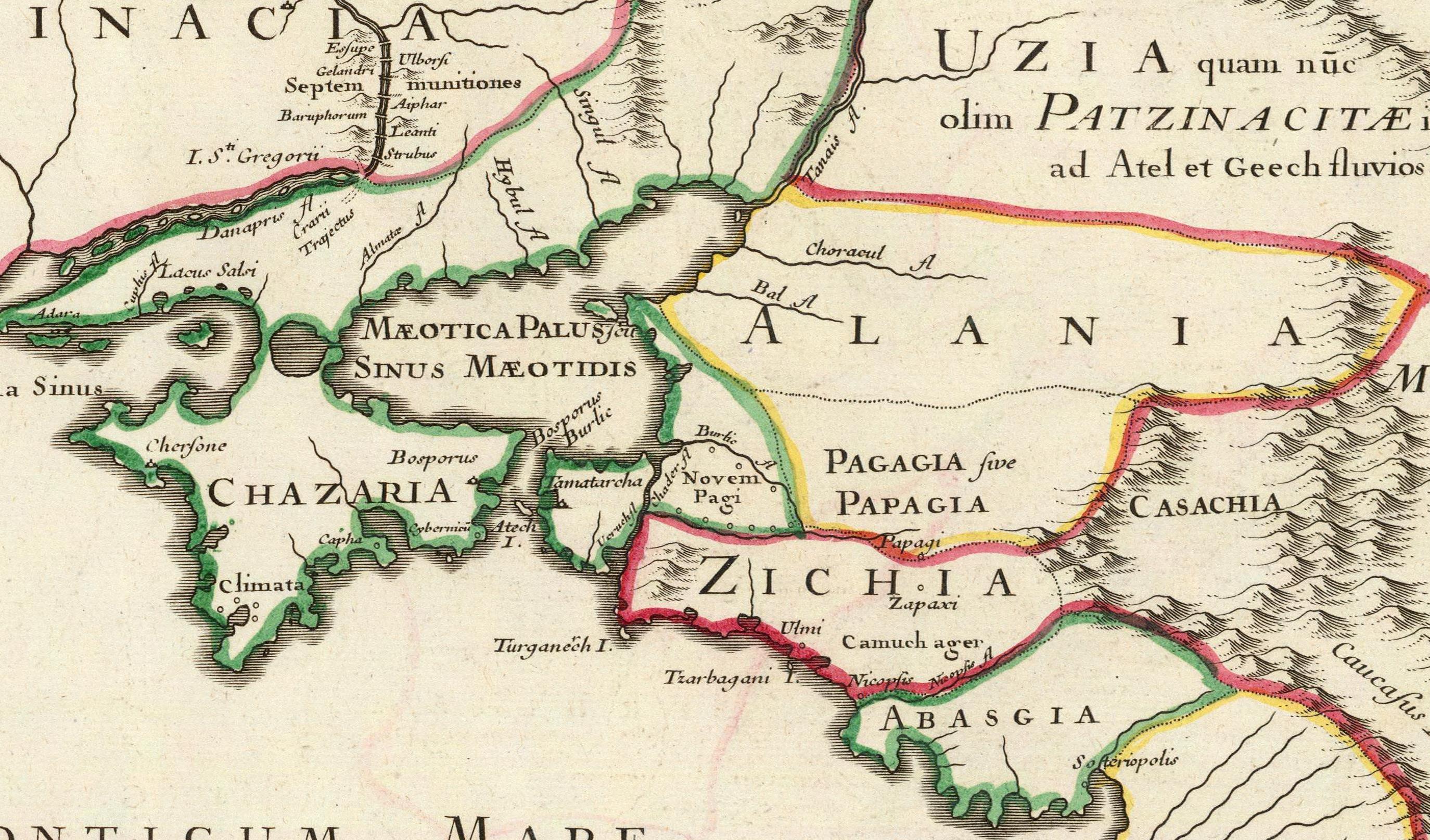
Latina: Imperii Orientalis et Circumjacentium Regionum, sub Constantino Porphyrogenito et ejus praedecessoribus descriptio. Auctore Guillelmo Del'Isle e Regia Scientiarum Academia, ad novam editionem Libri Constantini Porphyrogeniti de Administrando Imperio quae prodit studio Anselmi Bandurii, Monachi Benedictini Ragusini Melitensis cum ejus dem note et animadversionibus. (Paris : Guillelmo Del'Isle, 1715?). |
|||||||||||||||||||||||
| Date | circa 1715 | |||||||||||||||||||||||
| Source |
|
|||||||||||||||||||||||
| Author |
Anselmo Maria Banduri (1675-1743)
|
|||||||||||||||||||||||


.jpg&action=edit§ion=1)
Licensing[edit]
.jpg&action=edit§ion=2)
|
This is a faithful photographic reproduction of a two-dimensional, public domain work of art. The work of art itself is in the public domain for the following reason:
The official position taken by the Wikimedia Foundation is that "faithful reproductions of two-dimensional public domain works of art are public domain".
This photographic reproduction is therefore also considered to be in the public domain in the United States. In other jurisdictions, re-use of this content may be restricted; see Reuse of PD-Art photographs for details. | ||||
File history
Click on a date/time to view the file as it appeared at that time.
| Date/Time | Thumbnail | Dimensions | User | Comment | |
|---|---|---|---|---|---|
| current | 20:33, 29 January 2011 | | 2,748 × 1,614 (867 KB) | Geagea (talk | contribs) |
You cannot overwrite this file.
File usage on Commons
The following 2 pages use this file:
File usage on other wikis
The following other wikis use this file:
Metadata
.jpg&oldid=830639833)
Categories:
- Imperii Orientalis et Circumjacentium Regionum (early 18th century map) by Guillaume Delisle
- Details of old maps
- 18th-century maps of Circassia
- 1715 maps of the Tsardom of Russia
- Old maps of Samegrelo
- 1710s maps of Abkhazia
- Maps of the Khazars
- Maps of Alania
- Old maps of the Sea of Azov
- 18th-century maps of Crimea