File:Baldringen wayside cross(2-2).jpg
Jump to navigation
Jump to search
Size of this preview: 800 × 465 pixels. Other resolutions: 320 × 186 pixels | 640 × 372 pixels | 1,024 × 596 pixels | 1,280 × 744 pixels | 2,560 × 1,489 pixels | 3,853 × 2,241 pixels.
Original file (3,853 × 2,241 pixels, file size: 4.7 MB, MIME type: image/jpeg)
Captions
Captions
Add a one-line explanation of what this file represents
Summary[edit]
.jpg&action=edit§ion=1)
| Description |
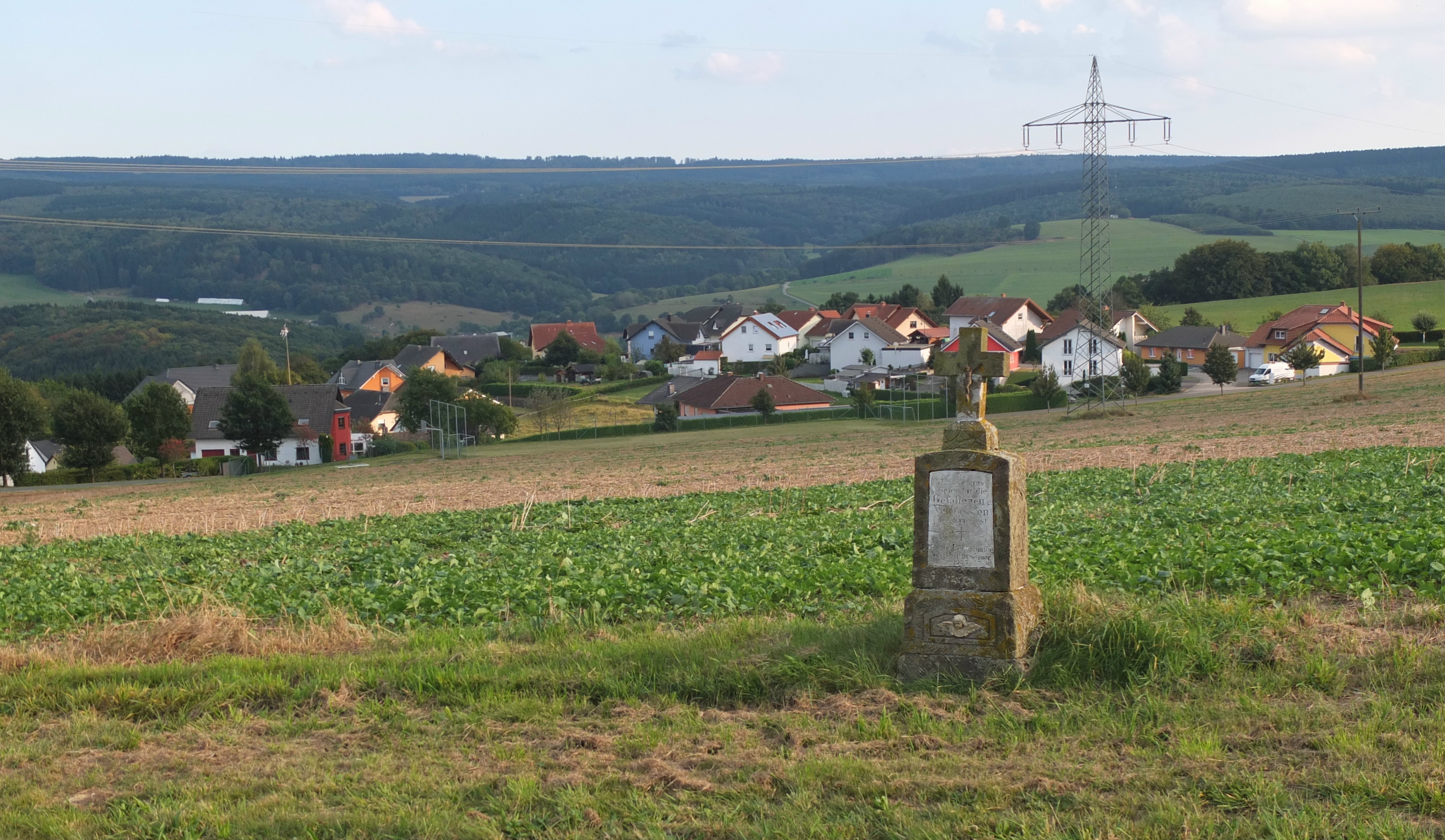
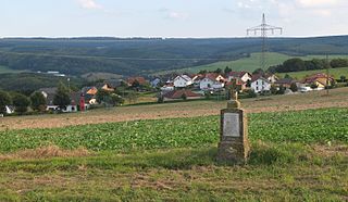
Deutsch: Wegekreuz (1947) zu Ehren der Kriegsopfer, nahe Baldringen an der K145, Baldringen im Hintergrund (Ansicht von NW).
English: Wayside cross (1947) commemorating the victims of war, near Baldringen, Germany, the village in the background (view NW). |
| Date | |
| Source | Own work |
| Author | Palauenc05 |
| Camera location | | View this and other nearby images on: OpenStreetMap |
|---|
.jpg¶ms=049.614038_N_0006.679685_E_globe:Earth_type:camera__&language=en)

|
This image has been assessed under the valued image criteria and is considered the most valued image on Commons within the scope: NW view of Baldringen, Germany. You can see its nomination here. |
.jpg)

|
This image was uploaded as part of Wiki Loves Monuments 2016.
|
Licensing[edit]
.jpg&action=edit§ion=2)
I, the copyright holder of this work, hereby publish it under the following license:
This file is licensed under the Creative Commons Attribution-Share Alike 4.0 International license.
- You are free:
- to share – to copy, distribute and transmit the work
- to remix – to adapt the work
- Under the following conditions:
- attribution – You must give appropriate credit, provide a link to the license, and indicate if changes were made. You may do so in any reasonable manner, but not in any way that suggests the licensor endorses you or your use.
- share alike – If you remix, transform, or build upon the material, you must distribute your contributions under the same or compatible license as the original.
File history
Click on a date/time to view the file as it appeared at that time.
| Date/Time | Thumbnail | Dimensions | User | Comment | |
|---|---|---|---|---|---|
| current | 15:45, 30 September 2016 | | 3,853 × 2,241 (4.7 MB) | Palauenc05 (talk | contribs) | User created page with UploadWizard |
You cannot overwrite this file.
File usage on Commons
The following 3 pages use this file:
File usage on other wikis
The following other wikis use this file:
- Usage on ceb.wikipedia.org
- Usage on ce.wikipedia.org
- Usage on de.wikipedia.org
- Usage on en.wikipedia.org
- Usage on es.wikipedia.org
- Usage on eu.wikipedia.org
- Usage on fr.wikipedia.org
- Usage on hu.wikipedia.org
- Usage on it.wikipedia.org
- Usage on ky.wikipedia.org
- Usage on lld.wikipedia.org
- Usage on nl.wikipedia.org
- Usage on pl.wikipedia.org
- Usage on pt.wikipedia.org
- Usage on ro.wikipedia.org
- Usage on ru.wikipedia.org
- Usage on simple.wikipedia.org
- Usage on sr.wikipedia.org
- Usage on sv.wikipedia.org
- Usage on tt.wikipedia.org
- Usage on uz.wikipedia.org
- Usage on vi.wikipedia.org
- Usage on www.wikidata.org
.jpg&oldid=847548915)