File:Baikal Amur Mainline map EN OSM 20170129.svg
Jump to navigation
Jump to search

Size of this PNG preview of this SVG file: 800 × 376 pixels. Other resolutions: 320 × 150 pixels | 640 × 301 pixels | 1,024 × 481 pixels | 1,280 × 602 pixels | 2,560 × 1,204 pixels | 938 × 441 pixels.
Original file (SVG file, nominally 938 × 441 pixels, file size: 6.14 MB)
Captions
Captions
Add a one-line explanation of what this file represents
| Description |
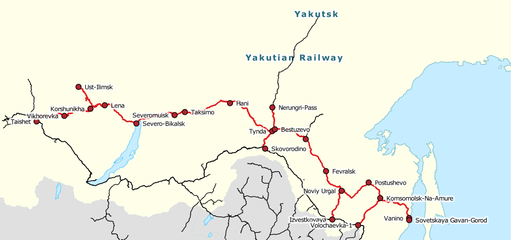
Русский: Схема Байкало-Амурской магистрали English: Baikal-Amur Mainline railway line. |
|||||||||
| Date | ||||||||||
| Source | openstreetmap.org | |||||||||
| Creator |
OpenStreetMap contributors |
|||||||||
| Permission (Reusing this file) |
OpenStreetMap data is available under the Open Database License (details). Map tiles are licensed under the Creative Commons Attribution-ShareAlike 2.0 license (CC-BY-SA 2.0).
This file is licensed under the Creative Commons Attribution-Share Alike 2.0 Generic license.
|
|||||||||
| Geotemporal data | ||||||||||
| Bounding box |
|
|||||||||
| Georeferencing | If inappropriate please set warp_status = skip to hide. | |||||||||
| Other versions | Baikal_Amur_Mainline_map_RU_OSM_20170129.svg | |||||||||
File history
Click on a date/time to view the file as it appeared at that time.
| Date/Time | Thumbnail | Dimensions | User | Comment | |
|---|---|---|---|---|---|
| current | 19:21, 30 January 2017 | | 938 × 441 (6.14 MB) | Svetlov Artem (talk | contribs) | {{OpenStreetMap |name = |location = |description ={{ru|1=Схема Байкало-Амурской магистрали}}{{en|1=Baikal-Amur Mainline railway line.}} |top = 62.7748 |bottom = 47.4281 |left =93.8672 |right =151.7871 |date = 2017... |
You cannot overwrite this file.
File usage on Commons
The following 5 pages use this file:
File usage on other wikis
The following other wikis use this file:
- Usage on be.wikipedia.org
- Usage on ca.wikipedia.org
- Usage on de.wikivoyage.org
- Usage on en.wikipedia.org
- Usage on en.wikivoyage.org
- Usage on es.wikipedia.org
- Usage on he.wikipedia.org
- Usage on ka.wikipedia.org
- Usage on sv.wikipedia.org
- Usage on tt.wikipedia.org
- Usage on uk.wikipedia.org
- Usage on www.wikidata.org